File:Zeichen 354 - Wasserschutzgebiet, StVO 1988.svg
Jump to navigation
Jump to search

Size of this PNG preview of this SVG file: 400 × 600 pixels. Other resolutions: 160 × 240 pixels | 320 × 480 pixels | 512 × 768 pixels | 683 × 1,024 pixels | 1,366 × 2,048 pixels | 421 × 631 pixels.
Original file (SVG file, nominally 421 × 631 pixels, file size: 14 KB)
Captions
Captions
Add a one-line explanation of what this file represents
Summary
[edit]| Description |
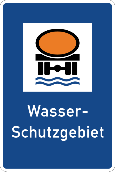
Deutsch: Zeichen 354 – Wasserschutzgebiet. Das Zeichen wurde in dieser Ausführung am 14. Juni 1988 verkündet und im Verkehrsblatt 13, 1988, S. 500, veröffentlicht. Es löste das Vorgängerzeichen ab, das 1971 eingeführt worden war.
English: Sign No. 354 – water reserves area
Image taken from the de:Straßenverkehrsordnung (German Road Regulations) as published by the de:Bundesministerium für Verkehr, Bau- und Wohnungswesen (German Federal Ministry of Traffic, Building and Housing) at [1]. |
| Date | 9 August 2006 (upload date) |
| Source | Own work |
| Author | Andreas06. Nach den Vorgaben 2017 interpretiert und digital umgesetzt durch Mediatus |
| Other versions |
Versionen von 1971 bis 1988: |
| SVG development |
._Das_Zeichen_mahnt_Fahrzeugf%C3%BChrer,_die_wassergef%C3%A4hrdende_Stoffe_geladen_haben,_StVO_1970.svg)

|
|
Do not upload new revisions over this file version without my explicit consent. Instead, use the possibility to upload a new version under a new name and tag it as a derivative or extract of this file. Mediatus |

Licensing
[edit]
| This image is in the public domain according to German copyright law because it is part of a statute, ordinance, official decree or judgment (official work) issued by a German authority or court (§ 5 Abs.1 UrhG).
|
 |
| This road sign image is in the public domain according to German copyright law because it is part of the German Verkehrszeichenkatalog (Road Sign Catalogue), Straßenverkehrsordnung (Road Traffic Code) or other statues, ordinances or official decrees proclaimed in the Verkehrsblatt (Traffic Gazette) (§ 5 Abs. 1 UrhG).
|
 |
File history
Click on a date/time to view the file as it appeared at that time.
| Date/Time | Thumbnail | Dimensions | User | Comment | |
|---|---|---|---|---|---|
| current | 12:03, 31 October 2017 | | 421 × 631 (14 KB) | Mediatus (talk | contribs) | nachgesteuert |
| 10:00, 4 April 2016 |  | 471 × 706 (14 KB) | Mediatus (talk | contribs) | neue Datei mit verbessertem Rand | |
| 13:41, 17 August 2013 |  | 480 × 720 (26 KB) | Mediatus (talk | contribs) | Originale Farbwerte nachgetragen: korrekter digitaler RAL-Farbton Signalblau (Farbcode: #154889) korrekter digitaler RAL-Farbton Tieforange (Farbcode: #EC7C25) | |
| 01:40, 9 August 2006 |  | 480 × 720 (25 KB) | Andreas 06 (talk | contribs) | {{German}} Zeichen 354 – Wasserschutzgebiet <br />{{English}} Sign No. 354 – water reserves area Image taken from the de:Straßenverkehrsordnung (German Road Regulations) as published by the [[:de:Bundesministerium für Verkehr, Bau- und Wohnung |
You cannot overwrite this file.
File usage on Commons
The following 16 pages use this file:
- Historic road signs in Germany
- Road signs of Germany
- User:Chumwa/OgreBot/Potential transport maps/2016 April 1-10
- Commons:Files used on the OpenStreetMap Wiki/30
- File:Zeichen 354.svg (file redirect)
- File:Zeichen 354 - Wasserschutzgebiet, StVO 1992.svg (file redirect)
- File:Zeichen 354 - Wasserschutzgebiet. Das Zeichen mahnt Fahrzeugführer, die wassergefährdende Stoffe geladen haben.svg
- File:Zeichen 354 - Wasserschutzgebiet (ältere Form). Das Zeichen mahnt Fahrzeugführer, die wassergefährdende Stoffe geladen haben, StVO 1970.svg
- Category:Water protection areas in Austria
- Category:Water protection areas in Bavaria
- Category:Water protection areas in Germany
- Category:Water protection areas in Hamburg
- Category:Water protection areas in Saxony
- Category:Water protection areas in Schleswig-Holstein
- Category:Water protection areas in Switzerland
File usage on other wikis
The following other wikis use this file:
- Usage on ar.wikipedia.org
- Usage on de.wikipedia.org
- Wasserschutzgebiet
- Bildtafel der Verkehrszeichen in der Bundesrepublik Deutschland von 2013 bis 2017
- Benutzer:Antonsusi/Verkehrszeichen
- Rahnsdorf (Zahna-Elster)
- Bildtafel der Verkehrszeichen in der Bundesrepublik Deutschland von 1971 bis 1992
- Bildtafel der Verkehrszeichen in der Bundesrepublik Deutschland von 1992 bis 2013
- Bildtafel der Verkehrszeichen in der Bundesrepublik Deutschland seit 2017
- Liste der Wasserschutzgebiete im Main-Tauber-Kreis
- Benutzer:Triplec85/Liste der Wasserschutzgebiete im Landkreis Konstanz
- Liste der Wasserschutzgebiete im Zollernalbkreis
- Liste der Wasserschutzgebiete im Neckar-Odenwald-Kreis
- Vorlage:Navigationsleiste Wasserschutzgebiete in Baden-Württemberg nach Land- und Stadtkreisen
- Liste der Wasserschutzgebiete in Heilbronn
- Liste der Wasserschutzgebiete im Landkreis Heilbronn
- Liste der Wasserschutzgebiete in Baden-Württemberg
- Benutzer:Triplec85/Liste der Wasserschutzgebiete in Berlin
- Benutzer:Triplec85/Liste der Wasserschutzgebiete in der Freien Hansestadt Bremen
- Benutzer:Triplec85/Liste der Wasserschutzgebiete in Hamburg
- Vorlage:Navigationsleiste Liste der Wasserschutzgebiete in Deutschland nach Bundesland
- Liste der Wasserschutzgebiete in Ulm
- Liste der Wasserschutzgebiete im Landkreis Tübingen
- Liste der Wasserschutzgebiete im Landkreis Freudenstadt
- Benutzer:Carolin/Wikipedia:Liste der Navigationsleisten zu Bundesländern in Deutschland
- Liste der Wasserschutzgebiete im Landkreis Böblingen
- Liste der Wasserschutzgebiete im Landkreis Ludwigsburg
- Liste der Wasserschutzgebiete in Karlsruhe
- Liste der Wasserschutzgebiete in Stuttgart
- Liste der Wasserschutzgebiete in Freiburg im Breisgau
- Liste der Wasserschutzgebiete in Mannheim
- Liste der Wasserschutzgebiete in Heidelberg
- Liste der Wasserschutzgebiete in Pforzheim
- Liste der Wasserschutzgebiete im Landkreis Calw
- Liste der Wasserschutzgebiete im Landkreis Rottweil
- Liste der Wasserschutzgebiete im Landkreis Reutlingen
- Liste der Wasserschutzgebiete im Landkreis Tuttlingen
- Liste der Wasserschutzgebiete im Landkreis Esslingen
- Liste der Wasserschutzgebiete im Ostalbkreis
- Liste der Wasserschutzgebiete im Landkreis Heidenheim
- Liste der Wasserschutzgebiete in Baden-Baden
- Liste der Wasserschutzgebiete im Alb-Donau-Kreis
- Liste der Wasserschutzgebiete im Bodenseekreis
- Liste der Wasserschutzgebiete im Landkreis Sigmaringen
- Liste der Wasserschutzgebiete im Landkreis Schwäbisch Hall
- Liste der Wasserschutzgebiete im Hohenlohekreis
- Liste der Wasserschutzgebiete im Landkreis Göppingen
- Liste der Wasserschutzgebiete im Landkreis Biberach
- Liste der Wasserschutzgebiete im Landkreis Emmendingen
- Liste der Wasserschutzgebiete im Enzkreis
- Liste der Wasserschutzgebiete im Landkreis Breisgau-Hochschwarzwald
View more global usage of this file.
Metadata
Categories:
- SVG historic road signs in Germany
- Diagrams of information road signs of Germany
- Diagrams of historic road signs of Germany, 1988 set
- Diagrams of information road signs of Germany, 1992 set
- Diagrams of information road signs of Germany, 2013 set
- Diagrams of information road signs of Germany, 2017 set
- Zeichen 354
- Diagrams of water protection area road signs
- Diagrams of black, blue, orange, white road signs
- Black, blue, orange, white rectangular road signs
- Diagrams of German-language road signs