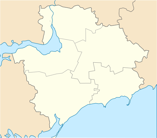
File:Zaporozhskaya oblast location map.svg
From Wikimedia Commons, the free media repository
Jump to navigation
Jump to search

Size of this PNG preview of this SVG file: 532 × 469 pixels. Other resolutions: 272 × 240 pixels | 545 × 480 pixels | 871 × 768 pixels | 1,162 × 1,024 pixels | 2,323 × 2,048 pixels.
Original file (SVG file, nominally 532 × 469 pixels, file size: 74 KB)
File information
Structured data
Captions
Captions
Add a one-line explanation of what this file represents
Summary
[edit]| DescriptionZaporozhskaya oblast location map.svg |
Русский: Районы Запорожской области с 17 июля 2020 года English: Districts of Zaporozhye region from, July 17, C.E. 2020 |
| Date | |
| Source | Own work |
| Author | RosssW |
Licensing
[edit]I, the copyright holder of this work, hereby publish it under the following license:
This file is licensed under the Creative Commons Attribution-Share Alike 4.0 International license.
- You are free:
- to share – to copy, distribute and transmit the work
- to remix – to adapt the work
- Under the following conditions:
- attribution – You must give appropriate credit, provide a link to the license, and indicate if changes were made. You may do so in any reasonable manner, but not in any way that suggests the licensor endorses you or your use.
- share alike – If you remix, transform, or build upon the material, you must distribute your contributions under the same or compatible license as the original.
File history
Click on a date/time to view the file as it appeared at that time.
| Date/Time | Thumbnail | Dimensions | User | Comment | |
|---|---|---|---|---|---|
| current | 13:05, 5 August 2020 |  | 532 × 469 (74 KB) | RosssW (talk | contribs) | Uploaded own work with UploadWizard |
You cannot overwrite this file.
File usage on Commons
There are no pages that use this file.
File usage on other wikis
The following other wikis use this file:
- Usage on be.wikipedia.org
- Запарожжа
- Гуляйполэ
- Кырыліўка
- Шаблон:На карце/Украіна Запарожская вобласць
- Прыазоўскэ
- Прышыб
- Мырнэ (Запарожская вобласць)
- Стэпнагірск
- Новамыкалаіўка (Запарожская вобласць)
- Розіўка
- Тэрнуватэ
- Малакатэрыніўка
- Новавасыліўка
- Мыхайліўка
- Кушугум
- Кам’янэ
- Камышуваха
- Камыш-Зара
- Залізнычнэ (Запарожская вобласць)
- Кам’янка (Запарожская вобласць)
- Балабынэ
- Андрыіўка (Бэрдзянскі раён)
- Малыніўка (Гуляйпольскі раён)
- Малыніўка (Бэрдзянскі раён)
- Підгірнэ (Васыліўскі раён)
- Підгірнэ (Мыхайліўскі раён)
- Підгірнэ (Новамыкалаіўскі раён)
- Підгірнэ (Прыморскі раён)
- Сэмэніўка (Мэлітопальскі раён)
- Сэмэніўка (Палогыўскі раён)
- Вэрбовэ (Вільнянскі раён)
- Вэрбовэ (Палогыўскі раён)
- Дзіброва (Більмацкі раён)
- Лабковэ
- П’ятыхаткы (Васыліўскі раён)
- Работынэ
- Usage on ce.wikipedia.org
- Запорожье
- Авангард (Запорожьен область)
- Августиновка
- Азов (Пологин кӀошт)
- Азовски (Запорожьен область)
- Акимовка (Запорожьен область)
- Александровка (Бердянскан кӀошт)
- Андреевка (Запорожьен область)
- Андровка (Бердянскан кӀошт)
- Антоновка (Запорожьен кӀошт)
- Астраханка (Запорожьен область)
- Атманай (Акимовкан кӀошт)
- Бабурка (Запорожьен кӀошт)
- Балабино
View more global usage of this file.
Metadata
This file contains additional information such as Exif metadata which may have been added by the digital camera, scanner, or software program used to create or digitize it. If the file has been modified from its original state, some details such as the timestamp may not fully reflect those of the original file. The timestamp is only as accurate as the clock in the camera, and it may be completely wrong.
| Width | 532.06885 |
|---|---|
| Height | 468.60001 |
Hidden categories: