File:Zaporizhzia nuclear power plant aerial.svg
Jump to navigation
Jump to search

Size of this PNG preview of this SVG file: 512 × 341 pixels. Other resolutions: 320 × 213 pixels | 640 × 426 pixels | 1,024 × 682 pixels | 1,280 × 853 pixels | 2,560 × 1,705 pixels.
Original file (SVG file, nominally 512 × 341 pixels, file size: 87 KB)
Captions
Captions
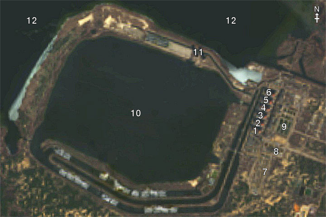
Annotated Zaporizhzia nuclear power plant Landsat-9 photograph
Summary
[edit]
| Description |
English: Zaporizhzia nuclear power plant satellite photograph from USGS LandsatLook annotated by CMG Lee based on http://bbc.co.uk/news/world-60609633 and http://world-nuclear.org/information-library/country-profiles/countries-t-z/russian-military-operation-and-ukraine-s-nuclear-p.aspx .
|
||||||||||||||||
| Date | |||||||||||||||||
| Source | http://landsatlook.usgs.gov/explore?sat=LANDSAT_9 | ||||||||||||||||
| Author | cmglee, Landsat, USGS |
Licensing
[edit]
This file is licensed under the Creative Commons Attribution-Share Alike 4.0 International license.
- You are free:
- to share – to copy, distribute and transmit the work
- to remix – to adapt the work
- Under the following conditions:
- attribution – You must give appropriate credit, provide a link to the license, and indicate if changes were made. You may do so in any reasonable manner, but not in any way that suggests the licensor endorses you or your use.
- share alike – If you remix, transform, or build upon the material, you must distribute your contributions under the same or compatible license as the original.
File history
Click on a date/time to view the file as it appeared at that time.
| Date/Time | Thumbnail | Dimensions | User | Comment | |
|---|---|---|---|---|---|
| current | 01:02, 7 March 2022 | | 512 × 341 (87 KB) | Cmglee (talk | contribs) | Uploaded a work by cmglee, Landsat, USGS from http://landsatlook.usgs.gov/explore?sat=LANDSAT_9 with UploadWizard |
You cannot overwrite this file.
File usage on Commons
There are no pages that use this file.
File usage on other wikis
The following other wikis use this file:
- Usage on bn.wikipedia.org
- Usage on de.wikipedia.org
- Usage on en.wikipedia.org
- Usage on fr.wikipedia.org
- Usage on hr.wikipedia.org
- Usage on hu.wikipedia.org
- Usage on mt.wikipedia.org
- Usage on ru.wikipedia.org
- Usage on uk.wikipedia.org