File:Zaporizhzhia frontline.png
Jump to navigation
Jump to search

Size of this preview: 666 × 600 pixels. Other resolutions: 267 × 240 pixels | 533 × 480 pixels | 853 × 768 pixels | 1,024 × 922 pixels.
Original file (1,024 × 922 pixels, file size: 123 KB, MIME type: image/png)
Captions
Captions
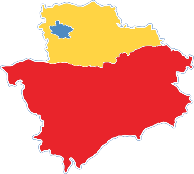
Map of the control of Zaporizhzhia Oblast by Russian (red) and Ukrainian (yellow) forces
Summary
[edit]| Description |
English: Map of Zaporizhzhia Oblast showing the rough zones of occupation during the southern offensive of the 2022 Russian invasion of Ukraine, as of June 2022.
Ukraine ( ) has maintained control over the north of the oblast, including the areas around the cities of Zaporizhzhia, Huliaipole and Orikhiv. The Russian occupation ( ) extends throughout the entire southern part of the oblast, including the major cities of Melitopol, Berdiansk and Enerhodar. |
| Date | |
| Source | Own work |
| Author | Grnrchst |
| Other versions |
[]
|


.png)


.png)


Licensing
[edit]
I, the copyright holder of this work, hereby publish it under the following license:
This file is licensed under the Creative Commons Attribution-Share Alike 4.0 International license.
- You are free:
- to share – to copy, distribute and transmit the work
- to remix – to adapt the work
- Under the following conditions:
- attribution – You must give appropriate credit, provide a link to the license, and indicate if changes were made. You may do so in any reasonable manner, but not in any way that suggests the licensor endorses you or your use.
- share alike – If you remix, transform, or build upon the material, you must distribute your contributions under the same or compatible license as the original.
File history
Click on a date/time to view the file as it appeared at that time.
| Date/Time | Thumbnail | Dimensions | User | Comment | |
|---|---|---|---|---|---|
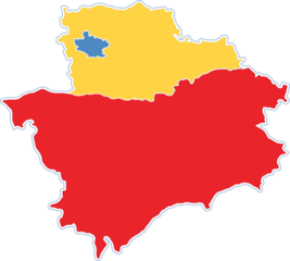
| current | 19:09, 23 March 2023 | | 1,024 × 922 (123 KB) | Iktsokh (talk | contribs) | Correction |
| 08:07, 20 June 2022 |  | 1,024 × 922 (121 KB) | Grnrchst (talk | contribs) | Uploaded own work with UploadWizard |
You cannot overwrite this file.
File usage on Commons
The following 52 pages use this file:
- Ukraine Regional Occupation Maps
- User:Jcornelius/Angola/2022 June 11-20
- File:Dnipropetrovsk-poltava oblast occupation.png
- File:Dnipropetrovsk Oblast border skirmishes.png
- File:Kharkiv Oblast Control Evolution.png
- File:Kherson military–civilian administration.png
- File:Kherson military–civilian administration hatched.svg
- File:Occupation of Mykolaiv Oblast by Russia (With Cities).png
- File:Poltava oblast border skirmishes.png
- File:Russian Occupation of Chernihiv Oblast.svg
- File:Russian Occupation of Crimea.svg
- File:Russian Occupation of Dnipropetrovsk & Poltava Oblasts.svg
- File:Russian Occupation of Dnipropetrovsk Oblast.svg
- File:Russian Occupation of Donetsk Oblast.svg
- File:Russian Occupation of Kharkiv Oblast.svg
- File:Russian Occupation of Kherson Oblast.svg
- File:Russian Occupation of Kyiv Oblast.png
- File:Russian Occupation of Kyiv Oblast.svg
- File:Russian Occupation of Mykolaiv Oblast.svg
- File:Russian Occupation of Poltava Oblast.svg
- File:Russian Occupation of Sumy Oblast.svg
- File:Russian Occupation of Zaporizhzhia Oblast.svg
- File:Russian Occupation of Zhytomyr Oblast.svg
- File:Russian occupation of Chernihiv Oblast.png
- File:Russian occupation of Chernihiv Oblast peak.png
- File:Russian occupation of Donetsk Oblast.png
- File:Russian occupation of Kharkiv Oblast.png
- File:Russian occupation of Luhansk Oblast.png
- File:Russian occupation of Luhansk Oblast.svg
- File:Russian occupation of Mykolaiv Oblast.png
- File:Russian occupation of Sumy Oblast.png
- File:Russian occupation of Zhytomyr Oblast.png
- File:Zaporizhzhia frontline.png
- File:Zaporizhzhia military–civilian administration hatched.svg
- File:Zaporizhzhia region.png
- File:Днепропетровская область.png
- File:Донецкая область или Донецкая народная Республика.png
- File:Житомирская область.png
- File:Запорожская область.png
- File:Карта звільнених територій Житомирської області.png
- File:Киев.png
- File:Киевская область.png
- File:Крым (Автономная Республика).png
- File:Луганская область или Луганская Народная Республика.png
- File:Николаевская область 2.png
- File:Одесская область 2.png
- File:Полтавская область.png
- File:Севастополь.png
- File:Сумская область.png
- File:Харьковская область 2.png
- File:Херсонская область.png
- File:Черниговская область 2.png