File:Zambrów (gmina wiejska) location map.png
Jump to navigation
Jump to search
Size of this preview: 486 × 600 pixels. Other resolutions: 194 × 240 pixels | 389 × 480 pixels | 994 × 1,227 pixels.
Original file (994 × 1,227 pixels, file size: 117 KB, MIME type: image/png)
Captions
Captions
Add a one-line explanation of what this file represents
| Description |
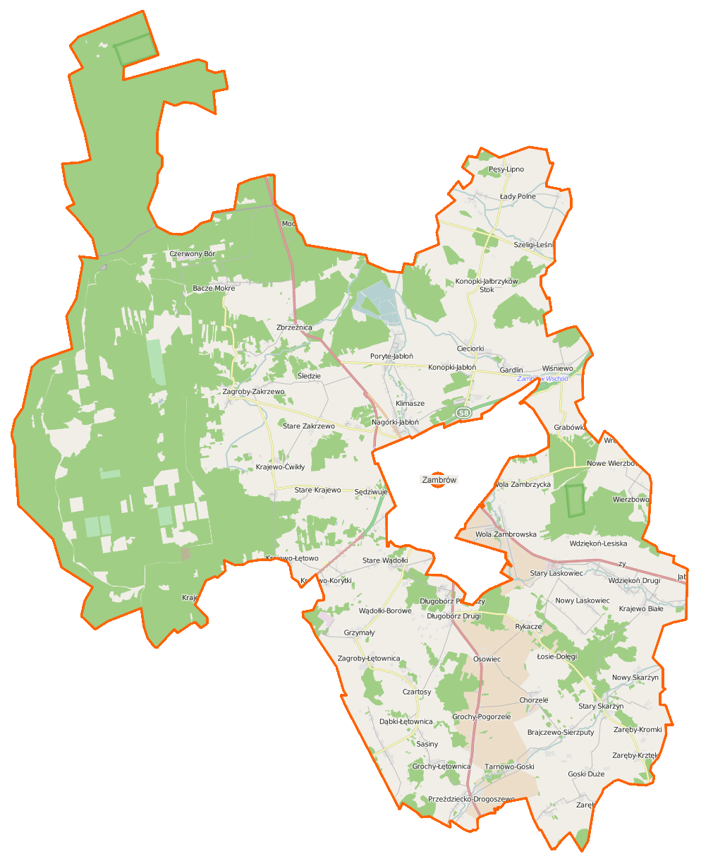
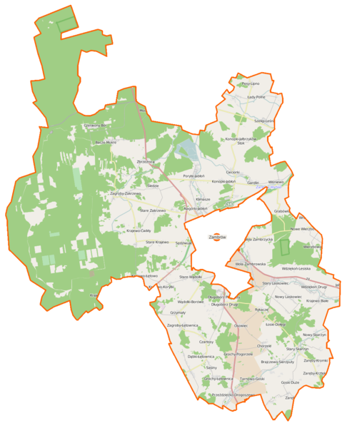
Polski: Mapa gminy Zambrów, Polska
English: Map of Gmina Zambrów, Poland |
|||||||||
| Date | ||||||||||
| Source | You may find a page on the OpenStreetMap wiki page for Zambrów (gmina) | |||||||||
| Creator |
OpenStreetMap contributors OpenStreetMap contributors |
|||||||||
| Permission (Reusing this file) |
OpenStreetMap data is available under the Open Database License (details). Map tiles are licensed under the Creative Commons Attribution-ShareAlike 2.0 license (CC-BY-SA 2.0).
This file is licensed under the Creative Commons Attribution-Share Alike 2.0 Generic license.
|
|||||||||
| Geotemporal data | ||||||||||
| Bounding box |
|
|||||||||
| Georeferencing | If inappropriate please set warp_status = skip to hide. | |||||||||
File history
Click on a date/time to view the file as it appeared at that time.
| Date/Time | Thumbnail | Dimensions | User | Comment | |
|---|---|---|---|---|---|
| current | 08:03, 27 February 2015 | | 994 × 1,227 (117 KB) | VanWiel (talk | contribs) | {{Information |Description= |Source= |Date= |Author= |Permission= |other_versions= }} |
| 15:01, 18 September 2014 |  | 648 × 785 (160 KB) | VanWiel (talk | contribs) | ||
| 06:19, 3 June 2014 |  | 817 × 1,000 (611 KB) | VanWiel (talk | contribs) | {{OpenStreetMap | name = Zambrów (gmina) | location = Zambrów (gmina) | description = {{pl|Mapa gminy Zambrów, Polska}} {{en|Map of Gmina Zambrów, Poland}} | top = 53.1216 | left = 22.0166 | r... |
You cannot overwrite this file.
File usage on Commons
There are no pages that use this file.
File usage on other wikis
The following other wikis use this file:
- Usage on de.wikipedia.org
- Usage on pl.wikipedia.org
- Zambrów (gmina wiejska)
- Rezerwat przyrody Grabówka
- Bacze Mokre
- Boruty-Goski
- Brajczewo-Sierzputy
- Chmiele-Pogorzele
- Cieciorki
- Czartosy
- Czerwony Bór (województwo podlaskie)
- Dąbki-Łętownica
- Długobórz Pierwszy
- Długobórz Drugi
- Gardlin
- Goski Duże
- Goski-Pełki
- Grochy-Łętownica
- Grochy-Pogorzele
- Klimasze
- Krajewo Białe
- Krajewo Borowe
- Krajewo-Ćwikły
- Krajewo-Korytki
- Krajewo-Łętowo
- Konopki-Jabłoń
- Konopki-Jałbrzyków Stok
- Koziki-Jałbrzyków Stok
- Łady-Borowe
- Łady Polne
- Łosie-Dołęgi
- Nagórki-Jabłoń
- Nowe Wierzbowo
- Nowe Zakrzewo (województwo podlaskie)
- Nowy Laskowiec
- Nowy Skarżyn
- Polki-Teklin
- Poryte-Jabłoń
- Przeździecko-Drogoszewo
- Przeździecko-Mroczki
- Pstrągi-Gniewoty
- Rykacze
- Szeligi-Kolonia
- Szeligi-Leśnica
- Sędziwuje
- Stary Laskowiec
- Stary Skarżyn
- Stare Krajewo
- Stare Wądołki
- Stare Zakrzewo
- Śledzie (województwo podlaskie)
View more global usage of this file.
_location_map.png)
_location_map.png&oldid=493340554)