File:Zakarpattia province physical map.svg
Jump to navigation
Jump to search

Size of this PNG preview of this SVG file: 532 × 417 pixels. Other resolutions: 306 × 240 pixels | 613 × 480 pixels | 980 × 768 pixels | 1,280 × 1,003 pixels | 2,560 × 2,007 pixels.
Original file (SVG file, nominally 532 × 417 pixels, file size: 786 KB)
Captions
Captions
Add a one-line explanation of what this file represents
Summary
[edit]
| Description |
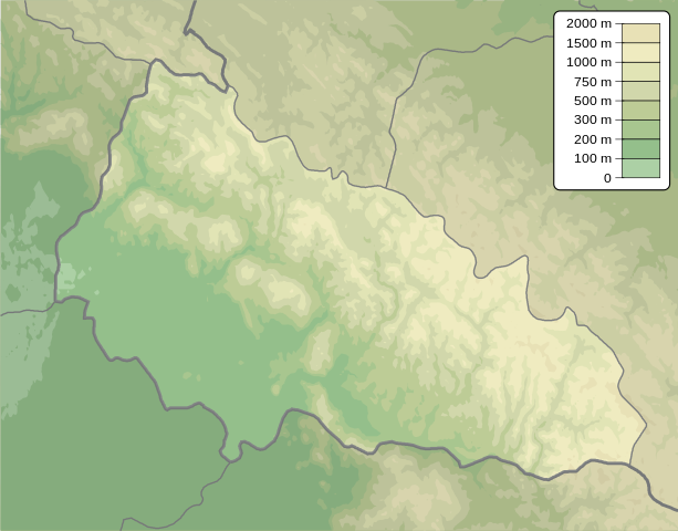
English: Physical map of Zakarpattia province, Ukraine
Русский: Физическая карта Закарпатской области, Украина |
| Date | |
| Source | Own work |
| Author | Urutseg |
Licensing
[edit]
| I, the copyright holder of this work, release this work into the public domain. This applies worldwide. In some countries this may not be legally possible; if so: I grant anyone the right to use this work for any purpose, without any conditions, unless such conditions are required by law. |
File history
Click on a date/time to view the file as it appeared at that time.
| Date/Time | Thumbnail | Dimensions | User | Comment | |
|---|---|---|---|---|---|
| current | 14:50, 13 December 2010 | | 532 × 417 (786 KB) | Urutseg (talk | contribs) | == {{int:filedesc}} == {{Information |Description={{en|1=Physical map of Zakarpattia province, Ukraine}} {{ru|1=Физическая карта Закарпатской области, Украина}} |Source={{own}} |Author=Urutseg |Dat |
You cannot overwrite this file.
File usage on Commons
There are no pages that use this file.
File usage on other wikis
The following other wikis use this file:
- Usage on ar.wikipedia.org
- Usage on be.wikipedia.org
- Usage on bg.wikipedia.org
- Usage on ca.wikipedia.org
- Usage on ceb.wikipedia.org
- Usage on ce.wikipedia.org
- Usage on cs.wikipedia.org
- Hoverla
- Lipovecké jezero
- Siněvir
- Pop Ivan
- Ozirce
- Stij
- Užocký průsmyk
- Antalovecka Poljana
- Brebeneskul
- Petros (Čornohora)
- Hutyn Tomnatyk
- Pop Ivan (Maramureš)
- Šablona:LocMap Ukrajina Zakarpatská oblast
- Bliznica
- Volovecké sedlo
- Pryslip (Krásná polonina)
- Pryslip (Boržava)
- Jablunický průsmyk
- Stoh (Karpaty)
- Usage on da.wikipedia.org
- Usage on de.wikipedia.org
View more global usage of this file.