File:Zaire 96map.png
Jump to navigation
Jump to search

No higher resolution available.
Zaire_96map.png (350 × 376 pixels, file size: 30 KB, MIME type: image/png)
Captions
Captions
Add a one-line explanation of what this file represents
Summary
[edit]
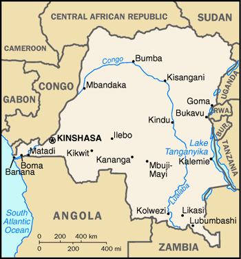
A map of Zaire from the 1996 World Factbook (as mirrored here). The GIF has been converted to a PNG. The map is also at the PCL map collection here.
Licensing
[edit]
This image is in the public domain because it contains materials that originally came from the United States Central Intelligence Agency's World Factbook.
|
 |
File history
Click on a date/time to view the file as it appeared at that time.
| Date/Time | Thumbnail | Dimensions | User | Comment | |
|---|---|---|---|---|---|
| current | 09:01, 27 December 2006 | | 350 × 376 (30 KB) | Hoshie (talk | contribs) | A map of Zaire from the 1996 World Factbook (as mirrored [http://dlhoffman.com/publiclibrary/factbook96/factbook/map-gif/cg-150.gif here]). The GIF has been converted to a PNG. The map is also at the PCL map collection [http://www.lib.utexas.edu/maps/cia9 |
You cannot overwrite this file.
File usage on Commons
The following page uses this file:
File usage on other wikis
The following other wikis use this file:
- Usage on azb.wikipedia.org
- Usage on en.wikipedia.org
- Usage on ja.wikipedia.org
- Usage on no.wikipedia.org
- Usage on pl.wikipedia.org
- Usage on ru.wikipedia.org