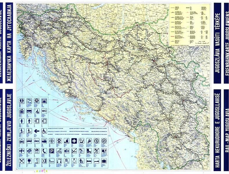
File:Yugoslavia Railway-Lines 1988.jpg
From Wikimedia Commons, the free media repository
Jump to navigation
Jump to search

Size of this preview: 789 × 600 pixels. Other resolutions: 316 × 240 pixels | 632 × 480 pixels | 1,011 × 768 pixels | 1,280 × 973 pixels | 2,560 × 1,946 pixels | 7,208 × 5,479 pixels.
Original file (7,208 × 5,479 pixels, file size: 6.01 MB, MIME type: image/jpeg)
File information
Structured data
Captions
Captions
Add a one-line explanation of what this file represents
Summary
[edit]| DescriptionYugoslavia Railway-Lines 1988.jpg |
English: The map of the Yugoslav Railways network in 1988 |
| Date | |
| Source | Old map |
| Author |
Izdaje: Zavod za novinsko-izdavačku i propagandnu delatnost JŽ-Beograd Izrada i štampa: Zavod za kartografiju "Geokarta" - Beograd, 1988. god. |
Licensing
[edit]| Public domainPublic domainfalsefalse |
The copyright to this work was owned by the federal authorities of the former Socialist Federal Republic of Yugoslavia, whose assets are now held jointly by its successor states according to the Agreement on succession issues of 2004 [1]. The Yugoslav successor states have variously enacted legislation that places certain official state documents such as law texts into the public domain.
See e.g. Art. 8.2.1 of the copyright law of Croatia [2]: "official texts in the domain of legislation, administration, judiciary (acts, regulations, decisions, reports, minutes, judgments, standards, and the like) and other official works and their collections, which are published for the purpose of officially informing the public". This template must not be used on its own. To establish PD status it must be used only with an appropriate license template such as {{PD-Croatia-exempt}}. You must make sure the file content has been declared as public domain by the laws of the relevant successor state.English ∙ slovenščina ∙ 中文 ∙ македонски ∙ +/− |
| Public domainPublic domainfalsefalse |
This work is in the public domain because according to the Copyright Law of Serbia (details), "Work is not copyrighted if the work is:
Deutsch | English | македонски | српски / srpski | +/− |
 |
File history
Click on a date/time to view the file as it appeared at that time.
| Date/Time | Thumbnail | Dimensions | User | Comment | |
|---|---|---|---|---|---|
| current | 22:52, 5 February 2018 |  | 7,208 × 5,479 (6.01 MB) | My-wiki-photos (talk | contribs) | {{Information |Description ={{en|1=The map of the Yugoslav Railways network in 1940}} |Source =Old map |Author =Izdaje: Zavod za novinsko-izdavačku i propagandnu delatnost JŽ-Beograd<br>Izrada i štampa: Zavod za kartografiju "Geok... |
You cannot overwrite this file.
File usage on Commons
There are no pages that use this file.