File:YubaRiverSlickens ASTER 2001aug29.jpg
Jump to navigation
Jump to search
Size of this preview: 771 × 600 pixels. Other resolutions: 309 × 240 pixels | 617 × 480 pixels | 987 × 768 pixels | 1,280 × 996 pixels | 1,415 × 1,101 pixels.
Original file (1,415 × 1,101 pixels, file size: 424 KB, MIME type: image/jpeg)
Captions
Captions
Add a one-line explanation of what this file represents
Summary
[edit]
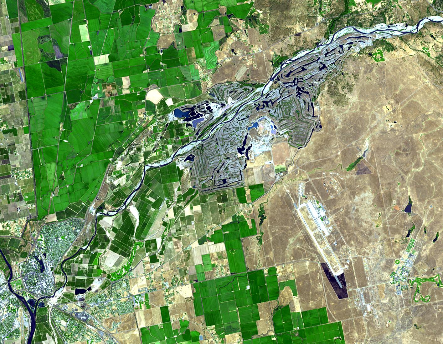
| Description | Satellite image of the Yuba River, California. Yuba City is in the lower left of the image. The Yuba Goldfields, an area of waste rock carried down from the Sierra foothills during the California Gold Rush, is visible as a large grayish area along the river. |
| Date | |
| Source | http://earthobservatory.nasa.gov/Newsroom/NewImages/images.php3?img_id=16919 |
| Author | NASA/GSFC/METI/ERSDAC/JAROS, and U.S./Japan ASTER Science Team |
| Permission (Reusing this file) |
Public domain |
Licensing
[edit]
| This file is in the public domain in the United States because it was solely created by NASA. NASA copyright policy states that "NASA material is not protected by copyright unless noted". (See Template:PD-USGov, NASA copyright policy page or JPL Image Use Policy.) | ||
 |
Warnings:
|
File history
Click on a date/time to view the file as it appeared at that time.
| Date/Time | Thumbnail | Dimensions | User | Comment | |
|---|---|---|---|---|---|
| current | 18:26, 10 May 2006 | | 1,415 × 1,101 (424 KB) | Holly Cheng (talk | contribs) | {{Information | Description=Satellite image of the w:Yuba River, California. w:Yuba City, California is in the lower left of the image. The Yuba Goldfields, an area of waste rock carried down from the Sierra foothills during the California Gold Ru |
You cannot overwrite this file.
File usage on Commons
The following page uses this file:
File usage on other wikis
The following other wikis use this file:
- Usage on ar.wikipedia.org
- Usage on arz.wikipedia.org
- Usage on bg.wikipedia.org
- Usage on de.wikipedia.org
- Usage on en.wikipedia.org
- Usage on fa.wikipedia.org
- Usage on fr.wikipedia.org
- Usage on www.wikidata.org