File:Ysperklamm 2007-09 NÖ-Naturdenkmal ME-028 (cropped).jpg
Original file (3,000 × 429 pixels, file size: 1.06 MB, MIME type: image/jpeg)
Captions
Summary
[edit]DescriptionYsperklamm 2007-09 NÖ-Naturdenkmal ME-028 (cropped).jpg |
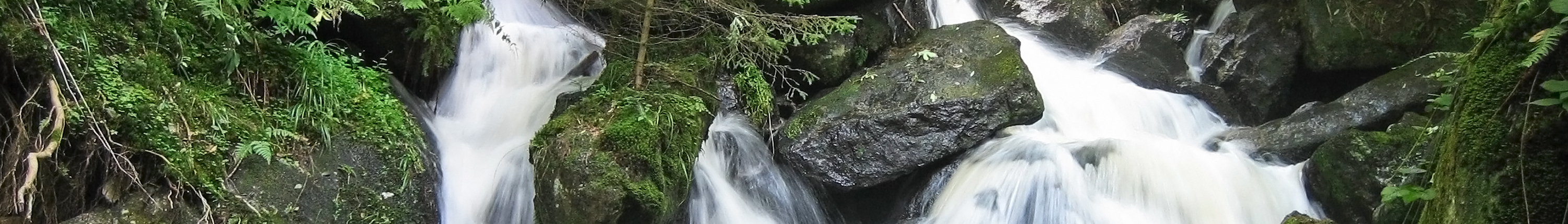
Deutsch: Die im Weinsberger Wald entspringende Große Ysper überwindet in der Ysperklamm auf einer Länge von 1,2 Kilometer einen Höhenunterschied von ca 300 Meter. Bis zum Jahr 1929 wurde die Klamm zu Holztrift benutzt, das Wasser dafür in dem im Jahr 1599 angelegten Ödteich oberhalb der Klamm gesammelt. Im Jahr 1956 brach der Damm nach der Schneeschmelze. Die Stege in der 1952 zum Naturdenkmal erklärten Klamm wurden wieder errichtet, der Teich (nicht denkmalgeschützt, weil künstlich angelegt) wurde zugeschüttet. |
|||
Date | ||||
Source | Own work | |||
Author | Duke of W4 | |||
Other versions |
|
Camera location | 48° 20′ 39.99″ N, 15° 03′ 27.56″ E | View this and other nearby images on: OpenStreetMap | 48.344442; 15.057656 |
---|
Licensing
[edit]- You are free:
- to share – to copy, distribute and transmit the work
- to remix – to adapt the work
- Under the following conditions:
- attribution – You must give appropriate credit, provide a link to the license, and indicate if changes were made. You may do so in any reasonable manner, but not in any way that suggests the licensor endorses you or your use.
- share alike – If you remix, transform, or build upon the material, you must distribute your contributions under the same or compatible license as the original.
This image was uploaded as part of Wiki Loves Earth 2014.
aragonés | العربية | asturianu | azərbaycanca | беларуская (тарашкевіца) | български | বাংলা | brezhoneg | català | čeština | Cymraeg | Deutsch | Ελληνικά | English | español | eesti | euskara | فارسی | français | galego | עברית | hrvatski | հայերեն | Bahasa Indonesia | italiano | 日本語 | ქართული | 한국어 | latviešu | македонски | മലയാളം | मराठी | Bahasa Melayu | norsk bokmål | नेपाली | Nederlands | norsk | polski | português | português do Brasil | русский | sicilianu | shqip | slovenščina | српски / srpski | svenska | ไทย | Türkçe | українська | اردو | 中文 | 中文(台灣) | +/− |
File history
Click on a date/time to view the file as it appeared at that time.
Date/Time | Thumbnail | Dimensions | User | Comment | |
---|---|---|---|---|---|
current | 22:07, 31 May 2024 | 3,000 × 429 (1.06 MB) | Atsirlin (talk | contribs) | File:Ysperklamm 2007-09 NÖ-Naturdenkmal ME-028.jpg cropped 79 % vertically, 79 % areawise using CropTool with precise mode. |
You cannot overwrite this file.
File usage on Commons
The following page uses this file:
File usage on other wikis
The following other wikis use this file:
- Usage on ru.wikivoyage.org
Metadata
This file contains additional information such as Exif metadata which may have been added by the digital camera, scanner, or software program used to create or digitize it. If the file has been modified from its original state, some details such as the timestamp may not fully reflect those of the original file. The timestamp is only as accurate as the clock in the camera, and it may be completely wrong.
Camera manufacturer | Canon |
---|---|
Camera model | Canon DIGITAL IXUS 50 |
Exposure time | 1/8 sec (0.125) |
F-number | f/2.8 |
Date and time of data generation | 09:34, 16 September 2007 |
Lens focal length | 5.8 mm |
Latitude | 48° 20′ 39.99″ N |
Longitude | 15° 3′ 27.56″ E |
Altitude | 675 meters above sea level |
Orientation | Normal |
Horizontal resolution | 437 dpi |
Vertical resolution | 437 dpi |
Software used | Adobe Photoshop Elements 8.0 Windows |
File change date and time | 18:11, 25 February 2014 |
Y and C positioning | Centered |
Exif version | 2.2 |
Date and time of digitizing | 09:34, 16 September 2007 |
Meaning of each component |
|
Image compression mode | 3 |
APEX shutter speed | 3 |
APEX aperture | 2.96875 |
APEX exposure bias | 0 |
Maximum land aperture | 2.96875 APEX (f/2.8) |
Metering mode | Center weighted average |
Flash | Flash did not fire, compulsory flash suppression |
Supported Flashpix version | 1 |
Color space | sRGB |
Focal plane X resolution | 11,520 |
Focal plane Y resolution | 11,571.428571429 |
Focal plane resolution unit | inches |
Sensing method | One-chip color area sensor |
File source | Digital still camera |
Custom image processing | Normal process |
Exposure mode | Auto exposure |
White balance | Auto white balance |
Digital zoom ratio | 1 |
Scene capture type | Standard |
GPS time (atomic clock) | 07:34 |
Geodetic survey data used | WGS-84 |
GPS date | 16 September 2007 |
GPS tag version | 0.0.2.2 |
Supported Flashpix version | 1 |
Image width | 3,000 px |
Image height | 2,000 px |
Date metadata was last modified | 19:11, 25 February 2014 |
Unique ID of original document | xmp.did:6BC68BCD3F9EE311A48ABE9E1B98CAF5 |
Structured data
In dieser Datei abgebildete Objekte
depicts
Einige Werte ohne einen Wikidata-Eintrag
48°20'39.98965193"N, 15°3'27.56113207"E
0.125 second
2.8
5.8 millimetre
image/jpeg
- Natural monuments in Austria with known ID
- Extracted images
- Files with coordinates missing SDC location of creation
- CC-BY-SA-3.0-AT
- Self-published work
- Images from Wiki Loves Earth 2014
- Images from Wiki Loves Earth 2014 in Austria
- Images from Wiki Loves Earth missing SDC depicts
- Images from Wiki Loves Earth missing SDC location of creation
- Images from Wiki Loves Earth missing SDC inception
- Images from Wiki Loves Earth missing SDC participant in