File:Yelabuga. The confluence of the river Toyma and Kama P6211077 2575.jpg
Jump to navigation
Jump to search
Size of this preview: 800 × 533 pixels. Other resolutions: 320 × 213 pixels | 640 × 427 pixels | 1,024 × 683 pixels | 1,280 × 853 pixels | 2,560 × 1,707 pixels | 3,862 × 2,575 pixels.
Original file (3,862 × 2,575 pixels, file size: 3.59 MB, MIME type: image/jpeg)
Captions
Captions
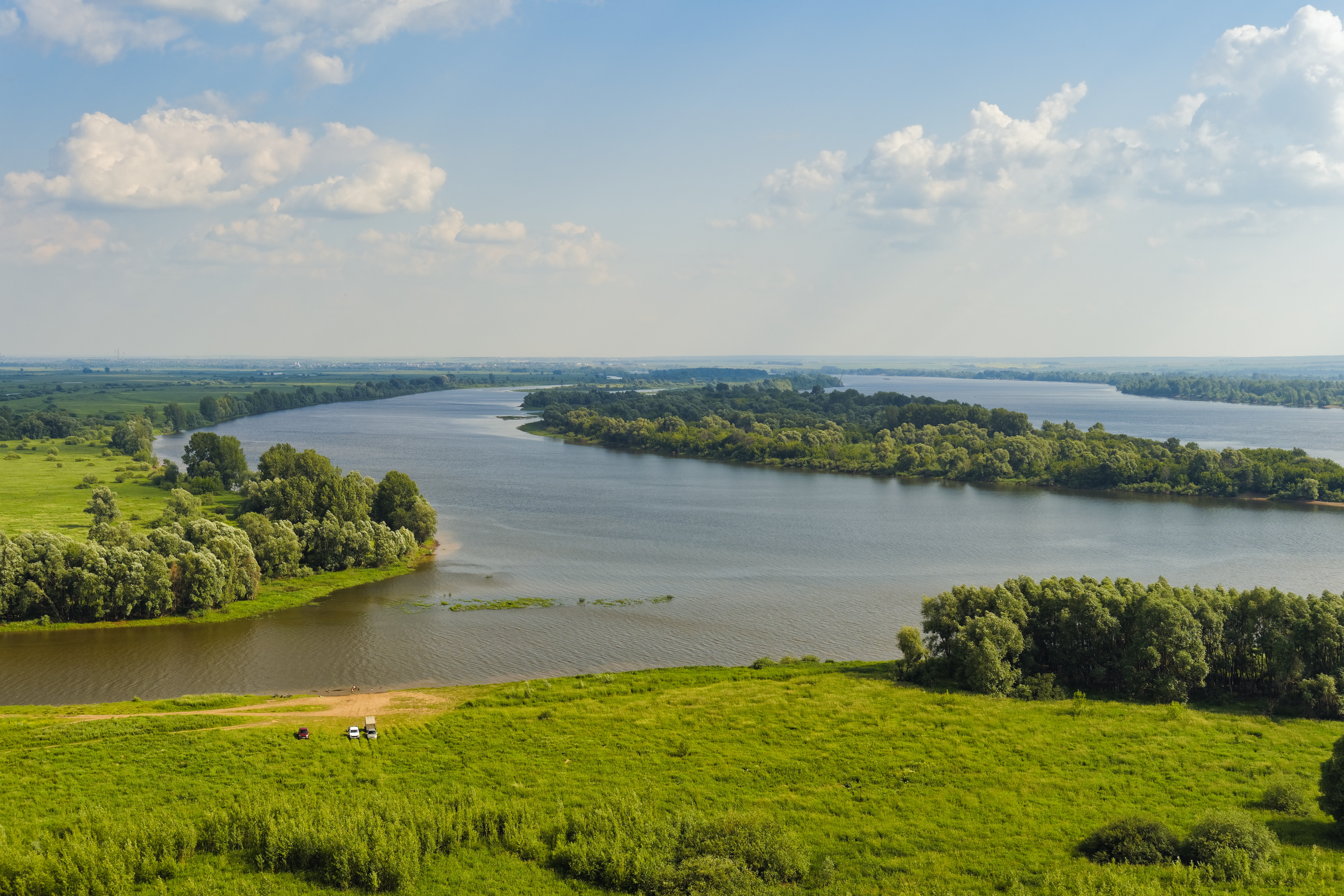
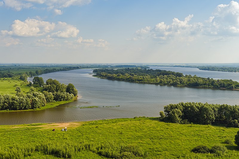
Yelabuga. The confluence of the river Toyma and Kama
Summary
[edit]
| Description |
Русский: Елабуга. Место впадения реки Тойма в Каму
English: Yelabuga. The confluence of the river Toyma and Kama |
| Date | |
| Source | Own work |
| Author | Alexxx1979 |
| Camera location | | View this and other nearby images on: OpenStreetMap |
|---|
Licensing
[edit]
I, the copyright holder of this work, hereby publish it under the following license:
This file is licensed under the Creative Commons Attribution-Share Alike 4.0 International license.
- You are free:
- to share – to copy, distribute and transmit the work
- to remix – to adapt the work
- Under the following conditions:
- attribution – You must give appropriate credit, provide a link to the license, and indicate if changes were made. You may do so in any reasonable manner, but not in any way that suggests the licensor endorses you or your use.
- share alike – If you remix, transform, or build upon the material, you must distribute your contributions under the same or compatible license as the original.
File history
Click on a date/time to view the file as it appeared at that time.
| Date/Time | Thumbnail | Dimensions | User | Comment | |
|---|---|---|---|---|---|
| current | 17:07, 24 December 2021 | | 3,862 × 2,575 (3.59 MB) | Alexxx1979 (talk | contribs) | Uploaded own work with UploadWizard |
You cannot overwrite this file.
File usage on Commons
The following 19 pages use this file:
- Category:Archaeological sites in Tatarstan
- Category:Births in Tatarstan
- Category:Bridges in Tatarstan
- Category:Companies of Tatarstan
- Category:Confluence of Toyma and Kama
- Category:Deaths in Tatarstan
- Category:Maps of Tatarstan
- Category:Monasteries in Tatarstan
- Category:Mosques in Tatarstan
- Category:Museums in Tatarstan
- Category:Organizations in Tatarstan
- Category:People of Tatarstan
- Category:Politicians of Tatarstan
- Category:Rivers of Tatarstan
- Category:Tatarstan
- Category:Transport in Tatarstan
- Category:Views of Tatarstan
- Category:Villages in Tatarstan
- Category:Visitor attractions in Tatarstan
File usage on other wikis
The following other wikis use this file:
- Usage on alt.wikipedia.org
- Usage on ar.wikipedia.org
- Usage on ast.wikipedia.org
- Usage on az.wikipedia.org
- Usage on be.wikipedia.org
- Usage on ca.wikipedia.org
- Usage on ce.wikipedia.org
- Usage on cs.wikipedia.org
- Usage on de.wikipedia.org
- Usage on de.wikivoyage.org
- Usage on diq.wikipedia.org
- Usage on el.wikipedia.org
- Usage on eu.wikipedia.org
- Usage on fi.wikipedia.org
- Usage on fi.wiktionary.org
- Usage on fr.wikivoyage.org
- Usage on ga.wikipedia.org
- Usage on gl.wikipedia.org
- Usage on he.wikipedia.org
- Usage on ku.wikipedia.org
- Usage on lmo.wikipedia.org
- Usage on lv.wikipedia.org
- Usage on mdf.wikipedia.org
- Usage on mhr.wikipedia.org
- Usage on mrj.wikipedia.org
- Usage on myv.wikipedia.org
- Usage on mzn.wikipedia.org
- Usage on nn.wikipedia.org
- Usage on no.wikipedia.org
- Usage on olo.wikipedia.org
- Usage on os.wikipedia.org
- Usage on pl.wikipedia.org
- Usage on pt.wikipedia.org
- Usage on ro.wikipedia.org
- Usage on ru.wikipedia.org
- Usage on ru.wikinews.org
- Usage on sr.wikipedia.org
- Usage on tg.wikipedia.org
View more global usage of this file.