File:Yahşihan-Demir-Köprü-arazi-topografik durum krokisi.jpg
Jump to navigation
Jump to search

Size of this preview: 684 × 599 pixels. Other resolutions: 274 × 240 pixels | 548 × 480 pixels | 877 × 768 pixels | 1,169 × 1,024 pixels | 2,266 × 1,985 pixels.
Original file (2,266 × 1,985 pixels, file size: 2.91 MB, MIME type: image/jpeg)
Captions
Captions
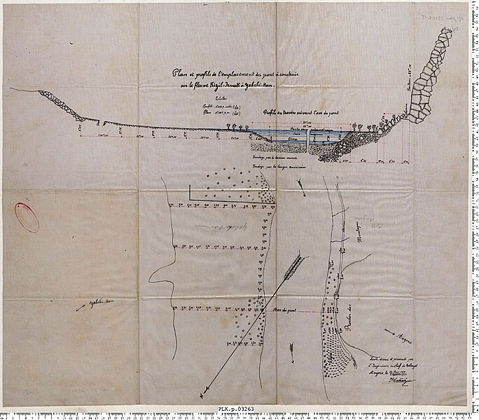
Land topographical map of the Demir Bridge dated 1904 in Yahşihan district of Kırıkkale
Summary
[edit]
| Description |
Türkçe: Kırıkkale'nin Yahşihan ilçesindeki 1904 tarihli Demir Köprü'nün arazi topografik durum krokisi
English: Land topographical map of the Demir Bridge dated 1904 in Yahşihan district of Kırıkkale |
| Date | |
| Source | Budak, A. (2019). Demir Köprü İnşasına Bir Örnek: Kırıkkale-Yahşihan Köprüsü. Akdeniz Sanat Dergisi, 178-179 |
| Author | Unknown author |
Licensing
[edit]
This work first published in the Ottoman Empire is now in the public domain because the Empire's copyright formalities were not met (copyright notice, registration, and deposit), or because the copyright term (30 years after the death of the author, sometimes less) expired before the Empire was dissolved (details).
|
.svg) |
File history
Click on a date/time to view the file as it appeared at that time.
| Date/Time | Thumbnail | Dimensions | User | Comment | |
|---|---|---|---|---|---|
| current | 20:29, 27 November 2023 | | 2,266 × 1,985 (2.91 MB) | SAİT71 (talk | contribs) | Uploaded a work by ? from Budak, A. (2019). Demir Köprü İnşasına Bir Örnek: Kırıkkale-Yahşihan Köprüsü. Akdeniz Sanat Dergisi, 178-179 with UploadWizard |
You cannot overwrite this file.
File usage on Commons
There are no pages that use this file.