File:Y Braich in cloud - geograph.org.uk - 1762459.jpg
Jump to navigation
Jump to search

Size of this preview: 800 × 600 pixels. Other resolutions: 320 × 240 pixels | 640 × 480 pixels | 1,024 × 768 pixels.
Original file (1,024 × 768 pixels, file size: 169 KB, MIME type: image/jpeg)
Captions
Captions
Add a one-line explanation of what this file represents
Summary
[edit]
| Description |
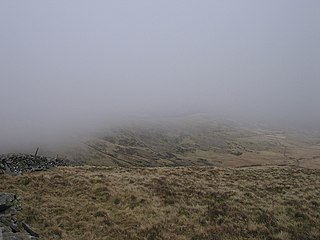
English: Y Braich in cloud. The old cart track from Bontddu to Harlech crosses the Diffwys ridge after gradually climbing up y Braich, its southern spur across the valley. The picture was taken from the track, which curves around the head of the valley in the foreground. For a clearer view taken minutes later from nearby, see 1762504. |
| Date | |
| Source | From geograph.org.uk |
| Author | Rudi Winter |
| Attribution (required by the license) | Rudi Winter / Y Braich in cloud / |
| Camera location | | View this and other nearby images on: OpenStreetMap |
|---|
_heading:135.00&language=en)
| Object location | | View this and other nearby images on: OpenStreetMap |
|---|
_heading:135.00&language=en)
Licensing
[edit]

|
This image was taken from the Geograph project collection. See this photograph's page on the Geograph website for the photographer's contact details. The copyright on this image is owned by Rudi Winter and is licensed for reuse under the Creative Commons Attribution-ShareAlike 2.0 license.
|
This file is licensed under the Creative Commons Attribution-Share Alike 2.0 Generic license.
Attribution: Rudi Winter
- You are free:
- to share – to copy, distribute and transmit the work
- to remix – to adapt the work
- Under the following conditions:
- attribution – You must give appropriate credit, provide a link to the license, and indicate if changes were made. You may do so in any reasonable manner, but not in any way that suggests the licensor endorses you or your use.
- share alike – If you remix, transform, or build upon the material, you must distribute your contributions under the same or compatible license as the original.
File history
Click on a date/time to view the file as it appeared at that time.
| Date/Time | Thumbnail | Dimensions | User | Comment | |
|---|---|---|---|---|---|
| current | 22:21, 11 March 2011 | | 1,024 × 768 (169 KB) | GeographBot (talk | contribs) | == {{int:filedesc}} == {{Information |description={{en|1=Y Braich in cloud The old cart track from Bontddu to Harlech crosses the Diffwys ridge after gradually climbing up y Braich, its southern spur across the valley. The picture was taken from the trac |
You cannot overwrite this file.
File usage on Commons
There are no pages that use this file.