File:Wyszogród (gmina) location map.png
Jump to navigation
Jump to search

Size of this preview: 622 × 599 pixels. Other resolutions: 249 × 240 pixels | 498 × 480 pixels | 922 × 888 pixels.
Original file (922 × 888 pixels, file size: 127 KB, MIME type: image/png)
Captions
Captions
Add a one-line explanation of what this file represents
| Description |
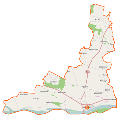
Polski: Mapa gminy Wyszogród, Polska
English: Map of Gmina Wyszogród, Poland |
|||||||||
| Date | ||||||||||
| Source | You may find a page on the OpenStreetMap wiki page for Wyszogród (gmina) | |||||||||
| Creator |
OpenStreetMap contributors OpenStreetMap contributors |
|||||||||
| Permission (Reusing this file) |
OpenStreetMap data is available under the Open Database License (details). Map tiles are licensed under the Creative Commons Attribution-ShareAlike 2.0 license (CC-BY-SA 2.0).
This file is licensed under the Creative Commons Attribution-Share Alike 2.0 Generic license.
|
|||||||||
| Geotemporal data | ||||||||||
| Bounding box |
|
|||||||||
| Georeferencing | If inappropriate please set warp_status = skip to hide. | |||||||||
File history
Click on a date/time to view the file as it appeared at that time.
| Date/Time | Thumbnail | Dimensions | User | Comment | |
|---|---|---|---|---|---|
| current | 07:09, 18 September 2014 | | 922 × 888 (127 KB) | VanWiel (talk | contribs) | {{Information |Description= |Source= |Date= |Author= |Permission= |other_versions= }} |
| 08:19, 1 June 2014 |  | 1,000 × 965 (444 KB) | VanWiel (talk | contribs) | {{OpenStreetMap | name = Wyszogród (gmina) | location = Wyszogród (gmina) | description = {{pl|Mapa gminy Wyszogród, Polska}} {{en|Map of Gmina Wyszogród, Poland}} | top = 52.5212 | left = 20.... |
You cannot overwrite this file.
File usage on Commons
There are no pages that use this file.
File usage on other wikis
The following other wikis use this file:
- Usage on fr.wikipedia.org
- Usage on nl.wikipedia.org
- Usage on pl.wikipedia.org
- Wyszogród (województwo mazowieckie)
- Wyszogród (gmina)
- Bolino
- Ciućkowo
- Grodkowo (województwo mazowieckie)
- Marcjanka (województwo mazowieckie)
- Pozarzyn
- Pruszczyn
- Kobylniki (województwo mazowieckie)
- Rębowo (województwo mazowieckie)
- Rostkowice (województwo mazowieckie)
- Starzyno (województwo mazowieckie)
- Wiązówka (województwo mazowieckie)
- Wilczkowo (województwo mazowieckie)
- Chmielewo (powiat płocki)
- Rakowo (powiat płocki)
- Słomin (powiat płocki)
- Drwały (gmina Wyszogród)
- Bielice (Rostkowice)
- Grodkówko
- Most w Wyszogrodzie
- Nowy cmentarz żydowski w Wyszogrodzie
- Parafia Świętej Trójcy w Wyszogrodzie
- Stary cmentarz żydowski w Wyszogrodzie
- Kościół Świętej Trójcy w Wyszogrodzie
- Kościół Matki Boskiej Anielskiej w Wyszogrodzie
- Most drewniany w Wyszogrodzie
- Moduł:Mapa/dane/Wyszogród
- Moduł:Mapa/dane/Wyszogród (gmina)
- Wychylówka (Grodkowo)
- Parafia św. Anny w Kobylnikach
- Parafia św. Jana Chrzciciela w Rębowie
- Rybaki (Wyszogród)
- Kępa Wyszogrodzka
- Zamek w Wyszogrodzie
- Usage on pl.wikibooks.org
_location_map.png&oldid=467738235)