File:Wybert's Castle - geograph.org.uk - 1455023.jpg
Jump to navigation
Jump to search
No higher resolution available.
Wybert's_Castle_-_geograph.org.uk_-_1455023.jpg (640 × 426 pixels, file size: 91 KB, MIME type: image/jpeg)
Captions
Captions
Add a one-line explanation of what this file represents
Summary
[edit]| Description |
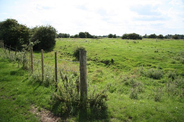
English: Wybert's Castle Moated site east of Wyberton also known as Wells Slade, seemingly neither Wybert's or a Castle.
Referred to as Wells Slade in 1541 it is most likely the site of moated house and pottery as early as 12th century was found during the dig by the Boston Archaeology Group in 1960. The name Wybert's Castle first appeared in 1887 and numerous myths about buried treasure abound |
| Date | |
| Source | From geograph.org.uk |
| Author | Richard Croft |
| Attribution (required by the license) | Richard Croft / Wybert's Castle / |
| Camera location | | View this and other nearby images on: OpenStreetMap |
|---|
| Object location | | View this and other nearby images on: OpenStreetMap |
|---|
Licensing
[edit]
|
This image was taken from the Geograph project collection. See this photograph's page on the Geograph website for the photographer's contact details. The copyright on this image is owned by Richard Croft and is licensed for reuse under the Creative Commons Attribution-ShareAlike 2.0 license.
|
This file is licensed under the Creative Commons Attribution-Share Alike 2.0 Generic license.
Attribution: Richard Croft
- You are free:
- to share – to copy, distribute and transmit the work
- to remix – to adapt the work
- Under the following conditions:
- attribution – You must give appropriate credit, provide a link to the license, and indicate if changes were made. You may do so in any reasonable manner, but not in any way that suggests the licensor endorses you or your use.
- share alike – If you remix, transform, or build upon the material, you must distribute your contributions under the same or compatible license as the original.

_heading:202.00&language=en)
_heading:202.00&language=en)
File history
Click on a date/time to view the file as it appeared at that time.
| Date/Time | Thumbnail | Dimensions | User | Comment | |
|---|---|---|---|---|---|
| current | 06:56, 2 March 2011 | | 640 × 426 (91 KB) | GeographBot (talk | contribs) | == {{int:filedesc}} == {{Information |description={{en|1=Wybert's Castle Moated site east of Wyberton also known as Wells Slade, seemingly neither Wybert's or a Castle. Referred to as Wells Slade in 1541 it is most likely the site of moated house and p |
You cannot overwrite this file.
File usage on Commons
There are no pages that use this file.