File:Wright Brothers Memorial Mound Group.jpg
Jump to navigation
Jump to search

Size of this preview: 800 × 450 pixels. Other resolutions: 320 × 180 pixels | 640 × 360 pixels | 1,024 × 576 pixels | 1,280 × 720 pixels | 2,816 × 1,584 pixels.
Original file (2,816 × 1,584 pixels, file size: 3.05 MB, MIME type: image/jpeg)
Captions
Captions
Add a one-line explanation of what this file represents
|
This is an image of a place or building that is listed on the National Register of Historic Places in the United States of America. Its reference number is 74001505. |
| Camera location | | View this and other nearby images on: OpenStreetMap |
|---|
| Description |
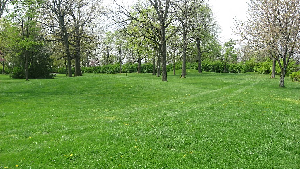
English: Overview from the northeast of the Wright Brothers Memorial Mound Group, located at the Wright Brothers Memorial near Huffman Prairie near Fairborn in Bath Township, Greene County, Ohio, United States. Composed of six mounds, the group is an important archaeological site. Huffman Prairie has been declared a National Historic Landmark because of its key role in the first flight experiments of the Wright Brothers; the mound group is independently listed on the National Register of Historic Places because of its archaeological significance. |
||
| Date | Taken on 3 April 2012 | ||
| Source | Own work | ||
| Author | Nyttend | ||
| Permission (Reusing this file) |
|
File history
Click on a date/time to view the file as it appeared at that time.
| Date/Time | Thumbnail | Dimensions | User | Comment | |
|---|---|---|---|---|---|
| current | 00:57, 7 May 2012 | | 2,816 × 1,584 (3.05 MB) | Nyttend (talk | contribs) | {{NRHP|74001505}} {{Location|39|47|42|N|84|5|21|W}} {{Information |Description={{en|Overview from the northeast of the {{w|Wright Brothers Memorial Mound Group}}, located at the Wright Brothers Memorial on {{w|Huffman Prairie}} near {{w|Fairborn, Ohio|... |
You cannot overwrite this file.
File usage on Commons
There are no pages that use this file.
File usage on other wikis
The following other wikis use this file:
- Usage on en.wikipedia.org