File:World borders utm.png
Jump to navigation
Jump to search
Size of this preview: 800 × 364 pixels. Other resolutions: 320 × 146 pixels | 640 × 292 pixels | 1,024 × 466 pixels | 1,280 × 583 pixels | 4,000 × 1,822 pixels.
Original file (4,000 × 1,822 pixels, file size: 594 KB, MIME type: image/png)
Captions
Captions
Add a one-line explanation of what this file represents
Summary
[edit]
| Description |
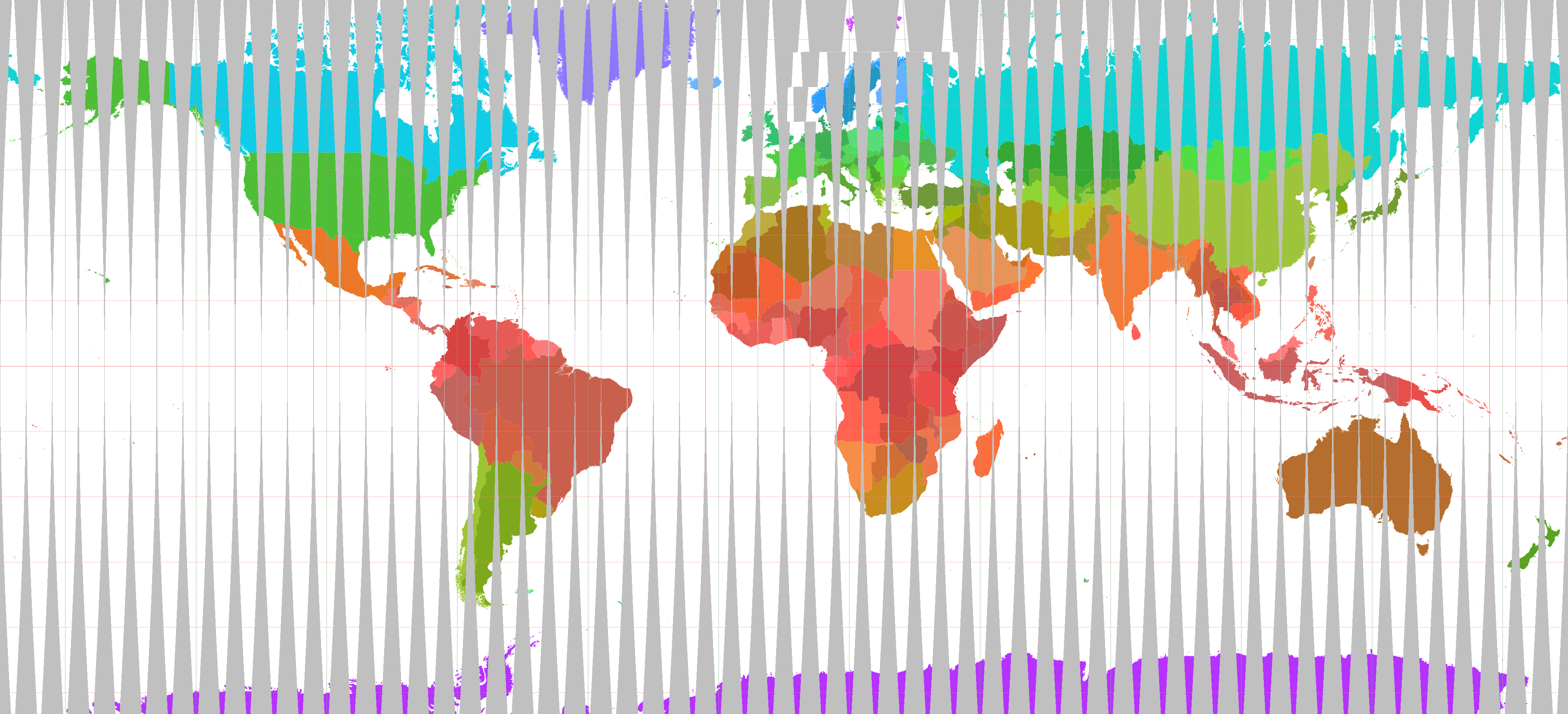
Nederlands: Staatkundige kaart van de Wereld in UTM met kleuren die varieren met de breedtegraad |
| Date |
21 November 2006 (original upload date) |
| Source | world_borders.shp; "The world_borders.zip dataset is Shapefile of the world's international borders, derived by Schuyler Erle from public domain sources." |
| Author | (Original text: productie van de afbeelding uit het .shp-bestand: Koenb) |
| Permission (Reusing this file) |
public domain |
Licensing
[edit]
| This work has been released into the public domain by its author, Koenb at Dutch Wikipedia. This applies worldwide. In some countries this may not be legally possible; if so: Koenb grants anyone the right to use this work for any purpose, without any conditions, unless such conditions are required by law. |
Original upload log
[edit]
The original description page was here. All following user names refer to nl.wikipedia.
- 2006-12-01 20:52 Koenb 4000×1822×8 (608230 bytes)
- 2006-11-24 21:33 Koenb 4000×1822×8 (650384 bytes)
- 2006-11-21 22:47 Koenb 4000×1930×8 (657534 bytes) {{Information| |Description=Staatkundige kaart van de Wereld in UTM met kleuren die varieren met de breedtegraad |Source=world_borders.shp; "The world_borders.zip dataset is Shapefile of the world's international borders, derived by Schuyler Erle from pub
File history
Click on a date/time to view the file as it appeared at that time.
| Date/Time | Thumbnail | Dimensions | User | Comment | |
|---|---|---|---|---|---|
| current | 14:28, 14 December 2007 | | 4,000 × 1,822 (594 KB) | BotMultichill (talk | contribs) | {{BotMoveToCommons|nl.wikipedia}} {{Information |Description={{nl|Staatkundige kaart van de Wereld in UTM met kleuren die varieren met de breedtegraad}} |Source=Transfered from [http://nl.wikipedia.org nl.wikipedia]<br/> (Original text : ''world_borders |
You cannot overwrite this file.
File usage on Commons
The following page uses this file:
File usage on other wikis
The following other wikis use this file:
- Usage on ast.wikipedia.org
- Usage on et.wikipedia.org
- Usage on fr.wikipedia.org
- Usage on nl.wikipedia.org
- Usage on www.wikidata.org