File:World borders albers.png
Jump to navigation
Jump to search

Size of this preview: 800 × 599 pixels. Other resolutions: 320 × 240 pixels | 640 × 480 pixels | 1,024 × 767 pixels | 1,280 × 959 pixels | 2,222 × 1,665 pixels.
Original file (2,222 × 1,665 pixels, file size: 635 KB, MIME type: image/png)
Captions
Captions
Add a one-line explanation of what this file represents
Summary
[edit]
| Description |
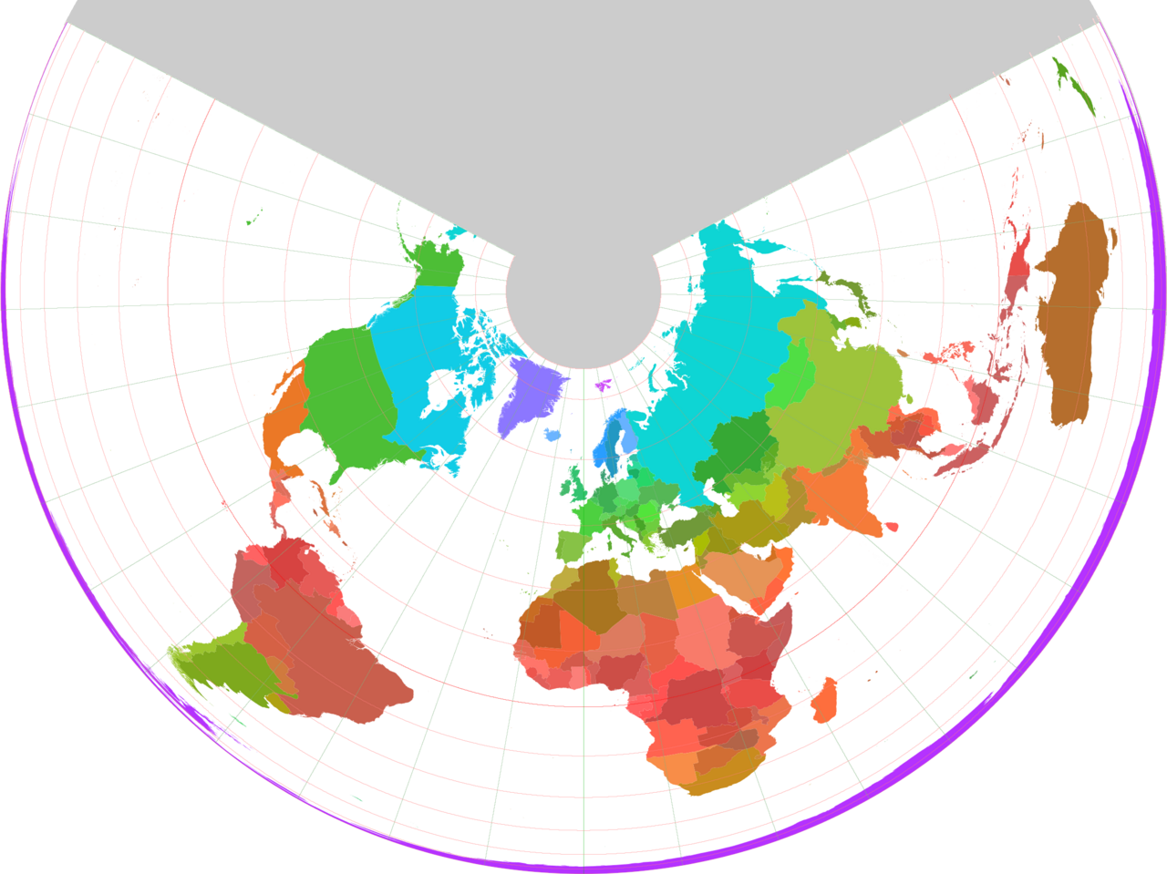
Nederlands: Staatkundige kaart van de Wereld op basis van een oppervlaktegetrouwe kegelprojectie (schaalvaste parallellen: 45-22,5 en 45+22,5 graden) met kleuren die varieren met de breedtegraad.
English: Political map of the World using a surface-area consistent conic projection (with fixed scale parallels 45-22.5 and 45+22.5 degrees) with colours that vary according to latitude. |
| Date | |
| Source | world_borders.shp; "The world_borders.zip dataset is Shapefile of the world's international borders, derived by Schuyler Erle from public domain sources." |
| Author | productie van de afbeelding uit het .shp-bestand: Koenb at Dutch Wikipedia |
| Permission (Reusing this file) |
public domain |
Licensing
[edit]
| This work has been released into the public domain by its author, Koenb at Dutch Wikipedia. This applies worldwide. In some countries this may not be legally possible; if so: Koenb grants anyone the right to use this work for any purpose, without any conditions, unless such conditions are required by law. |
Original upload log
[edit]
The original description page was here. All following user names refer to nl.wikipedia.
- 2006-12-24 20:34 Koenb 2222×1665×8 (650259 bytes) {{Information| |Description=Staatkundige kaart van de Wereld op basis van een oppervlaktegetrouwe kegelprojectie (schaalvaste parallellen: 45-22,5 en 45+22,5 graden) met kleuren die varieren met de breedtegraad |Source=world_borders.shp; "The world_border
File history
Click on a date/time to view the file as it appeared at that time.
| Date/Time | Thumbnail | Dimensions | User | Comment | |
|---|---|---|---|---|---|
| current | 14:30, 14 December 2007 | | 2,222 × 1,665 (635 KB) | BotMultichill (talk | contribs) | {{BotMoveToCommons|nl.wikipedia}} {{Information |Description={{nl|Staatkundige kaart van de Wereld op basis van een oppervlaktegetrouwe kegelprojectie (schaalvaste parallellen: 45-22,5 en 45+22,5 graden) met kleuren die varieren met de breedtegraad}} |S |
You cannot overwrite this file.
File usage on Commons
The following 2 pages use this file:
- File:World borders alders.png (file redirect)
- Category:Albers projection
File usage on other wikis
The following other wikis use this file:
- Usage on fr.wikipedia.org
- Usage on nl.wikipedia.org
- Usage on www.wikidata.org