File:Woodmansey, HU17 (geograph 3553467).jpg
Jump to navigation
Jump to search
Size of this preview: 788 × 599 pixels. Other resolutions: 316 × 240 pixels | 631 × 480 pixels | 1,010 × 768 pixels | 1,280 × 974 pixels | 2,560 × 1,947 pixels | 3,312 × 2,519 pixels.
Original file (3,312 × 2,519 pixels, file size: 1.73 MB, MIME type: image/jpeg)
Captions
Captions
Add a one-line explanation of what this file represents
Summary
[edit].jpg&action=edit§ion=1)
| Description |
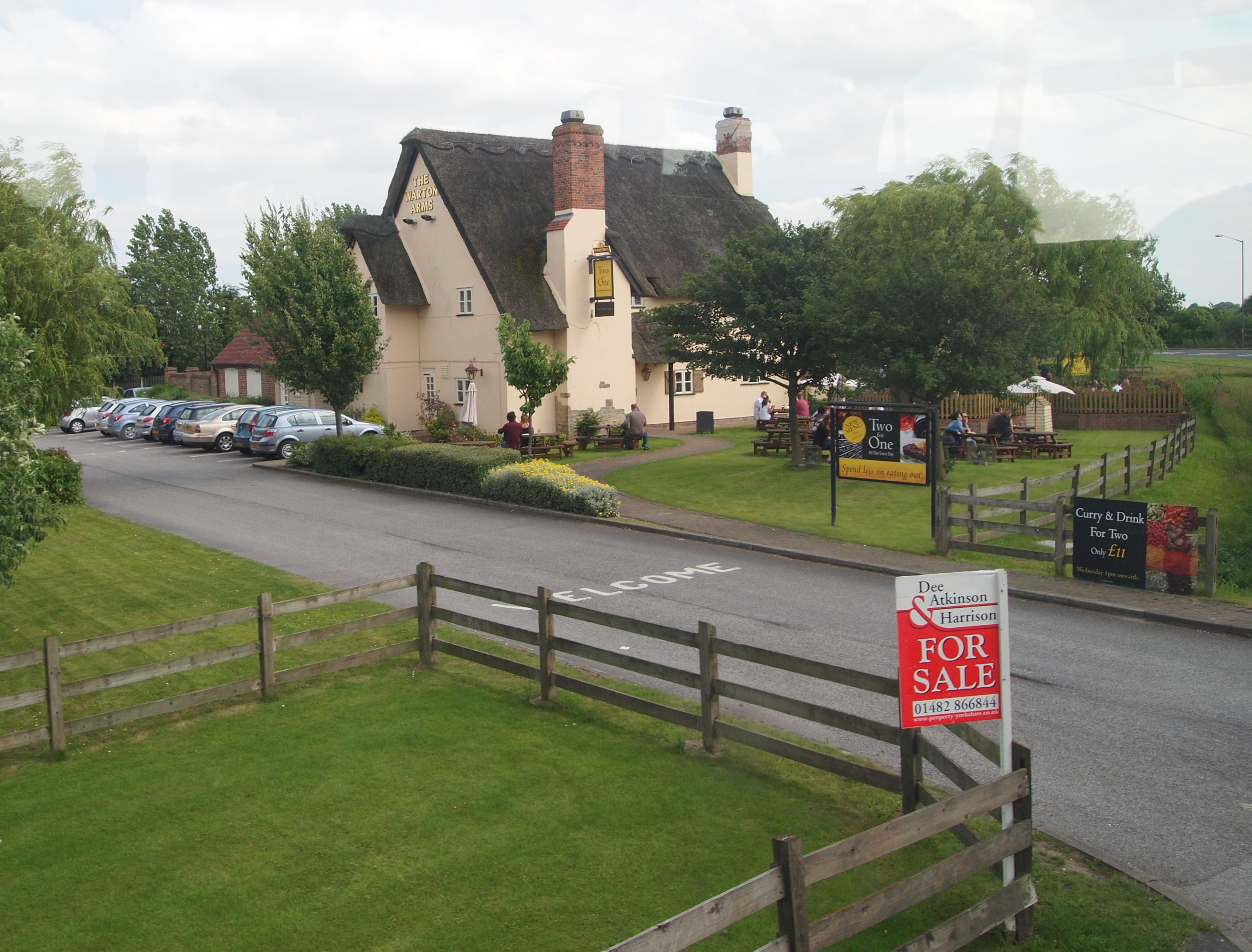
English: HU17, Woodmansey, East Riding of Yorkshire, England. The apparently 'olde worlde' "Warton Arms" pub on the side of the Hull-Beverley Road (the A1174) was actually built the late 1990s. A couple of Belgian thatchers secured the contract to thatch it. Beverley lies behind the photographer. |
| Date | |
| Source | From geograph.org.uk |
| Author | David Hallam-Jones |
| Permission (Reusing this file) |
Creative Commons Attribution Share-alike license 2.0 |
| Attribution (required by the license) | David Hallam-Jones / Woodmansey, HU17 / |
| Camera location | | View this and other nearby images on: OpenStreetMap |
|---|
.jpg¶ms=053.827036_N_-000.399242_E_globe:Earth_type:camera_source:geograph-osgb36(TA05463794)_heading:180.00&language=en)
| Object location | | View this and other nearby images on: OpenStreetMap |
|---|
.jpg¶ms=053.826860_N_-000.399250_E_globe:Earth_class:object_type:object_source:geograph-osgb36(TA05463792)_heading:180.00&language=en)
Licensing
[edit].jpg&action=edit§ion=2)

|
This image was taken from the Geograph project collection. See this photograph's page on the Geograph website for the photographer's contact details. The copyright on this image is owned by David Hallam-Jones and is licensed for reuse under the Creative Commons Attribution-ShareAlike 2.0 license.
|
This file is licensed under the Creative Commons Attribution-Share Alike 2.0 Generic license.
Attribution: David Hallam-Jones
- You are free:
- to share – to copy, distribute and transmit the work
- to remix – to adapt the work
- Under the following conditions:
- attribution – You must give appropriate credit, provide a link to the license, and indicate if changes were made. You may do so in any reasonable manner, but not in any way that suggests the licensor endorses you or your use.
- share alike – If you remix, transform, or build upon the material, you must distribute your contributions under the same or compatible license as the original.
File history
Click on a date/time to view the file as it appeared at that time.
| Date/Time | Thumbnail | Dimensions | User | Comment | |
|---|---|---|---|---|---|
| current | 15:53, 14 November 2020 | | 3,312 × 2,519 (1.73 MB) | Keith D (talk | contribs) | Transferred from geograph.co.uk using [https://tools.wmflabs.org/geograph2commons/ geograph2commons] |
You cannot overwrite this file.
File usage on Commons
There are no pages that use this file.
Metadata
.jpg&oldid=716067123)
Categories:
- Warton Arms, Woodmansey
- Thatched roofs in the East Riding of Yorkshire
- Fences in the East Riding of Yorkshire
- Signs in the East Riding of Yorkshire
- Car parks in the East Riding of Yorkshire
- Picnic tables in the East Riding of Yorkshire
- Trees in the East Riding of Yorkshire
- July 2013 in the East Riding of Yorkshire