File:Wood Cemetery TxHM (24834424016).jpg

Original file (2,736 × 3,648 pixels, file size: 3.72 MB, MIME type: image/jpeg)
Captions
Captions
Summary
[edit].jpg&action=edit§ion=1)
| Description |
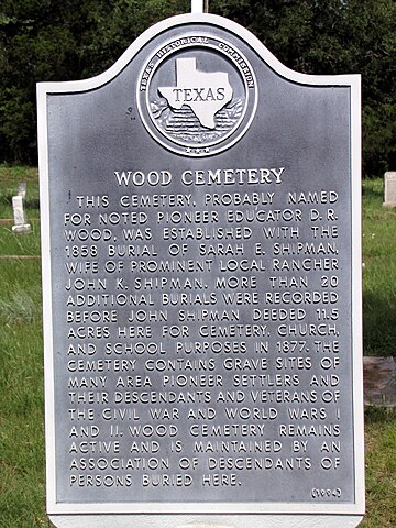
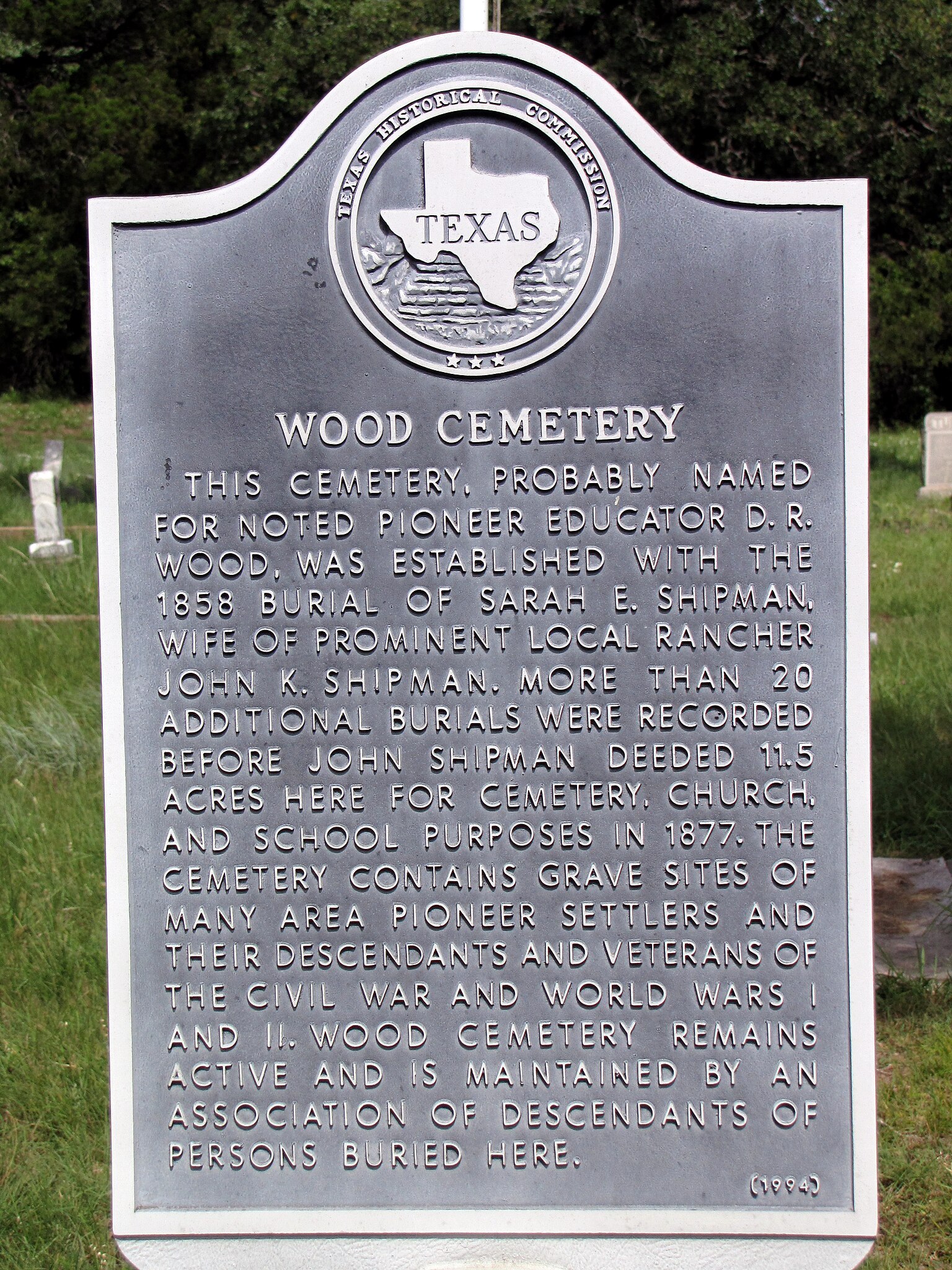
This cemetery, probably named for noted pioneer educator D. R. Wood, was established with the 1858 burial of Sarah E. Shipman, wife of prominent local rancher John K. Shipman. More than 20 additional burials were recorded before John Shipman deeded 11.5 acres here for cemetery, church, and school purposes in 1877. The cemetery contains grave sites of many area pioneer settlers and their descendants and veterans of the Civil War and World Wars I and II. Wood Cemetery remains active and is maintained by an association of descendants of persons buried here. (1994) (This image represents an Open Plaques entry) |
| Date | |
| Source | Wood Cemetery TxHM |
| Author | QuesterMark from Where the West Begins, United States |
| Camera location | | View this and other nearby images on: OpenStreetMap |
|---|
.jpg¶ms=031.582430_N_-097.855612_E_globe:Earth_type:camera_source:Flickr_&language=en)
Licensing
[edit].jpg&action=edit§ion=2)
- You are free:
- to share – to copy, distribute and transmit the work
- to remix – to adapt the work
- Under the following conditions:
- attribution – You must give appropriate credit, provide a link to the license, and indicate if changes were made. You may do so in any reasonable manner, but not in any way that suggests the licensor endorses you or your use.
- share alike – If you remix, transform, or build upon the material, you must distribute your contributions under the same or compatible license as the original.
| This image was originally posted to Flickr by QuesterMark at https://flickr.com/photos/52855156@N00/24834424016 (archive). It was reviewed on 7 November 2018 by FlickreviewR 2 and was confirmed to be licensed under the terms of the cc-by-sa-2.0. |
File history
Click on a date/time to view the file as it appeared at that time.
| Date/Time | Thumbnail | Dimensions | User | Comment | |
|---|---|---|---|---|---|
| current | 15:35, 7 November 2018 | | 2,736 × 3,648 (3.72 MB) | Jnicho02 (talk | contribs) | Transferred from Flickr via #flickr2commons |
You cannot overwrite this file.
File usage on Commons
There are no pages that use this file.
.jpg&oldid=888686463)