File:Winnemucca Dry Lake, State Route 447 Between Pyramid Lake and Gerlach, Nevada (11128475283).jpg
Original file (4,000 × 3,000 pixels, file size: 2.42 MB, MIME type: image/jpeg)
Captions
Captions
Summary
[edit].jpg&action=edit§ion=1)
| Description |
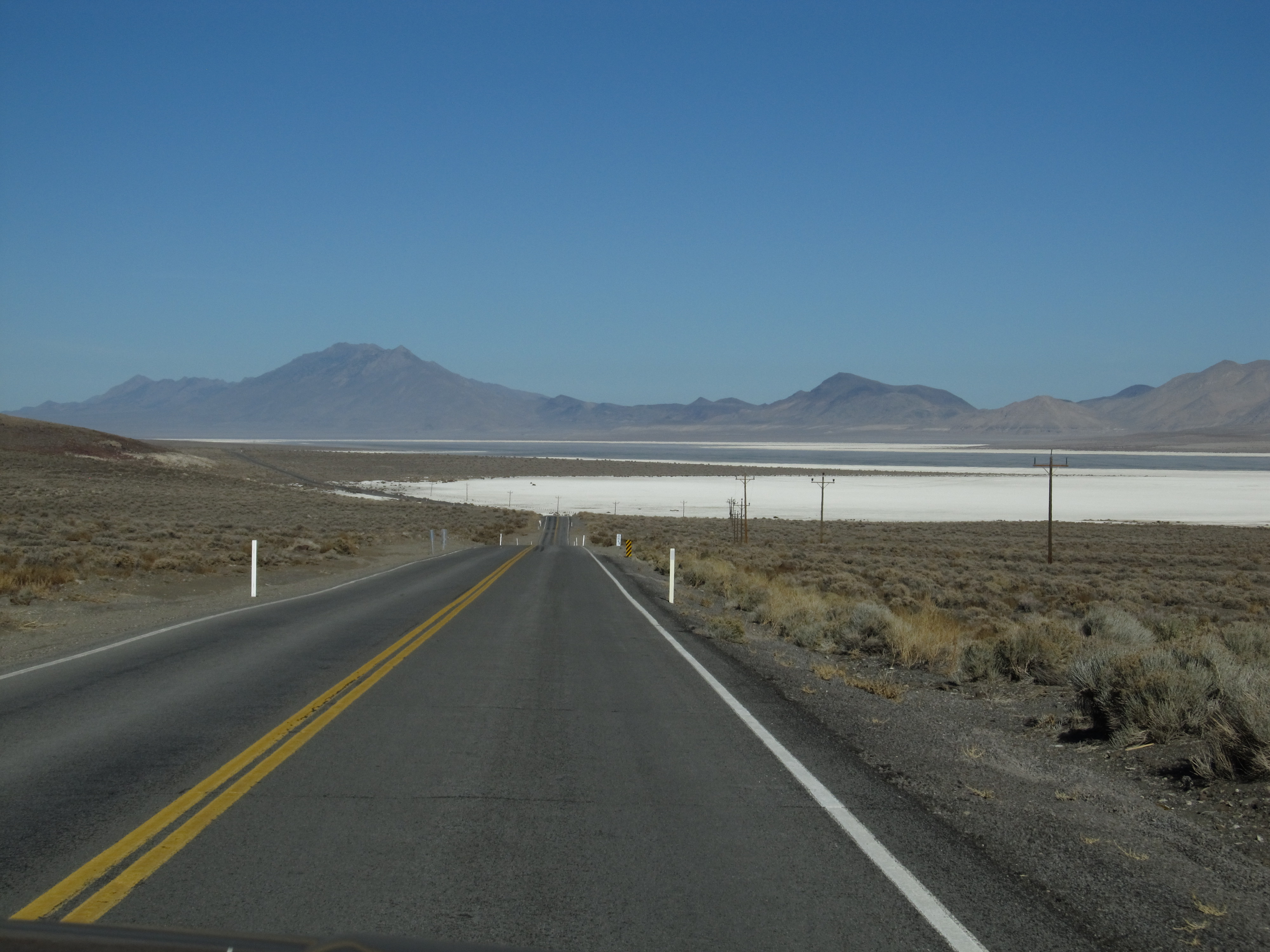
Winnemucca Lake is a dry lake bed lying in northwest Nevada. It is on the dividing line between Washoe and Pershing counties. Until the 1930s, it was a shallow lake, but was dried out by construction projects. Winnemucca Lake is home to several petroglyphs long believed to be very old. In 2013, researchers dated the carvings to between 14,800 and 10,500 years ago. Either date would make them the oldest known petroglyphs found in North America. The carvings lie within the Pyramid Lake Indian Reservation. Winnemucca Lake is a sub-basin within the Lahontan Basin in northwestern Nevada.[1] It lies east of Pyramid Lake and is on the dividing line between Washoe and Pershing counties. The lake bed lies between the Lake Range on the west and the Nightingale Mountains and Selenite Range to the east. Winnemucca Lake is about 45 km (28 mi) long and about 7 km (4.3 mi) wide. The lake bed is at an elevation of 1,150 m (3,770 ft),[2][3] which is below the water level of adjacent Pyramid Lake.[4] Winnemucca Lake was a shallow tule-filled lake and an important stop for migrating waterfowl. After the Derby Dam was built on the Truckee River in 1903 (the first project of the Reclamation Act), and State Route 447 (which blocked the slough connecting it to Pyramid Lake) was built, Winnemucca Lake dried out and has remained seasonally dry since the late 1930s.[5][6] In 1936, Franklin D. Roosevelt made an effort to rescue the lake and designated the area as the Winnemucca Lake National Wildlife Refuge. In 1962, the refuge designation was removed, making this area the first refuge designation lost because of lack of water. en.wikipedia.org/wiki/Winnemucca_Lake en.wikipedia.org/wiki/Wikipedia:Text_of_Creative_Commons_... |
| Date | Taken on 29 November 2013, 02:35 |
| Source | Winnemucca Dry Lake, State Route 447 Between Pyramid Lake and Gerlach, Nevada |
| Author | Ken Lund from Reno, Nevada, USA |
| Camera location | | View this and other nearby images on: OpenStreetMap |
|---|
.jpg¶ms=040.060394_N_-119.379394_E_globe:Earth_type:camera_source:Flickr_&language=en)
Licensing
[edit].jpg&action=edit§ion=2)
- You are free:
- to share – to copy, distribute and transmit the work
- to remix – to adapt the work
- Under the following conditions:
- attribution – You must give appropriate credit, provide a link to the license, and indicate if changes were made. You may do so in any reasonable manner, but not in any way that suggests the licensor endorses you or your use.
- share alike – If you remix, transform, or build upon the material, you must distribute your contributions under the same or compatible license as the original.
| This image was originally posted to Flickr by Ken Lund at https://flickr.com/photos/75683070@N00/11128475283. It was reviewed on 5 December 2015 by FlickreviewR and was confirmed to be licensed under the terms of the cc-by-sa-2.0. |
File history
Click on a date/time to view the file as it appeared at that time.
| Date/Time | Thumbnail | Dimensions | User | Comment | |
|---|---|---|---|---|---|
| current | 22:03, 5 December 2015 | | 4,000 × 3,000 (2.42 MB) | INeverCry (talk | contribs) | Transferred from Flickr via Flickr2Commons |
You cannot overwrite this file.
File usage on Commons
There are no pages that use this file.
.jpg&oldid=589760289)