File:Windy End, old reservoir demolished - geograph.org.uk - 1121306.jpg
Jump to navigation
Jump to search
No higher resolution available.
Windy_End,_old_reservoir_demolished_-_geograph.org.uk_-_1121306.jpg (640 × 480 pixels, file size: 116 KB, MIME type: image/jpeg)
Captions
Captions
Add a one-line explanation of what this file represents
Summary
[edit]| Description |
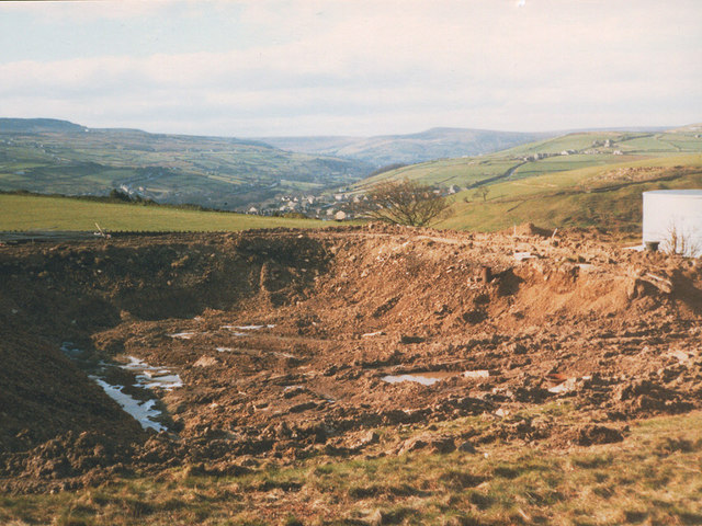
English: Windy End: old reservoir demolished The original service reservoir at Windy End was an open one, with puddle clay embankments and stone lining internally. At some point it had a steel sheet roof put over it. The reservoir was demolished during 1987 to make way for a new one 1121314. |
| Date | |
| Source | From geograph.org.uk |
| Author | Stephen Craven |
| Attribution (required by the license) | Stephen Craven / Windy End: old reservoir demolished / |
| Camera location | | View this and other nearby images on: OpenStreetMap |
|---|
| Object location | | View this and other nearby images on: OpenStreetMap |
|---|
Licensing
[edit]
|
This image was taken from the Geograph project collection. See this photograph's page on the Geograph website for the photographer's contact details. The copyright on this image is owned by Stephen Craven and is licensed for reuse under the Creative Commons Attribution-ShareAlike 2.0 license.
|
This file is licensed under the Creative Commons Attribution-Share Alike 2.0 Generic license.
Attribution: Stephen Craven
- You are free:
- to share – to copy, distribute and transmit the work
- to remix – to adapt the work
- Under the following conditions:
- attribution – You must give appropriate credit, provide a link to the license, and indicate if changes were made. You may do so in any reasonable manner, but not in any way that suggests the licensor endorses you or your use.
- share alike – If you remix, transform, or build upon the material, you must distribute your contributions under the same or compatible license as the original.

_heading:225.00&language=en)
_heading:225.00&language=en)
File history
Click on a date/time to view the file as it appeared at that time.
| Date/Time | Thumbnail | Dimensions | User | Comment | |
|---|---|---|---|---|---|
| current | 02:12, 25 February 2011 | | 640 × 480 (116 KB) | GeographBot (talk | contribs) | == {{int:filedesc}} == {{Information |description={{en|1=Windy End: old reservoir demolished The original service reservoir at Windy End was an open one, with puddle clay embankments and stone lining internally. At some point it had a steel sheet roof pu |
You cannot overwrite this file.
File usage on Commons
There are no pages that use this file.