File:Willerby Hill Business Park (geograph 6234720).jpg
Jump to navigation
Jump to search

Size of this preview: 800 × 529 pixels. Other resolutions: 320 × 212 pixels | 640 × 423 pixels | 1,024 × 677 pixels | 1,280 × 846 pixels | 1,906 × 1,260 pixels.
Original file (1,906 × 1,260 pixels, file size: 1.44 MB, MIME type: image/jpeg)
Captions
Captions
Add a one-line explanation of what this file represents
Summary
[edit].jpg&action=edit§ion=1)
| Description | |
| Date | |
| Source | From geograph.org.uk |
| Author | David Howard |
| Permission (Reusing this file) |
Creative Commons Attribution Share-alike license 2.0 |
| Attribution (required by the license) | David Howard / Willerby Hill Business Park / |
| Camera location | | View this and other nearby images on: OpenStreetMap |
|---|
.jpg¶ms=053.771692_N_-000.449298_E_globe:Earth_type:camera_source:geograph-osgb36(TA02303171)_heading:270.00&language=en)
| Object location | | View this and other nearby images on: OpenStreetMap |
|---|
.jpg¶ms=053.771610_N_-000.449910_E_globe:Earth_class:object_type:object_source:geograph-osgb36(TA02263170)_heading:270.00&language=en)
Licensing
[edit].jpg&action=edit§ion=2)

|
This image was taken from the Geograph project collection. See this photograph's page on the Geograph website for the photographer's contact details. The copyright on this image is owned by David Howard and is licensed for reuse under the Creative Commons Attribution-ShareAlike 2.0 license.
|
This file is licensed under the Creative Commons Attribution-Share Alike 2.0 Generic license.
Attribution: David Howard
- You are free:
- to share – to copy, distribute and transmit the work
- to remix – to adapt the work
- Under the following conditions:
- attribution – You must give appropriate credit, provide a link to the license, and indicate if changes were made. You may do so in any reasonable manner, but not in any way that suggests the licensor endorses you or your use.
- share alike – If you remix, transform, or build upon the material, you must distribute your contributions under the same or compatible license as the original.
File history
Click on a date/time to view the file as it appeared at that time.
| Date/Time | Thumbnail | Dimensions | User | Comment | |
|---|---|---|---|---|---|
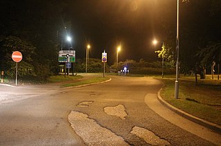
| current | 17:07, 18 August 2021 | | 1,906 × 1,260 (1.44 MB) | Keith D (talk | contribs) | == {{int:filedesc}} == {{Information |Description={{en|1=Willerby Hill Business Park, Cottingham, East Riding of Yorkshire, England.}} |Source=From [https://www.geograph.org.uk/photo/6234720 geograph.org.uk] |Date=2019-08-06 |Author=[https://www.geograph.org.uk/profile/6358 David Howard] |Permission=Creative Commons Attribution Share-alike license 2.0 |Other fields={{Credit line |Author=David Howard |License=[http... |
You cannot overwrite this file.
File usage on Commons
There are no pages that use this file.
Metadata
.jpg&oldid=899968342)
Categories:
- Roads in Cottingham, East Riding of Yorkshire
- A164 road (England)
- Roundabouts in the East Riding of Yorkshire
- Road signs in the East Riding of Yorkshire
- 40 mph speed limit road signs in the East Riding of Yorkshire
- No entry road signs in the East Riding of Yorkshire
- Street lights in the East Riding of Yorkshire
- Night in the East Riding of Yorkshire
- Hedges in the East Riding of Yorkshire
- Trees in the East Riding of Yorkshire
- August 2019 in the East Riding of Yorkshire