File:Wildfires on Central America 2015-04-23 1850Z.jpg
Jump to navigation
Jump to search
Size of this preview: 461 × 599 pixels. Other resolutions: 184 × 240 pixels | 369 × 480 pixels | 591 × 768 pixels | 788 × 1,024 pixels | 1,575 × 2,048 pixels | 4,000 × 5,200 pixels.
Original file (4,000 × 5,200 pixels, file size: 3.14 MB, MIME type: image/jpeg)
Captions
Captions
Add a one-line explanation of what this file represents
Summary
[edit]
| Description |
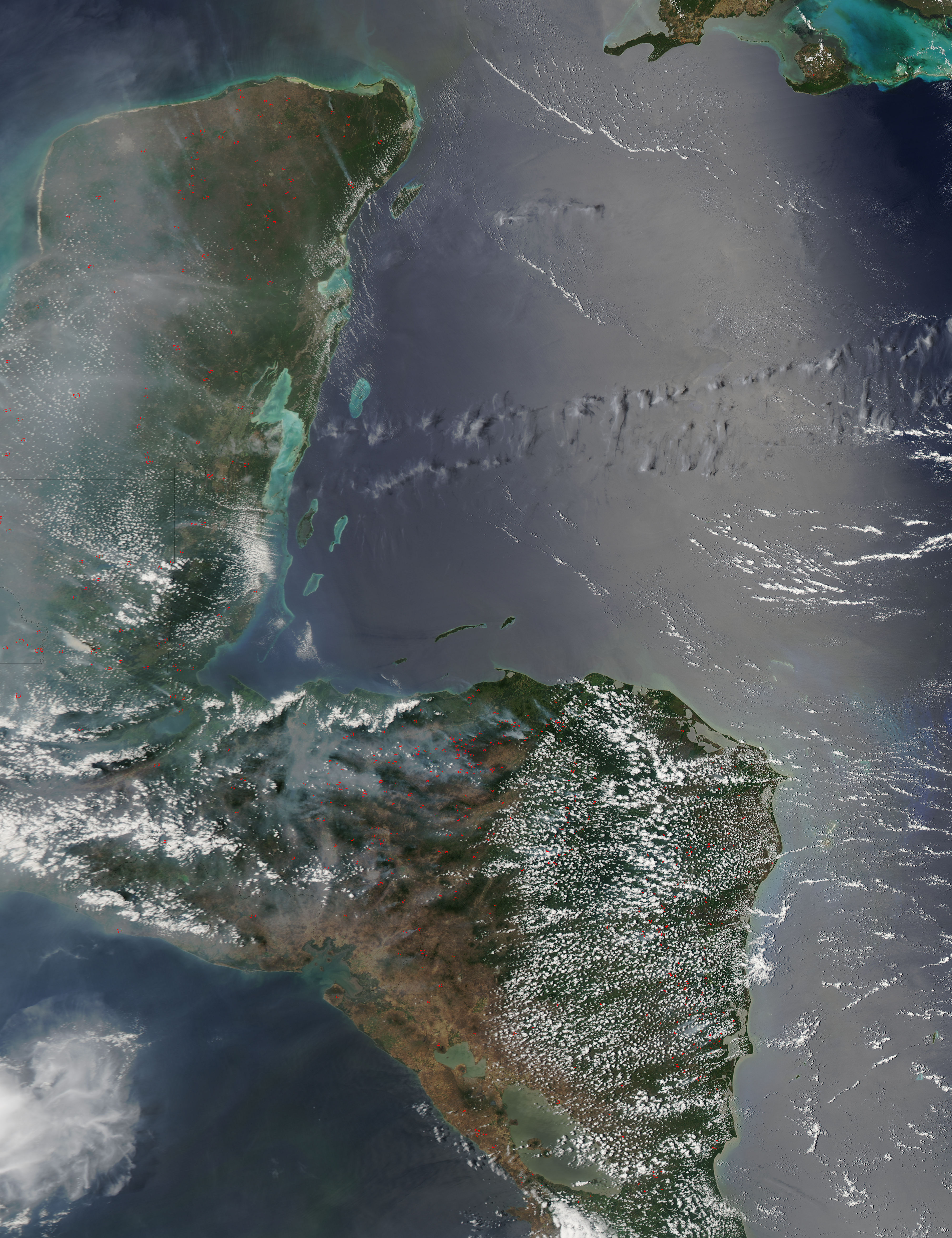
English: This image taken from NASA's Aqua MODIS satellite at 18:50 UTC of April 23, 2015 shows wildfires across north Central America, that includes Mexico, Guatemala, Honduras, El Salvador and Nicaragua. In the drought season in the tropics (from November to May), wildfires are common in the region. Español: Esta imagen tomada del satélite Aqua MODIS de la NASA a las 18:50 UTC del 23 de abril de 2015, muestra a los incendios forestales azotando al norte de Centroamérica que incluye a México, Guatemala, Honduras, El Salvador y Nicaragua. En la temporada seca en los trópicos (de noviembre a mayo), los incendios forestales son muy comunes en la región. |
| Date | UTC |
| Source | http://lance-modis.eosdis.nasa.gov/cgi-bin/imagery/single.cgi?image=CentralAmerica.A2015113.1850.250m.jpg |
| Author | Aqua MODIS satellite from NASA |
Licensing
[edit]
| This file is in the public domain in the United States because it was solely created by NASA. NASA copyright policy states that "NASA material is not protected by copyright unless noted". (See Template:PD-USGov, NASA copyright policy page or JPL Image Use Policy.) | ||
 |
Warnings:
|
File history
Click on a date/time to view the file as it appeared at that time.
| Date/Time | Thumbnail | Dimensions | User | Comment | |
|---|---|---|---|---|---|
| current | 01:53, 25 April 2015 | | 4,000 × 5,200 (3.14 MB) | Byralaal (talk | contribs) | User created page with UploadWizard |
You cannot overwrite this file.
File usage on Commons
There are no pages that use this file.
File usage on other wikis
The following other wikis use this file:
- Usage on es.wikipedia.org
- Usage on pt.wikipedia.org