File:Wildfires Ravage Corrientes as seen by Landsat 9.jpg
Jump to navigation
Jump to search

Size of this preview: 617 × 600 pixels. Other resolutions: 247 × 240 pixels | 494 × 480 pixels | 790 × 768 pixels | 1,053 × 1,024 pixels | 2,106 × 2,048 pixels | 7,875 × 7,657 pixels.
Original file (7,875 × 7,657 pixels, file size: 5.72 MB, MIME type: image/jpeg)
Captions
Captions
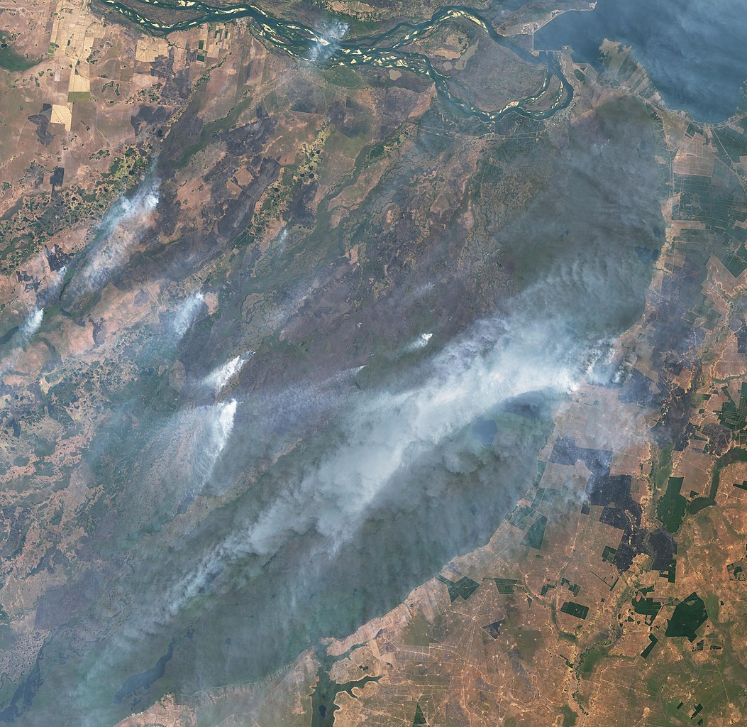
Wildfires in Corrientes Province as seen by Landsat 9.
Summary
[edit]
| Description |
Español: Incendios en la Provincia de Corrientes vistos por el satélite Landsat 9.
English: Amidst a record-setting heatwave and ongoing drought, northeastern Argentina has been experiencing widespread wildfires. In late January 2022, more than a thousand fires were burning around Corrientes province, a predominantly rural and agricultural region that has seen little to no rain in two months. Since the fires began in December, more than 520,000 hectares (1.3 million acres) have burned, killing wildlife and livestock, decimating pasturelands, and destroying crops such as yerba mate and rice. |
| Date | |
| Source | https://earthobservatory.nasa.gov/images/149478/wildfires-ravage-corrientes-argentina |
| Author | NASA Earth Observatory images by Lauren Dauphin, using Landsat data from the U.S. Geological Survey |
Licensing
[edit]
| This file is in the public domain in the United States because it was solely created by NASA. NASA copyright policy states that "NASA material is not protected by copyright unless noted". (See Template:PD-USGov, NASA copyright policy page or JPL Image Use Policy.) | ||
 |
Warnings:
|
File history
Click on a date/time to view the file as it appeared at that time.
| Date/Time | Thumbnail | Dimensions | User | Comment | |
|---|---|---|---|---|---|
| current | 14:07, 22 February 2022 | | 7,875 × 7,657 (5.72 MB) | BugWarp (talk | contribs) | Uploaded a work by NASA Earth Observatory images by Lauren Dauphin, using Landsat data from the U.S. Geological Survey from https://earthobservatory.nasa.gov/images/149478/wildfires-ravage-corrientes-argentina with UploadWizard |
You cannot overwrite this file.
File usage on Commons
The following page uses this file:
File usage on other wikis
The following other wikis use this file:
- Usage on en.wikipedia.org
- Usage on es.wikipedia.org
- Usage on www.wikidata.org