File:Wikimolaargyre.jpg
Jump to navigation
Jump to search
Size of this preview: 800 × 415 pixels. Other resolutions: 320 × 166 pixels | 640 × 332 pixels | 1,024 × 531 pixels | 1,902 × 986 pixels.
Original file (1,902 × 986 pixels, file size: 721 KB, MIME type: image/jpeg)
Captions
Captions
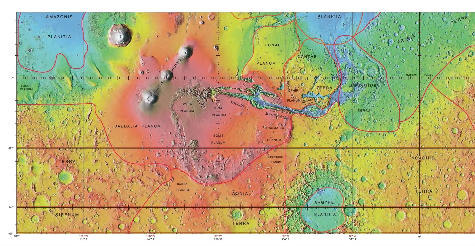
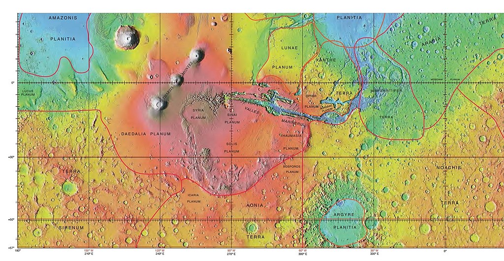
Noachis Terra's map


Summary
[edit]
| Description |
English: MOLA map showing boundaries in southern hemisphere of Mars |
| Date | |
| Source | http://planetarynames.wr.usgs.gov/images/mola_regional_boundaries.pdf |
| Author | Jim Secosky modified NASA image. |
| Permission (Reusing this file) |
Caption is International Astronomical Union Working Group for Planetary System Nomenclature. "Gazetteer of Planetary Nomenclature." |
Licensing
[edit]
| This file is in the public domain in the United States because it was solely created by NASA. NASA copyright policy states that "NASA material is not protected by copyright unless noted". (See Template:PD-USGov, NASA copyright policy page or JPL Image Use Policy.) | ||
 |
Warnings:
|
File history
Click on a date/time to view the file as it appeared at that time.
| Date/Time | Thumbnail | Dimensions | User | Comment | |
|---|---|---|---|---|---|
| current | 20:55, 20 March 2018 | | 1,902 × 986 (721 KB) | BlindForay (talk | contribs) | Cropped scrollbar, whitespace. |
| 23:54, 21 February 2015 |  | 1,920 × 1,080 (758 KB) | Jimmarsmars (talk | contribs) | {{Information |Description ={{en|1=MOLA map showing boundaries in southern hemisphere of Mars}} |Source =http://planetarynames.wr.usgs.gov/images/mola_regional_boundaries.pdf |Author =Jim Secosky modified NASA image. |Date... |
You cannot overwrite this file.
File usage on Commons
There are no pages that use this file.
File usage on other wikis
The following other wikis use this file:
- Usage on ca.wikipedia.org
- Usage on en.wikipedia.org
- Usage on eo.wikipedia.org
- Usage on es.wikipedia.org
- Usage on fa.wikipedia.org
- Usage on nl.wikipedia.org
- Usage on nn.wikipedia.org
- Usage on pnb.wikipedia.org
- Usage on ur.wikipedia.org
- Usage on zh.wikipedia.org