File:Wiżajny (gmina) location map.png
Jump to navigation
Jump to search

Size of this preview: 480 × 599 pixels. Other resolutions: 192 × 240 pixels | 384 × 480 pixels | 778 × 971 pixels.
Original file (778 × 971 pixels, file size: 132 KB, MIME type: image/png)
Captions
Captions
Add a one-line explanation of what this file represents
| Description |
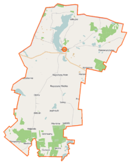
Polski: Mapa gminy Wiżajny, Polska
English: Map of Gmina Wiżajny, Poland |
|||||||||
| Date | ||||||||||
| Source | You may find a page on the OpenStreetMap wiki page for Wiżajny (gmina) | |||||||||
| Creator |
OpenStreetMap contributors OpenStreetMap contributors |
|||||||||
| Permission (Reusing this file) |
OpenStreetMap data is available under the Open Database License (details). Map tiles are licensed under the Creative Commons Attribution-ShareAlike 2.0 license (CC-BY-SA 2.0).
This file is licensed under the Creative Commons Attribution-Share Alike 2.0 Generic license.
|
|||||||||
| Geotemporal data | ||||||||||
| Bounding box |
|
|||||||||
| Georeferencing | If inappropriate please set warp_status = skip to hide. | |||||||||
File history
Click on a date/time to view the file as it appeared at that time.
| Date/Time | Thumbnail | Dimensions | User | Comment | |
|---|---|---|---|---|---|
| current | 10:18, 16 September 2014 | | 778 × 971 (132 KB) | VanWiel (talk | contribs) | |
| 10:40, 8 June 2014 |  | 778 × 971 (179 KB) | VanWiel (talk | contribs) | {{OpenStreetMap | name = Wiżajny (gmina) | location = Wiżajny (gmina) | description = {{pl|Mapa gminy Wiżajny, Polska}} {{en|Map of Gmina Wiżajny, Poland}} | top = 54.4137 | left = 22.7623 | r... |
You cannot overwrite this file.
File usage on Commons
There are no pages that use this file.
File usage on other wikis
The following other wikis use this file:
- Usage on pl.wikipedia.org
- Okliny
- Wiżajny (gmina)
- Bolcie
- Burniszki
- Dzierwany
- Grzybina
- Jegliniszki
- Laskowskie
- Leszkiemie
- Ługiele
- Kłajpeda (województwo podlaskie)
- Makowszczyzna (województwo podlaskie)
- Maszutkinie
- Mauda
- Mierkinie
- Poplin
- Rogożajny Małe
- Rogożajny Wielkie
- Soliny
- Sześciwłóki
- Sudawskie
- Stankuny
- Wiłkupie
- Wiżajny
- Wiżgóry
- Antosin (województwo podlaskie)
- Marianka (województwo podlaskie)
- Wysokie (gmina Wiżajny)
- Użmauda
- Dziadówek
- Wiżajny (jezioro)
- Cisówek (Dzierwany)
- Jaczne
- Kamionka (powiat suwalski)
- Kłajpedka
- Stara Hańcza
- Stołupianka
- Żelazkowizna
- Jaczno (jezioro)
- Kameduł (jezioro)
- Dunajewo
- Jegliniszki (jezioro)
- Mauda (jezioro)
- Parafia św. Teresy w Wiżajnach
- Rowelska Góra
- Gulberek
- Kościół św. Teresy z Ávili w Wiżajnach
- Moduł:Mapa/dane/Wiżajny (gmina)
- Wikipedysta:Wlodek k1/brudnopis
- Dwór w Starej Hańczy
View more global usage of this file.
_location_map.png)
_location_map.png&oldid=506140352)