File:Wiśniew (gmina) location map.png
Jump to navigation
Jump to search

Size of this preview: 553 × 599 pixels. Other resolutions: 221 × 240 pixels | 443 × 480 pixels | 742 × 804 pixels.
Original file (742 × 804 pixels, file size: 105 KB, MIME type: image/png)
Captions
Captions
Add a one-line explanation of what this file represents
| Description |
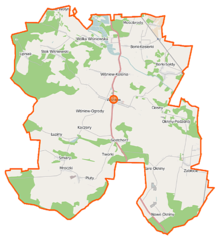
Polski: Mapa gminy Wiśniew, Polska
English: Map of Gmina Wiśniew, Poland |
|||||||||
| Date | ||||||||||
| Source | You may find a page on the OpenStreetMap wiki page for Wiśniew (gmina) | |||||||||
| Creator |
OpenStreetMap contributors OpenStreetMap contributors |
|||||||||
| Permission (Reusing this file) |
OpenStreetMap data is available under the Open Database License (details). Map tiles are licensed under the Creative Commons Attribution-ShareAlike 2.0 license (CC-BY-SA 2.0).
This file is licensed under the Creative Commons Attribution-Share Alike 2.0 Generic license.
|
|||||||||
| Geotemporal data | ||||||||||
| Bounding box |
|
|||||||||
| Georeferencing | If inappropriate please set warp_status = skip to hide. | |||||||||
File history
Click on a date/time to view the file as it appeared at that time.
| Date/Time | Thumbnail | Dimensions | User | Comment | |
|---|---|---|---|---|---|
| current | 06:47, 7 October 2014 | | 742 × 804 (105 KB) | VanWiel (talk | contribs) | {{OpenStreetMap | name = Wiśniew (gmina) | location = Wiśniew (gmina) | description = {{pl|Mapa gminy Wiśniew, Polska}} {{en|Map of Gmina Wiśniew, Poland}} | top = 52.1297 | left = 22.1903 | r... |
You cannot overwrite this file.
File usage on Commons
There are no pages that use this file.
File usage on other wikis
The following other wikis use this file:
- Usage on fr.wikipedia.org
- Usage on nl.wikipedia.org
- Usage on pl.wikipedia.org
- Wiśniew (powiat siedlecki)
- Wiśniew (gmina)
- Zabłocie (powiat siedlecki)
- Helenów (gmina Wiśniew)
- Mościbrody
- Wólka Wiśniewska
- Ciosny (województwo mazowieckie)
- Stok Wiśniewski
- Kaczory (gmina Wiśniew)
- Gostchorz
- Śmiary
- Daćbogi (województwo mazowieckie)
- Łupiny (województwo mazowieckie)
- Tworki (powiat siedlecki)
- Mroczki (powiat siedlecki)
- Wólka Wołyniecka
- Lipniak (województwo mazowieckie)
- Myrcha
- Radomyśl (województwo mazowieckie)
- Stare Okniny
- Pluty (gmina Wiśniew)
- Okniny-Podzdrój
- Nowe Okniny
- Borki-Sołdy
- Borki-Paduchy
- Borki-Kosiorki
- Wiśniew-Kolonia
- Kolonia Mościbrody
- Radomyśl (przystanek kolejowy)
- Borki Kosy
- Kosiorki (przystanek kolejowy)
- Parafia Najświętszego Serca Jezusowego w Wiśniewie
- Leśniczówka (gmina Wiśniew)
- Jastrzębie Kąty
- Moduł:Mapa/dane/Wiśniew (gmina)
- Parafia Świętej Rodziny w Śmiarach
- Parafia św. Andrzeja z Awelinu w Radomyśli
- Usage on pl.wikibooks.org
_location_map.png&oldid=506884794)