File:Whiteinch Victoria Park railway station (site), Glasgow (geograph 6067793).jpg
Jump to navigation
Jump to search
Size of this preview: 800 × 600 pixels. Other resolutions: 320 × 240 pixels | 640 × 480 pixels | 1,024 × 768 pixels | 1,280 × 960 pixels | 1,600 × 1,200 pixels.
Original file (1,600 × 1,200 pixels, file size: 597 KB, MIME type: image/jpeg)
Captions
Captions
Add a one-line explanation of what this file represents
Summary
[edit],_Glasgow_(geograph_6067793).jpg&action=edit§ion=1)
| Description |
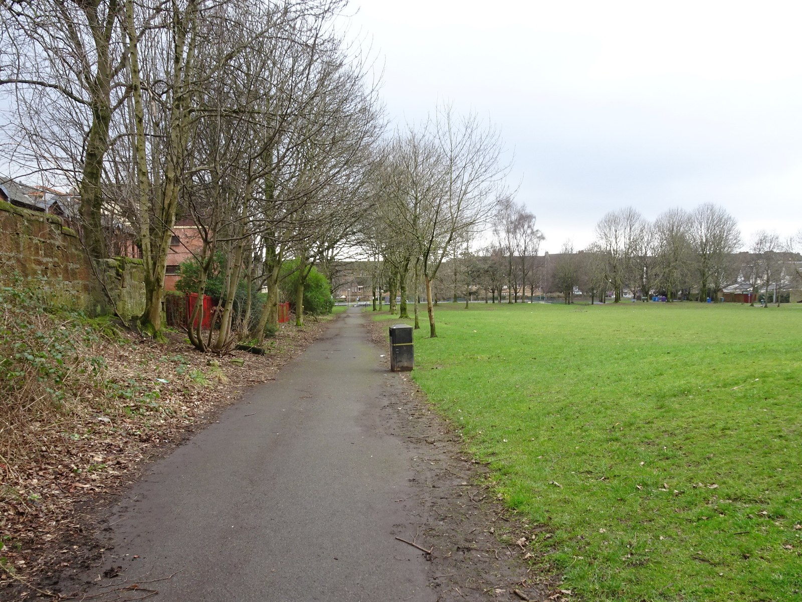
English: Whiteinch Victoria Park railway station (site), Glasgow Opened in 1897 by the North British Railway as the terminus of a short branch line from Jordanhill, this site had previously been for goods only. It closed to passengers in 1951 and completely in 1967. View south west towards the buffers. The path is partially on the site of the platform with goods sidings having been further to the right. Little trace now remains and the site is now a public park. |
| Date | |
| Source | From geograph.org.uk |
| Author | Nigel Thompson |
| Permission (Reusing this file) |
Creative Commons Attribution Share-alike license 2.0 |
| Attribution (required by the license) | Nigel Thompson / Whiteinch Victoria Park railway station (site), Glasgow / |
| Camera location | | View this and other nearby images on: OpenStreetMap |
|---|
,_Glasgow_(geograph_6067793).jpg¶ms=055.877827_N_-004.340454_E_globe:Earth_type:camera_source:geograph-osgb36(NS53686744)_heading:225.00&language=en)
| Object location | | View this and other nearby images on: OpenStreetMap |
|---|
,_Glasgow_(geograph_6067793).jpg¶ms=055.877270_N_-004.341380_E_globe:Earth_class:object_type:object_source:geograph-osgb36(NS53626738)_heading:225.00&language=en)
Licensing
[edit],_Glasgow_(geograph_6067793).jpg&action=edit§ion=2)

|
This image was taken from the Geograph project collection. See this photograph's page on the Geograph website for the photographer's contact details. The copyright on this image is owned by Nigel Thompson and is licensed for reuse under the Creative Commons Attribution-ShareAlike 2.0 license.
|
This file is licensed under the Creative Commons Attribution-Share Alike 2.0 Generic license.
Attribution: Nigel Thompson
- You are free:
- to share – to copy, distribute and transmit the work
- to remix – to adapt the work
- Under the following conditions:
- attribution – You must give appropriate credit, provide a link to the license, and indicate if changes were made. You may do so in any reasonable manner, but not in any way that suggests the licensor endorses you or your use.
- share alike – If you remix, transform, or build upon the material, you must distribute your contributions under the same or compatible license as the original.
File history
Click on a date/time to view the file as it appeared at that time.
| Date/Time | Thumbnail | Dimensions | User | Comment | |
|---|---|---|---|---|---|
| current | 22:56, 4 January 2020 | | 1,600 × 1,200 (597 KB) | Lamberhurst (talk | contribs) | Transferred from geograph.co.uk using [https://tools.wmflabs.org/geograph2commons/ geograph2commons] |
You cannot overwrite this file.
File usage on Commons
The following page uses this file:
File usage on other wikis
The following other wikis use this file:
- Usage on en.wikipedia.org
,_Glasgow_(geograph_6067793).jpg&oldid=858385364)