File:White Rock Dam Removal - coffer dam and Pawcatuck River (21435929852).jpg

Original file (5,248 × 2,952 pixels, file size: 6.4 MB, MIME type: image/jpeg)
Captions
Captions
Summary
[edit].jpg&action=edit§ion=1)
| Description |
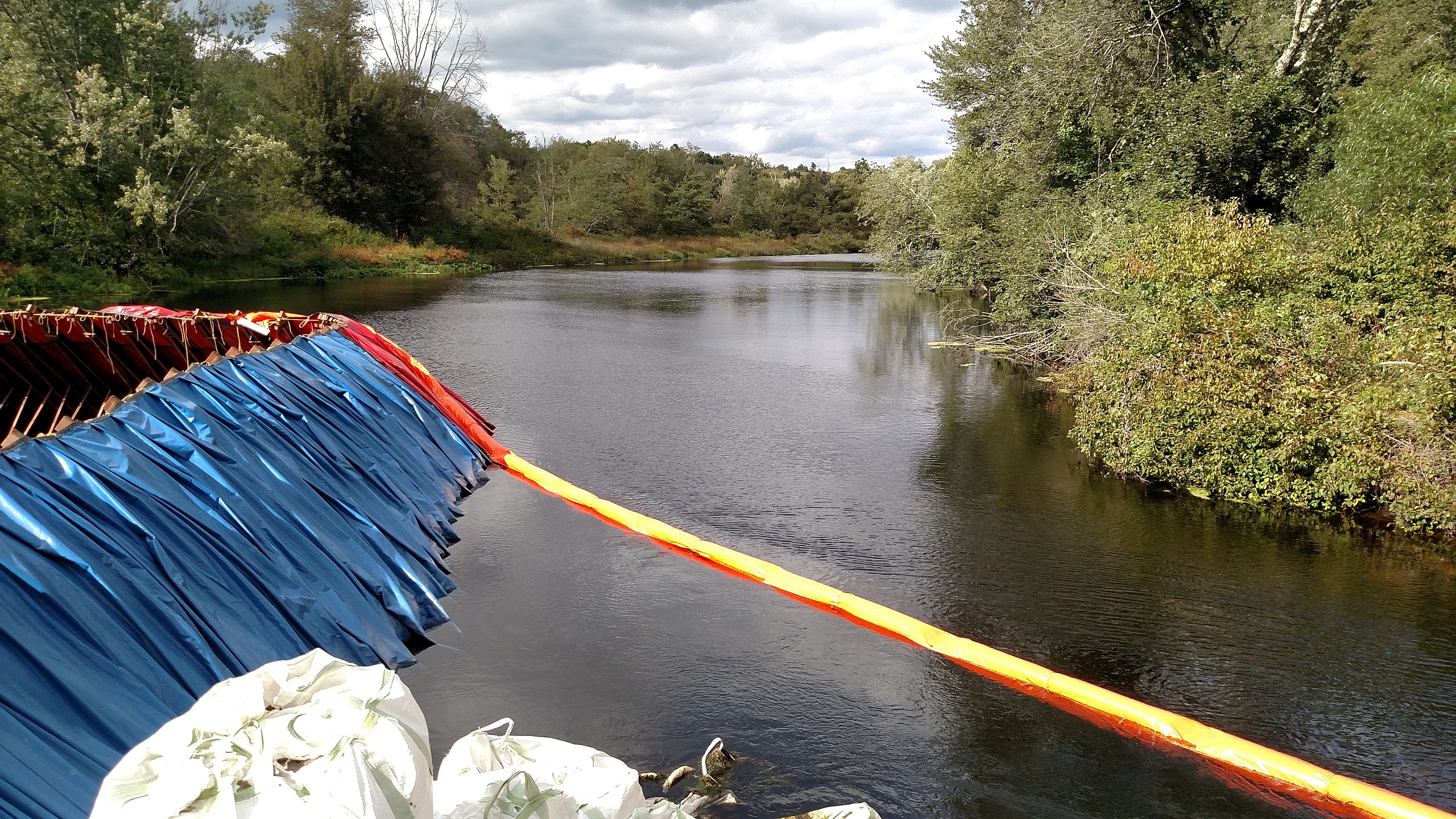
This Hurricane Sandy resilience project includes removal of the White Rock dam in Westerly, R.I. and Stonington, Conn. In fall 2015, the entire dam will be removed from the Pawcatuck River. The project will open up close to 25 miles of the Pawcatuck River and associated wetlands for migrating American shad, alewife, blueback herring, American eel, and sea-run trout. More project details: <a href="http://www.fws.gov/hurricane/sandy/projects/CTRIDamRemoval.html" rel="nofollow">www.fws.gov/hurricane/sandy/projects/CTRIDamRemoval.html</a> Photo credit: Scott Comings, The Nature Conservancy Like us on Facebook: <a href="http://facebook.com/usfwsnortheast" rel="nofollow">facebook.com/usfwsnortheast</a> Follow us on Twitter: <a href="https://twitter.com/usfwsnortheast" rel="nofollow">twitter.com/usfwsnortheast</a> |
| Date | |
| Source | White Rock Dam Removal - coffer dam and Pawcatuck River |
| Author | U.S. Fish and Wildlife Service Northeast Region |
| Camera location | | View this and other nearby images on: OpenStreetMap |
|---|
.jpg¶ms=041.400730_N_-071.841187_E_globe:Earth_type:camera_source:Flickr_&language=en)
Licensing
[edit].jpg&action=edit§ion=2)
This image or recording is the work of a U.S. Fish and Wildlife Service employee, taken or made as part of that person's official duties. As a work of the U.S. federal government, the image is in the public domain. For more information, see the Fish and Wildlife Service copyright policy.
|
 |
| This image was originally posted to Flickr by U. S. Fish and Wildlife Service - Northeast Region at https://flickr.com/photos/43322816@N08/21435929852 (archive). It was reviewed on 12 May 2018 by FlickreviewR 2 and was confirmed to be licensed under the terms of the Public Domain Mark. |
This image or recording is the work of a U.S. Fish and Wildlife Service employee, taken or made as part of that person's official duties. As a work of the U.S. federal government, the image is in the public domain. For more information, see the Fish and Wildlife Service copyright policy.
|
|
File history
Click on a date/time to view the file as it appeared at that time.
| Date/Time | Thumbnail | Dimensions | User | Comment | |
|---|---|---|---|---|---|
| current | 13:36, 12 May 2018 | | 5,248 × 2,952 (6.4 MB) | OceanAtoll (talk | contribs) | Transferred from Flickr via #flickr2commons |
You cannot overwrite this file.
File usage on Commons
There are no pages that use this file.
.jpg&oldid=815691163)