File:Whiskey Island, Michigan, topo map.jpg
Jump to navigation
Jump to search
No higher resolution available.
Whiskey_Island,_Michigan,_topo_map.jpg (413 × 295 pixels, file size: 20 KB, MIME type: image/jpeg)
Captions
Captions
Add a one-line explanation of what this file represents
| Description |
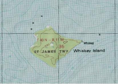
English: Topographical map of Whiskey Island in the Beaver Island group in Lake Michigan |
| Source | http://www.topozone.com/map.asp?lon=-85.6098137&lat=45.8116629&datum=nad83 |
| Author | US Geologic Survey |
This image is in the public domain in the United States because it only contains materials that originally came from the United States Geological Survey, an agency of the United States Department of the Interior. For more information, see the official USGS copyright policy.
|
File history
Click on a date/time to view the file as it appeared at that time.
| Date/Time | Thumbnail | Dimensions | User | Comment | |
|---|---|---|---|---|---|
| current | 16:44, 12 March 2013 | | 413 × 295 (20 KB) | Cblakework (talk | contribs) | {{subst:Upload marker added by en.wp UW}} {{Information |Description = {{en|Topographical map of Whiskey Island in the Beaver Island group in Lake Michigan}} |Source = http://www.topozone.com/map.asp?lon=-85.6098137&lat=45.8116629&datum=nad83 |Author =... |
You cannot overwrite this file.
File usage on Commons
There are no pages that use this file.
File usage on other wikis
The following other wikis use this file:
- Usage on ceb.wikipedia.org
- Usage on en.wikipedia.org
- Usage on www.wikidata.org