File:WetterKraftwerkHarkort.jpg
Jump to navigation
Jump to search
No higher resolution available.
WetterKraftwerkHarkort.jpg (640 × 480 pixels, file size: 89 KB, MIME type: image/jpeg)
Captions
Captions
Add a one-line explanation of what this file represents
Summary
[edit]
| Description |
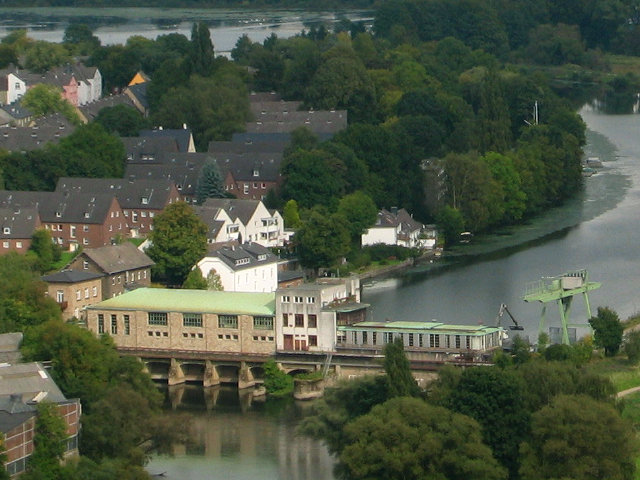
Deutsch: Kraftwerk Harkort am Obergraben der Ruhr, Schöntaler Straße 66, Alt-Wetter; der linke Gebäudeteil ist das denkmalgeschützte Turbinenhaus, dahinter Häuser an der Ringstraße
This is a photograph of an architectural monument.
It is on the list of cultural monuments of Wetter (Ruhr), no. 117. | ||
| Address |
|
||
| Date | Taken on 2 September 2008 | ||
| Source | Own work | ||
| Author | Holger1959 | ||
| Permission (Reusing this file) |
I, the copyright holder of this work, hereby publish it under the following license: This file is licensed under the Creative Commons Attribution-Share Alike 3.0 Unported license.
|
||
| OpenStreetMap | Way 26770152 |
| Object location | | View this and other nearby images on: OpenStreetMap |
|---|
| Annotations | This image is annotated: View the annotations at Commons |
File history
Click on a date/time to view the file as it appeared at that time.
| Date/Time | Thumbnail | Dimensions | User | Comment | |
|---|---|---|---|---|---|
| current | 17:48, 26 June 2012 | | 640 × 480 (89 KB) | Holger1959 (talk | contribs) | == {{int:filedesc}} == {{Information |Description ={{de|1=Kraftwerk Harkort am Obergraben der Ruhr, Hauptstr. 50, Alt-Wetter; der linke Gebäudeteil ist das denkmalgeschützte Turbinenhaus, dahinter Häuser an der Ringstraße}} {{Kulturdenkmal | Ty... |
You cannot overwrite this file.
File usage on Commons
The following 3 pages use this file:
File usage on other wikis
The following other wikis use this file:
- Usage on de.wikipedia.org
- Usage on www.wikidata.org