File:Westerwolde vlag.svg
Jump to navigation
Jump to search

Size of this PNG preview of this SVG file: 743 × 492 pixels. Other resolutions: 320 × 212 pixels | 640 × 424 pixels | 1,024 × 678 pixels | 1,280 × 848 pixels | 2,560 × 1,695 pixels.
Original file (SVG file, nominally 743 × 492 pixels, file size: 129 KB)
Captions
Captions
Add a one-line explanation of what this file represents
Summary
[edit]
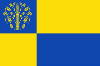
| Description | Flag of Westerwolde, in Groningen province, the Netherlands. |
| Date | |
| Source | dvhn.nl |
| Author | Hoge Raad van Adel, SVG by Arch |
Licensing
[edit]
This image depicts a flag of a Dutch municipality or province. These flags are registered with the Hoge Raad van Adel. Usage of the flag is often restricted by municipal rules and laws.
In view of Dutch legislation, this image is regarded as being in the public domain, as are reproductions of this flag.
|
 | |
| This file has been identified as being free of known restrictions under copyright law, including all related and neighboring rights. | ||
File history
Click on a date/time to view the file as it appeared at that time.
| Date/Time | Thumbnail | Dimensions | User | Comment | |
|---|---|---|---|---|---|
| current | 02:55, 7 March 2020 | | 743 × 492 (129 KB) | D'Arch (talk | contribs) | == {{int:filedesc}} == {{Information |Description=Flag of Westerwolde, in Groningen province, the Netherlands. |Sourcehttps://www.dvhn.nl/groningen/De-korenschoof-overleeft-opnieuw-in-Westerwolde-25314110.html dvhn.nl |Date=2020 |Author=Hoge Raad van Adel, SVG by Arch |Permission={{PD-NL-gemeentevlag}} |other_versions= }} == {{int:license-header}} == {{PD-NL-gemeentevlag}} Category:SVG flags of municipalities of Groningen Vlag |
You cannot overwrite this file.
File usage on Commons
The following 11 pages use this file:
- Flags of municipalities of Groningen
- Flags of municipalities of the Netherlands
- Gallery of flags by design
- User:D'Arch/gallery-flags in SVG-part15
- Template:Westerwolde(municipality)year
- Category:2019 in Westerwolde (municipality)
- Category:2020 in Westerwolde (municipality)
- Category:2023 in Westerwolde (municipality)
- Category:Geography of Westerwolde (municipality)
- Category:Views of Westerwolde (municipality)
- Category:Westerwolde (municipality)
File usage on other wikis
The following other wikis use this file:
- Usage on af.wikipedia.org
- Usage on ca.wikipedia.org
- Usage on de.wikipedia.org
- Usage on en.wikipedia.org
- Usage on eo.wikipedia.org
- Usage on es.wikipedia.org
- Usage on fa.wikipedia.org
- Usage on fr.wikipedia.org
- Usage on fy.wikipedia.org
- Vriescheloo
- De Maten
- Ter Apel
- Bourtange
- Westerwâlde (gemeente)
- Westerwâldske Aa
- Blijham
- Lyts-Ulsda
- Aldeskâns
- Bellingwolde
- Den Ham (Westerwâlde)
- B.L. Tijdenskanaal
- De Bult (Westerwâlde)
- De Lethe
- Wedde
- Wedderheide
- Vlagtwedde (plak)
- Hebrecht
- Jipsinghuizen
- Jipsingboertange
- Sellingen
- Agodorp
- Burgemeester Beinsdorp
- Barnflair
- Ruiten Aa
- Ruiten-Aa-kanaal
- Veelerveen
- Wollinghuizen
View more global usage of this file.