File:Western end of Stonar Cut - geograph.org.uk - 454842.jpg
Jump to navigation
Jump to search
No higher resolution available.
Western_end_of_Stonar_Cut_-_geograph.org.uk_-_454842.jpg (640 × 480 pixels, file size: 57 KB, MIME type: image/jpeg)
Captions
Captions
Add a one-line explanation of what this file represents
Summary
[edit]
| Description |
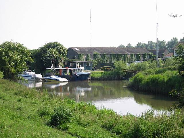
English: Western end of Stonar Cut Opened in 1776 the Stonar Cut formed a shortcut across the neck of the Sandwich Loop of the River Stour so that floodwater caused by high rainfall or a high spring tide could take the shortest route to the sea without flooding Sandwich. Its sluice gates were renewed in 1999 and for 175 years the gates were manned fulltime. |
| Date | |
| Source | From geograph.org.uk |
| Author | Nick Smith |
| Attribution (required by the license) | Nick Smith / Western end of Stonar Cut / |
| Camera location | | View this and other nearby images on: OpenStreetMap |
|---|
_heading:67.00&language=en)
| Object location | | View this and other nearby images on: OpenStreetMap |
|---|
_heading:67.00&language=en)
Licensing
[edit]

|
This image was taken from the Geograph project collection. See this photograph's page on the Geograph website for the photographer's contact details. The copyright on this image is owned by Nick Smith and is licensed for reuse under the Creative Commons Attribution-ShareAlike 2.0 license.
|
This file is licensed under the Creative Commons Attribution-Share Alike 2.0 Generic license.
Attribution: Nick Smith
- You are free:
- to share – to copy, distribute and transmit the work
- to remix – to adapt the work
- Under the following conditions:
- attribution – You must give appropriate credit, provide a link to the license, and indicate if changes were made. You may do so in any reasonable manner, but not in any way that suggests the licensor endorses you or your use.
- share alike – If you remix, transform, or build upon the material, you must distribute your contributions under the same or compatible license as the original.
File history
Click on a date/time to view the file as it appeared at that time.
| Date/Time | Thumbnail | Dimensions | User | Comment | |
|---|---|---|---|---|---|
| current | 16:51, 4 February 2011 | | 640 × 480 (57 KB) | GeographBot (talk | contribs) | == {{int:filedesc}} == {{Information |description={{en|1=Western end of Stonar Cut Opened in 1776 the Stonar Cut formed a shortcut across the neck of the Sandwich Loop of the River Stour so that floodwater caused by high rainfall or a high spring tide cou |
You cannot overwrite this file.
File usage on Commons
There are no pages that use this file.