File:Western Brooks Mtns AK 66to69N 147to158W Topo Rainbow Zebra 1020.jpg
Jump to navigation
Jump to search
Size of this preview: 800 × 436 pixels. Other resolutions: 320 × 175 pixels | 640 × 349 pixels | 1,024 × 559 pixels | 1,280 × 698 pixels | 2,560 × 1,396 pixels | 6,600 × 3,600 pixels.
Original file (6,600 × 3,600 pixels, file size: 18.73 MB, MIME type: image/jpeg)
Captions
Captions
Add a one-line explanation of what this file represents
Summary
[edit]
| Description |
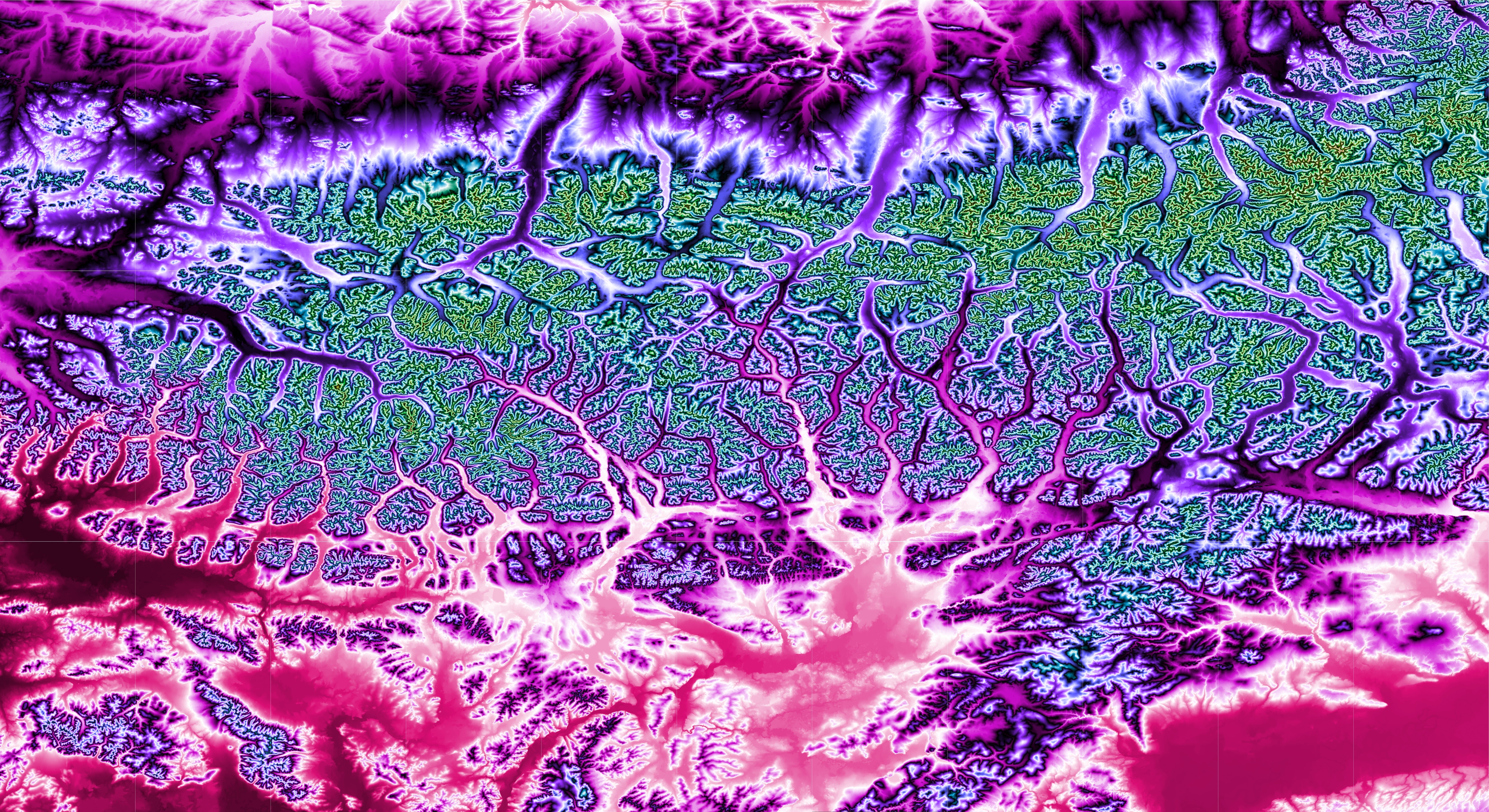
English: This topographic map shows the western and central portion of the Brooks Mountain Range in northern Alaska. The map's coverage extends from 66 to 69 degrees north latitude and from 147 to 158 degrees west longitude. Produced with Map Render 3D from GHz Limited. Used IrfanView to stitch together multiple maps. Then used IrfanView to resample to half its width. This substantially reduced the obliqueness caused by cylindrical projection at a high latitude. |
| Date | |
| Source |
[3 arc second Digital Elevation Models obtained from the website http://www.viewfinderpanoramas.org/dem3.html] |
| Author | Jonathan de Ferranti |
Licensing
[edit]
| This file is in the public domain in the United States because it was solely created by NASA. NASA copyright policy states that "NASA material is not protected by copyright unless noted". (See Template:PD-USGov, NASA copyright policy page or JPL Image Use Policy.) | ||
 |
Warnings:
|
File history
Click on a date/time to view the file as it appeared at that time.
| Date/Time | Thumbnail | Dimensions | User | Comment | |
|---|---|---|---|---|---|
| current | 23:26, 5 December 2018 | | 6,600 × 3,600 (18.73 MB) | Rainbow Zebra 13 (talk | contribs) | User created page with UploadWizard |
You cannot overwrite this file.
File usage on Commons
The following page uses this file: