File:Western Avenue, Los Angeles, California (14516334634).jpg
Original file (4,000 × 3,000 pixels, file size: 2.93 MB, MIME type: image/jpeg)
Captions
Captions
Summary
[edit].jpg&action=edit§ion=1)
| Description |
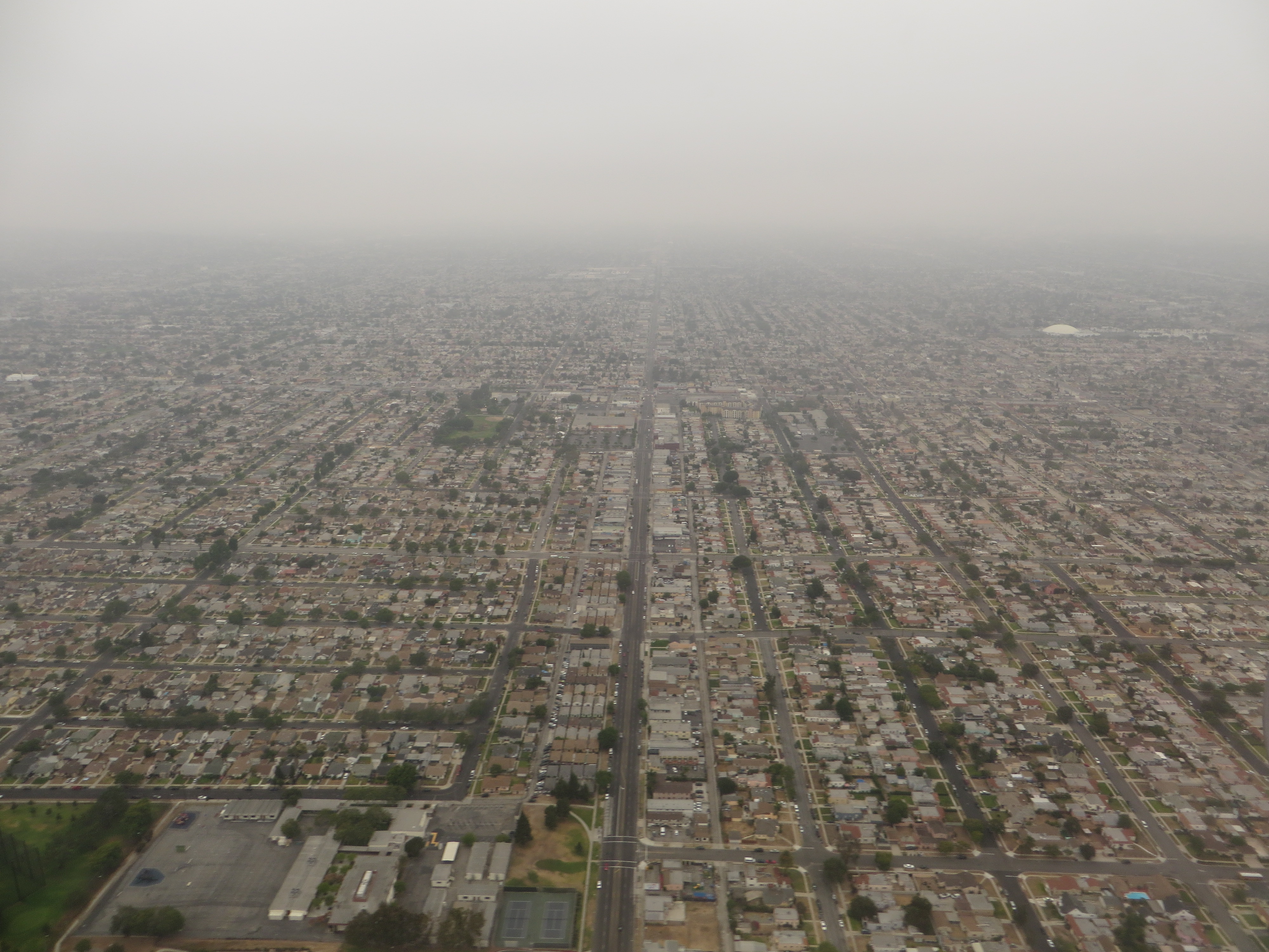
Western Avenue is a major four-lane street in the City of Los Angeles (west of Downtown Los Angeles) and through the center portion of Los Angeles County. It is one of the longest north–south streets in Los Angeles city and county, apart from Sepulveda Boulevard. it is about 29 miles long. The name of the street is derived from its history as the westernmost border of Los Angeles in the 19th century, before annexations in the early 20th century expanded the city westward. Western Avenue passes through a diversity of neighborhoods ranging from the wealthiest to the most economically depressed in Los Angeles County. From the south, near the Pacific Ocean, it passes north through San Pedro, Lomita, Torrance, Gardena, Inglewood, and South Los Angeles. Around the Pico Boulevard, Olympic Boulevard, and Wilshire Boulevard intersections, Western Avenue passes through Koreatown. Further north, Western Avenue passes through the East Hollywood district. Around the Santa Monica Boulevard, Sunset Boulevard, and Hollywood Boulevard intersection, it passes through the East Hollywood neighborhoods of Little Armenia and Thai Town. The northern terminus of Western is north of Franklin Avenue in the Los Feliz district, at the base of the Hollywood Hills. The road curves promptly east becoming Los Feliz Boulevard, a major east/west thoroughfare through Los Feliz to the Golden State Freeway. California State Route 213 is designated as the portion from Interstate 405 to 25th Street, in San Pedro. en.wikipedia.org/wiki/Western_Avenue_(Los_Angeles) en.wikipedia.org/wiki/Wikipedia:Text_of_Creative_Commons_... |
| Date | |
| Source | Western Avenue, Los Angeles, California |
| Author | Ken Lund from Reno, Nevada, USA |
| Camera location | | View this and other nearby images on: OpenStreetMap |
|---|
.jpg¶ms=033.949111_N_-118.309001_E_globe:Earth_type:camera_source:Flickr_&language=en)
Licensing
[edit].jpg&action=edit§ion=2)
- You are free:
- to share – to copy, distribute and transmit the work
- to remix – to adapt the work
- Under the following conditions:
- attribution – You must give appropriate credit, provide a link to the license, and indicate if changes were made. You may do so in any reasonable manner, but not in any way that suggests the licensor endorses you or your use.
- share alike – If you remix, transform, or build upon the material, you must distribute your contributions under the same or compatible license as the original.
| This image was originally posted to Flickr by Ken Lund at https://flickr.com/photos/75683070@N00/14516334634. It was reviewed on 4 December 2015 by FlickreviewR and was confirmed to be licensed under the terms of the cc-by-sa-2.0. |
File history
Click on a date/time to view the file as it appeared at that time.
| Date/Time | Thumbnail | Dimensions | User | Comment | |
|---|---|---|---|---|---|
| current | 03:58, 4 December 2015 | | 4,000 × 3,000 (2.93 MB) | INeverCry (talk | contribs) | Transferred from Flickr via Flickr2Commons |
You cannot overwrite this file.
File usage on Commons
There are no pages that use this file.
.jpg&oldid=470254249)