File:Westbrook station aerial view, April 1990.JPG
Jump to navigation
Jump to search
No higher resolution available.
Westbrook_station_aerial_view,_April_1990.JPG (454 × 303 pixels, file size: 29 KB, MIME type: image/jpeg)
Captions
Captions
Add a one-line explanation of what this file represents
| Description |
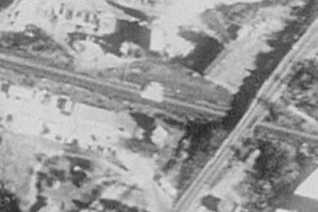
English: Aerial view of Westbrook station in April 1990, a month before opening |
|||
| Date | ||||
| Source | USGS imagery available via Google Earth | |||
| Author | USGS | |||
| Permission (Reusing this file) |
|
File history
Click on a date/time to view the file as it appeared at that time.
| Date/Time | Thumbnail | Dimensions | User | Comment | |
|---|---|---|---|---|---|
| current | 04:41, 28 April 2016 | | 454 × 303 (29 KB) | Pi.1415926535 (talk | contribs) | {{Information |Description ={{en|1=Aerial view of Westbrook station in April 1990, a month before opening}} |Source =USGS imagery available via Google Earth |Author =USGS |Date =1990-04-22 |Permission ={{PD-USGov-USGS}}... |
You cannot overwrite this file.
File usage on Commons
There are no pages that use this file.