File:West virginia ref 2001.jpg
Jump to navigation
Jump to search

No higher resolution available.
West_virginia_ref_2001.jpg (567 × 505 pixels, file size: 219 KB, MIME type: image/jpeg)
Captions
Captions
Add a one-line explanation of what this file represents
Summary
[edit]
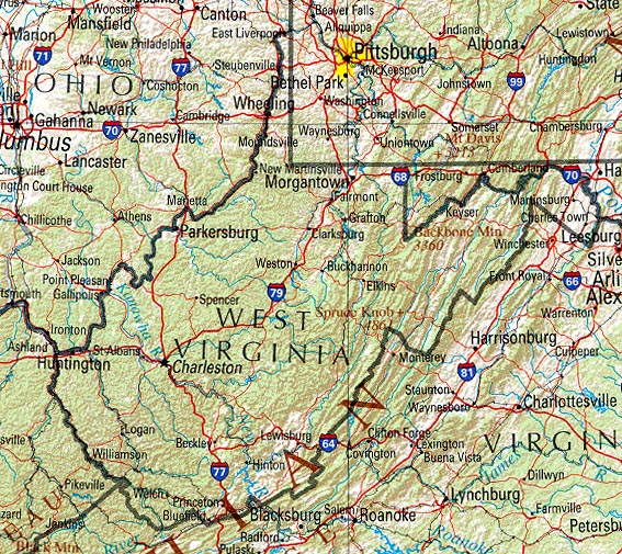
Reference Map of West Virginia
Source: http://www.lib.utexas.edu/maps/us_2001/west_virginia_ref_2001.jpg
University of Texas, Perry-Castañeda Library Map Collection, West Virginia Maps
Shaded relief map with state boundaries, forest cover, place names, major highways. Portion of "The National Atlas of the United States of America. General Reference", compiled by U.S. Geological Survey 2001, printed 2002
Licensing
[edit]
This image is in the public domain in the United States because it only contains materials that originally came from the United States Geological Survey, an agency of the United States Department of the Interior. For more information, see the official USGS copyright policy.
|
File history
Click on a date/time to view the file as it appeared at that time.
| Date/Time | Thumbnail | Dimensions | User | Comment | |
|---|---|---|---|---|---|
| current | 09:51, 8 May 2007 | | 567 × 505 (219 KB) | Herrick~commonswiki (talk | contribs) | Reference Map of West Virginia Source: http://www.lib.utexas.edu/maps/us_2001/west_virginia_ref_2001.jpg University of Texas, Perry-Castañeda Library Map Collection, West Virginia Maps Shaded relief map with state boundaries, forest cover, place n |
You cannot overwrite this file.
File usage on Commons
The following page uses this file:
File usage on other wikis
The following other wikis use this file:
- Usage on de.wikipedia.org
- Usage on fr.wikipedia.org