File:West Sussex County Council election results 2013.svg
Jump to navigation
Jump to search

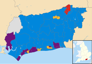
Size of this PNG preview of this SVG file: 800 × 559 pixels. Other resolutions: 320 × 223 pixels | 640 × 447 pixels | 1,024 × 715 pixels | 1,280 × 894 pixels | 2,560 × 1,788 pixels | 1,425 × 995 pixels.
Original file (SVG file, nominally 1,425 × 995 pixels, file size: 1.38 MB)
Captions
Captions
Add a one-line explanation of what this file represents
Summary
[edit]
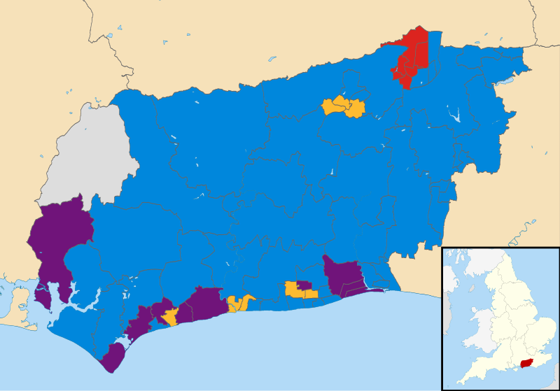
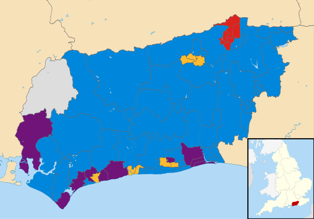
| Description | Map showing the results of the West Sussex County Council elections, 2013; derived from Blank map of West Sussex, UK with electoral divisions shown. Equirectangular map projection on WGS 84 datum, with N/S stretched 155% Geographic limits: *West: 1.01W *East: 0.10E *North: 51.20N *South: 50.70N |
| Date | (UTC) |
| Source |
This file was derived from: West Sussex UK electoral division map (blank).svg: |
| Author |
|
.svg)
| This is a retouched picture, which means that it has been digitally altered from its original version. Modifications: Coloured according to winning party in 2013 elections. The original can be viewed here: West Sussex UK electoral division map (blank).svg:
|
Licensing
[edit]
I, the copyright holder of this work, hereby publish it under the following license:
This file is licensed under the Creative Commons Attribution-Share Alike 3.0 Unported license.
- You are free:
- to share – to copy, distribute and transmit the work
- to remix – to adapt the work
- Under the following conditions:
- attribution – You must give appropriate credit, provide a link to the license, and indicate if changes were made. You may do so in any reasonable manner, but not in any way that suggests the licensor endorses you or your use.
- share alike – If you remix, transform, or build upon the material, you must distribute your contributions under the same or compatible license as the original.
Original upload log
[edit]
This image is a derivative work of the following images:
- File:West_Sussex_UK_electoral_division_map_(blank).svg licensed with Cc-by-sa-3.0
- 2010-10-05T17:50:25Z Nilfanion 1425x995 (1440531 Bytes) {{Information |Description=Blank map of [[w:West Sussex|West Sussex]], UK with electoral divisions shown. Equirectangular map projection on WGS 84 datum, with N/S stretched 155% Geographic limits: *West: 1.01W *East: 0.10E
Uploaded with derivativeFX
File history
Click on a date/time to view the file as it appeared at that time.
| Date/Time | Thumbnail | Dimensions | User | Comment | |
|---|---|---|---|---|---|
| current | 09:02, 4 May 2013 | | 1,425 × 995 (1.38 MB) | Spiritofsussex (talk | contribs) | == {{int:filedesc}} == {{Information |Description=Map showing the results of the West Sussex County Council elections, 2013; derived from Blank map of West Sussex, UK with electoral divisions shown. Equirectangular map projection on ... |
You cannot overwrite this file.
File usage on Commons
There are no pages that use this file.
File usage on other wikis
The following other wikis use this file:
- Usage on en.wikipedia.org
- Usage on www.wikidata.org