File:West China (Szechwan) Diocese map.png
Jump to navigation
Jump to search

Size of this preview: 800 × 534 pixels. Other resolutions: 320 × 213 pixels | 640 × 427 pixels | 1,024 × 683 pixels | 1,280 × 854 pixels | 2,560 × 1,708 pixels | 7,952 × 5,304 pixels.
Original file (7,952 × 5,304 pixels, file size: 34.76 MB, MIME type: image/png)
Captions
Captions
Add a one-line explanation of what this file represents
Summary
[edit]_Diocese_map.png&action=edit§ion=1)
| Description |
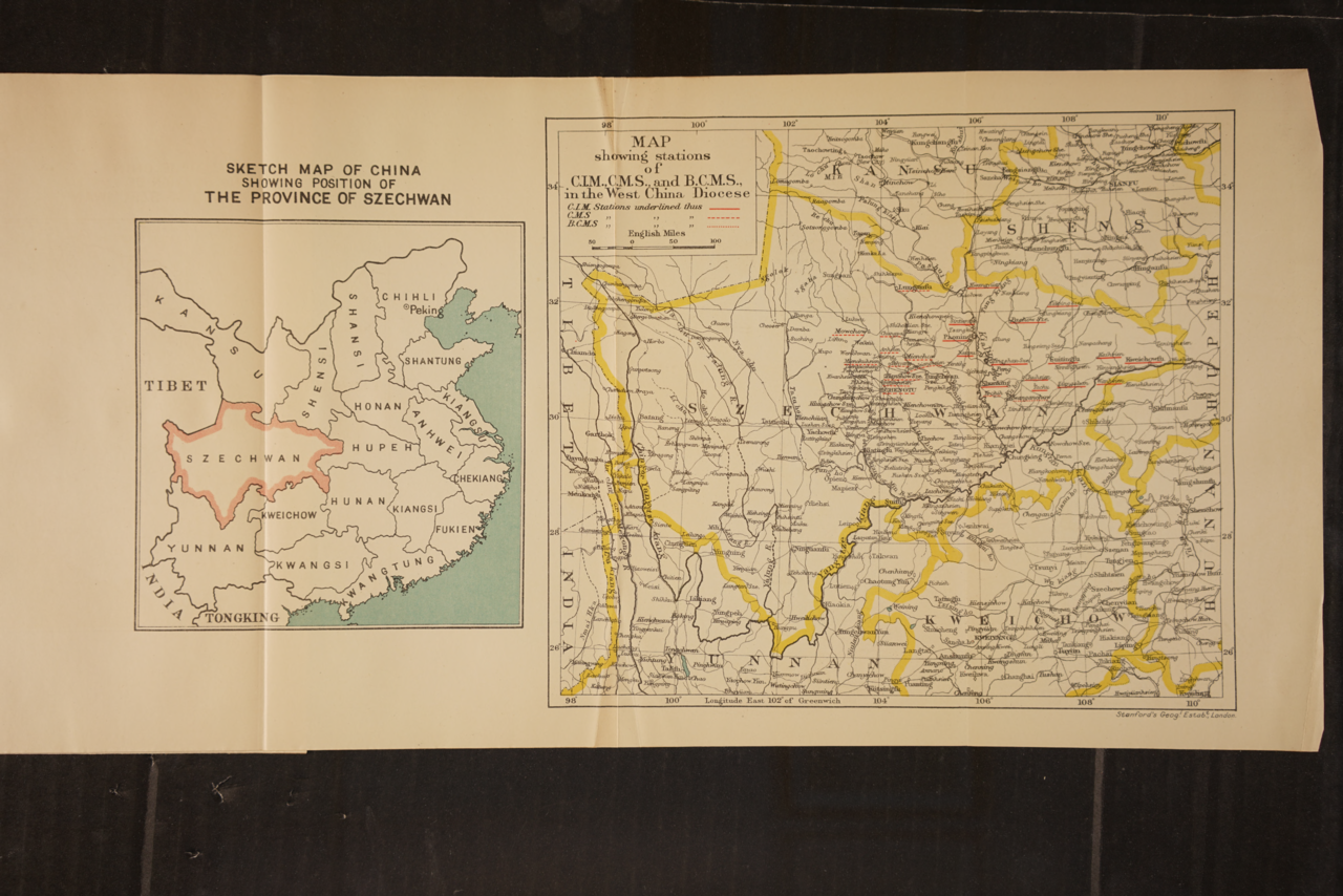
English: Right: Sketch map of China showing position of the Province of Szechwan. Left: Map of Szechwan showing mission stations of China Inland Mission (C.I.M.), Church Missionary Society (C.M.S.) and Bible Churchmen's Missionary Society (B.C.M.S.), in the West China Diocese. It is based on the 1908 map specially created by Edward Stanford for the China Inland Mission: File:Map of Szechwan for the China Inland Mission.jpg. |
| Date | |
| Source | https://archive.org/details/wwcasselsfirstbi00broo/page/378/mode/2up |
| Author |
Marshall Broomhall Edward Stanford |
Licensing
[edit]_Diocese_map.png&action=edit§ion=2)
|
This work is in the public domain in its country of origin and other countries and areas where the copyright term is the author's life plus 70 years or fewer. This work is in the public domain in the United States because it was published (or registered with the U.S. Copyright Office) before January 1, 1929. | |
| This file has been identified as being free of known restrictions under copyright law, including all related and neighboring rights. | |
File history
Click on a date/time to view the file as it appeared at that time.
| Date/Time | Thumbnail | Dimensions | User | Comment | |
|---|---|---|---|---|---|
| current | 09:00, 27 May 2023 | | 7,952 × 5,304 (34.76 MB) | Uriel1022 (talk | contribs) | Uploaded a work by {{w|Marshall Broomhall}}<br>{{w|Edward Stanford}} from https://archive.org/details/wwcasselsfirstbi00broo/page/378/mode/2up with UploadWizard |
You cannot overwrite this file.
File usage on Commons
The following page uses this file:
_Diocese_map.png&oldid=769875195)