File:Wendover Arm, The Disused Canal and Towpath near Little Tring - geograph.org.uk - 1251577.jpg
Jump to navigation
Jump to search
Size of this preview: 450 × 600 pixels. Other resolutions: 180 × 240 pixels | 480 × 640 pixels.
Original file (480 × 640 pixels, file size: 224 KB, MIME type: image/jpeg)
Captions
Captions
Add a one-line explanation of what this file represents
Summary
[edit]
| Description |
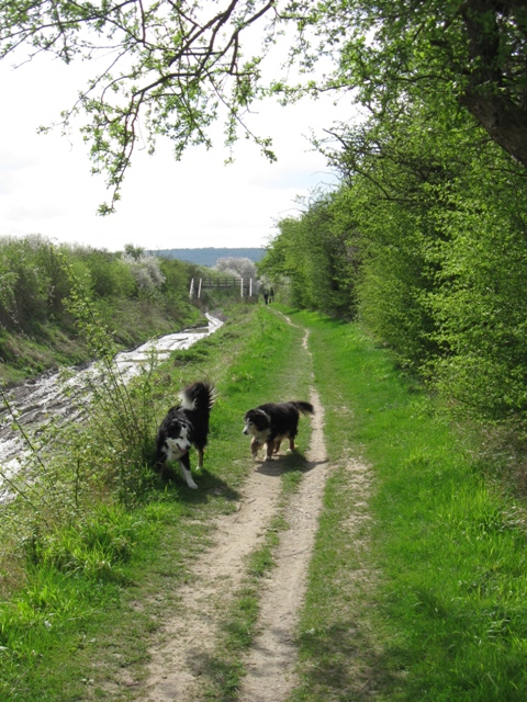
English: Wendover Arm: The Disused Canal and Towpath near Little Tring The line of the canal is comparatively straight at this point. When I first walked along this section of the disused canal some 40 years ago the towpath was a somewhat overgrown path. What is now a mud-filled ditch was a 30 foot wide hedge filled with wildlife.
See 1235539 |
| Date | |
| Source | From geograph.org.uk |
| Author | Chris Reynolds |
| Attribution (required by the license) | Chris Reynolds / Wendover Arm: The Disused Canal and Towpath near Little Tring / |
| Camera location | | View this and other nearby images on: OpenStreetMap |
|---|
_heading:202.00&language=en)
| Object location | | View this and other nearby images on: OpenStreetMap |
|---|
_heading:202.00&language=en)
Licensing
[edit]

|
This image was taken from the Geograph project collection. See this photograph's page on the Geograph website for the photographer's contact details. The copyright on this image is owned by Chris Reynolds and is licensed for reuse under the Creative Commons Attribution-ShareAlike 2.0 license.
|
This file is licensed under the Creative Commons Attribution-Share Alike 2.0 Generic license.
Attribution: Chris Reynolds
- You are free:
- to share – to copy, distribute and transmit the work
- to remix – to adapt the work
- Under the following conditions:
- attribution – You must give appropriate credit, provide a link to the license, and indicate if changes were made. You may do so in any reasonable manner, but not in any way that suggests the licensor endorses you or your use.
- share alike – If you remix, transform, or build upon the material, you must distribute your contributions under the same or compatible license as the original.
File history
Click on a date/time to view the file as it appeared at that time.
| Date/Time | Thumbnail | Dimensions | User | Comment | |
|---|---|---|---|---|---|
| current | 21:45, 26 February 2011 | | 480 × 640 (224 KB) | GeographBot (talk | contribs) | == {{int:filedesc}} == {{Information |description={{en|1=Wendover Arm: The Disused Canal and Towpath near Little Tring The line of the canal is comparatively straight at this point. When I first walked along this section of the disused canal some 40 year |
You cannot overwrite this file.
File usage on Commons
There are no pages that use this file.