File:Weiten - Mollenburg.JPG
Jump to navigation
Jump to search
Size of this preview: 800 × 533 pixels. Other resolutions: 320 × 213 pixels | 640 × 427 pixels | 1,024 × 683 pixels | 1,280 × 853 pixels | 2,598 × 1,732 pixels.
Original file (2,598 × 1,732 pixels, file size: 4.38 MB, MIME type: image/jpeg)
Captions
Captions
Add a one-line explanation of what this file represents
Summary
[edit]| Description |
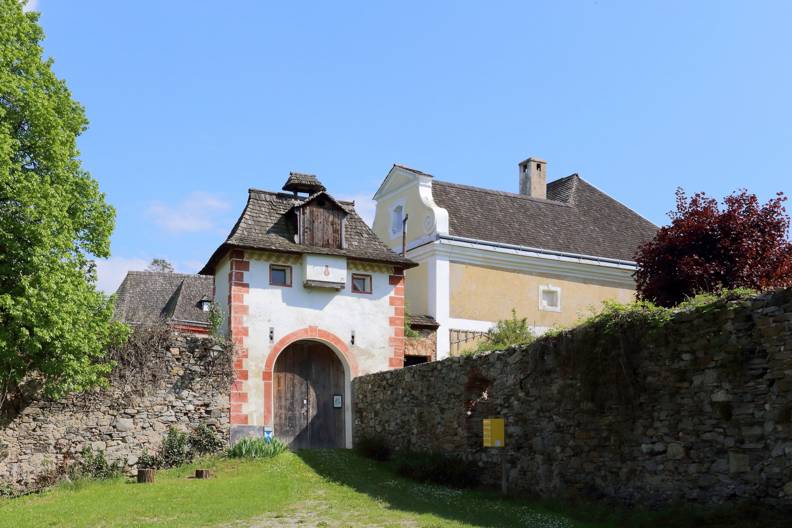
Deutsch: Vorburg der Burgruine Mollenburg, in der niederösterreichischen Marktgemeinde Weiten.
Die Burg wurde bereits in der romanischen Zeit errichtet und in der Mitte des 16. Jahrhunderts zu einem wehrhaften Renaissanceschloss umgebaut. Ab 1860 wurde die Burg aus steuerlichen Gründen durch den Verwalter Johann Niedermaier zur Ruine gemacht. Mitte der 1970er Jahre wurde die Ruine vom Wiener Stadtrat Dr. Jörg Mauthe gekauft, der die Vorburg restaurierte und bewohnbar machte: [1]. |
| Date | |
| Source | Own work |
| Author | C.Stadler/Bwag |
| Permission (Reusing this file) |
Deutsch: Hallo, du darfst mein Foto kostenlos nutzen, aber nenne mich bitte als Fotograf, beispielsweise „Foto: C.Stadler/Bwag“ oder © C.Stadler/Bwag; CC-BY-SA-4.0. Auf mehr Angaben bestehe ich nicht - im Gegensatz zu manch anderen, die die Vorgaben der unten angeführten Lizenzierung auf Punkt und Beistrich einfordern. English: Feel free to use my photos, but please mention me as the author like © C.Stadler/Bwag or © C.Stadler/Bwag; CC-BY-SA-4.0 (that's good enough) and if you want send me a message: bwag@gmx.net. |
| Other versions |
|
.JPG)

| Camera location | | View this and other nearby images on: OpenStreetMap |
|---|
| Object location | | View this and other nearby images on: OpenStreetMap |
|---|
Licensing
[edit]This file is licensed under the Creative Commons Attribution 3.0 Unported license.
- You are free:
- to share – to copy, distribute and transmit the work
- to remix – to adapt the work
- Under the following conditions:
- attribution – You must give appropriate credit, provide a link to the license, and indicate if changes were made. You may do so in any reasonable manner, but not in any way that suggests the licensor endorses you or your use.
| Annotations | This image is annotated: View the annotations at Commons |

File history
Click on a date/time to view the file as it appeared at that time.
| Date/Time | Thumbnail | Dimensions | User | Comment | |
|---|---|---|---|---|---|
| current | 15:33, 12 May 2013 | | 2,598 × 1,732 (4.38 MB) | Bwag (talk | contribs) | {{Information |Description= {{de|1= Burgruine bei Mollenburg, ein Ortsteil der niederösterreichischen Marktgemeinde Weiten.}} {{Denkmalgeschütztes Objekt Österreich|1=32973}} |Source= ... |
You cannot overwrite this file.
File usage on Commons
The following 2 pages use this file:
File usage on other wikis
The following other wikis use this file: