File:Weilburg - Ansicht vom Tempelchen (002).JPG
Jump to navigation
Jump to search

Size of this preview: 399 × 599 pixels. Other resolutions: 160 × 240 pixels | 320 × 480 pixels | 512 × 768 pixels | 682 × 1,024 pixels | 1,365 × 2,048 pixels | 3,311 × 4,967 pixels.
Original file (3,311 × 4,967 pixels, file size: 4.1 MB, MIME type: image/jpeg)
Captions
Captions
Add a one-line explanation of what this file represents
Summary
[edit].JPG&action=edit§ion=1)
| Description | |
| Date | |
| Source | Own work |
| Author | Gerold Rosenberg (talk) 15:07, 15 April 2015 (UTC) |
| Camera location | | View this and other nearby images on: OpenStreetMap |
|---|
.JPG¶ms=050.482092_N_0008.258938_E_globe:Earth_type:camera_alt:169.9_source:exif_heading:15.00&language=en)
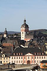
This is a picture of the Hessian Kulturdenkmal (cultural monument) with the ID 52362 (Wikidata)
|
This is a picture of the Hessian Kulturdenkmal (cultural monument) with the ID 52345 (Wikidata)
|
This is a picture of the Hessian Kulturdenkmal (cultural monument) with the ID 52314 (Wikidata)
|
This is a picture of the Hessian Kulturdenkmal (cultural monument) with the ID 52361 (Wikidata)
|
Licensing
[edit].JPG&action=edit§ion=2)
I, the copyright holder of this work, hereby publish it under the following license:
This file is licensed under the Creative Commons Attribution-Share Alike 3.0 Unported license.
- You are free:
- to share – to copy, distribute and transmit the work
- to remix – to adapt the work
- Under the following conditions:
- attribution – You must give appropriate credit, provide a link to the license, and indicate if changes were made. You may do so in any reasonable manner, but not in any way that suggests the licensor endorses you or your use.
- share alike – If you remix, transform, or build upon the material, you must distribute your contributions under the same or compatible license as the original.
| Annotations | This image is annotated: View the annotations at Commons |
.JPG)
File history
Click on a date/time to view the file as it appeared at that time.
| Date/Time | Thumbnail | Dimensions | User | Comment | |
|---|---|---|---|---|---|
| current | 10:41, 6 August 2016 | | 3,311 × 4,967 (4.1 MB) | Gerold Rosenberg (talk | contribs) | gedreht und zugeschnitten |
| 15:07, 15 April 2015 |  | 3,456 × 5,184 (5.06 MB) | Gerold Rosenberg (talk | contribs) | {{Information |Description ={{de|Weilburg}} |Source ={{own}} |Author = ~~~~ |Date = 2015- |Permission = |Other_versions = }} == {{int:license-header}} == {{self|cc-by-sa-3.0}} Category:Weilburg |
You cannot overwrite this file.
File usage on Commons
The following 3 pages use this file:
File usage on other wikis
The following other wikis use this file:
- Usage on de.wikipedia.org
.JPG&oldid=938383640)