File:Weichersbach.jpg
Jump to navigation
Jump to search

Size of this preview: 800 × 385 pixels. Other resolutions: 320 × 154 pixels | 640 × 308 pixels | 1,024 × 493 pixels | 1,280 × 617 pixels | 2,560 × 1,233 pixels | 10,380 × 5,000 pixels.
Original file (10,380 × 5,000 pixels, file size: 15.36 MB, MIME type: image/jpeg)
Captions
Captions
Add a one-line explanation of what this file represents
Summary
[edit]
| Description |
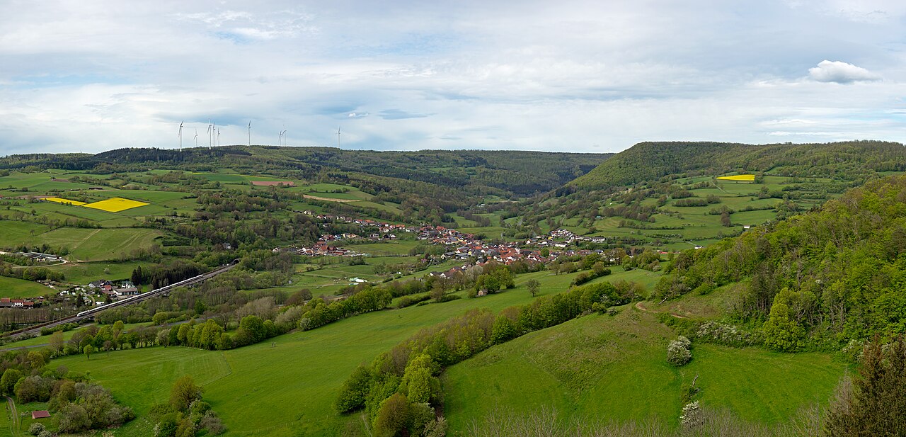
Deutsch: Blick von Burg Schwarzenfels nach Norden auf Weichersbach im Tal der Schmalen Sinn. Links unten das Südportal des Landrückentunnels und ein ICE
English: Looking from Schwarzenberg castle northward to Weichersbach in the valley of the Schmale Sinn. At the bottom left is the south portal of the Landrücken Tunnel and an ICE train. |
| Date | |
| Source | Own work |
| Author | Jörg Braukmann |
| Other versions |
2009:  |
| Camera location | | View this and other nearby images on: OpenStreetMap |
|---|
Licensing
[edit]
I, the copyright holder of this work, hereby publish it under the following license:
This file is licensed under the Creative Commons Attribution-Share Alike 4.0 International license.
- You are free:
- to share – to copy, distribute and transmit the work
- to remix – to adapt the work
- Under the following conditions:
- attribution – You must give appropriate credit, provide a link to the license, and indicate if changes were made. You may do so in any reasonable manner, but not in any way that suggests the licensor endorses you or your use.
- share alike – If you remix, transform, or build upon the material, you must distribute your contributions under the same or compatible license as the original.
This image was uploaded as part of Wiki Loves Earth 2024.
|
 |
| Annotations | This image is annotated: View the annotations at Commons |
This image has been assessed using the Quality image guidelines and is considered a Quality image.
|
File history
Click on a date/time to view the file as it appeared at that time.
| Date/Time | Thumbnail | Dimensions | User | Comment | |
|---|---|---|---|---|---|
| current | 11:06, 19 May 2024 | | 10,380 × 5,000 (15.36 MB) | Milseburg (talk | contribs) | Uploaded own work with UploadWizard |
You cannot overwrite this file.
File usage on Commons
The following 6 pages use this file:
File usage on other wikis
The following other wikis use this file:
- Usage on de.wikipedia.org