File:Watersheds of Minnesota.GIF
Jump to navigation
Jump to search
No higher resolution available.
Watersheds_of_Minnesota.GIF (550 × 550 pixels, file size: 23 KB, MIME type: image/gif)
Captions
Captions
Add a one-line explanation of what this file represents
Summary
[edit]
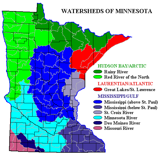
English: Map of rivers in Minnesota — showing major river basins, divides, and county lines.
- Credits
- Original source map from Interactive Watershed Homepage archive copy at the Wayback Machine, a work of the US government; modified by submitter, who releases all rights and specifically licenses use of this image under en:GNU Free Documentation License.
This image is in the public domain in the United States because it only contains materials that originally came from the United States Geological Survey, an agency of the United States Department of the Interior. For more information, see the official USGS copyright policy.
|
File history
Click on a date/time to view the file as it appeared at that time.
| Date/Time | Thumbnail | Dimensions | User | Comment | |
|---|---|---|---|---|---|
| current | 16:55, 27 June 2007 | | 550 × 550 (23 KB) | Kablammo (talk | contribs) | Map of Minnesota showing major river basins, divides, and county lines. Original source map from [http://gisdmnspl.cr.usgs.gov/cgi-bin/mapserv.exe?map=c:/apache2/htdocs/watershed/major_basins.map Interactive Watershed Homepage], a work of the US gove |
You cannot overwrite this file.
File usage on Commons
There are no pages that use this file.
File usage on other wikis
The following other wikis use this file:
- Usage on en.wikipedia.org