File:Watershed sign Wurmloh Hohe Matze.jpg
Jump to navigation
Jump to search
Size of this preview: 450 × 600 pixels. Other resolutions: 180 × 240 pixels | 360 × 480 pixels | 576 × 768 pixels | 768 × 1,024 pixels | 1,920 × 2,560 pixels.
Original file (1,920 × 2,560 pixels, file size: 1.82 MB, MIME type: image/jpeg)
Captions
Captions
Add a one-line explanation of what this file represents
Summary
[edit]
| Description | |
| Date | |
| Source | Own work |
| Author | Chianti |
| Copyleft: This work of art is free; you can redistribute it and/or modify it according to terms of the Free Art License. You will find a specimen of this license on the Copyleft Attitude site as well as on other sites. |
| Camera location | | View this and other nearby images on: OpenStreetMap |
|---|
File history
Click on a date/time to view the file as it appeared at that time.
| Date/Time | Thumbnail | Dimensions | User | Comment | |
|---|---|---|---|---|---|
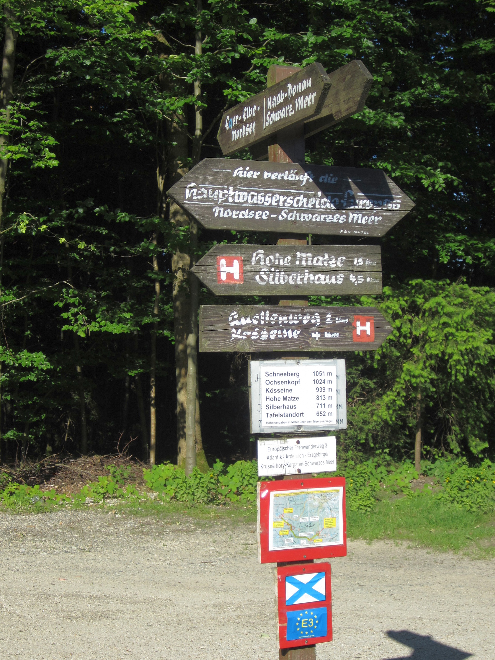
| current | 12:02, 11 July 2019 | | 1,920 × 2,560 (1.82 MB) | Chianti (talk | contribs) | {{Information |description ={{en|1=Watershed and directions signs at E3 European long distance path in the Fichtelgebirge}} {{de|1=Wegweiser und Wasserscheiden-Hinweis am Fichtelgebirgs-Höhenweg Nähe Wurmlohpass}} |date =016-06-24 |source ={{own}} |author =User:Chianti }} {{FAL}} {{Location|49.991685|11.942131}} [[Category:Drainage divides in Germa... |
You cannot overwrite this file.
File usage on Commons
There are no pages that use this file.