File:Wandelpad over de Hoge Berg tussen de tuinwallen (35773302564).jpg
Jump to navigation
Jump to search

Size of this preview: 800 × 533 pixels. Other resolutions: 320 × 213 pixels | 640 × 427 pixels | 1,024 × 683 pixels | 1,280 × 853 pixels | 1,536 × 1,024 pixels.
Original file (1,536 × 1,024 pixels, file size: 1.19 MB, MIME type: image/jpeg)
Captions
Captions
Add a one-line explanation of what this file represents
Summary
[edit].jpg&action=edit§ion=1)
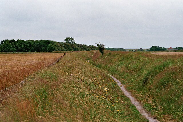
| Description | A footpath across The hoge Berg area between walls made of earth so called tuinwallen. Camera: Canon Eos 3000 Film: Fujifilm Superia X-tra 400 ISO Lens: Tamron AF70-300mm |
| Date | |
| Source | Wandelpad over de Hoge Berg tussen de tuinwallen |
| Author | m66roepers from Nederland |
| Camera location | | View this and other nearby images on: OpenStreetMap |
|---|
.jpg¶ms=053.043715_N_0004.809136_E_globe:Earth_type:camera_source:Flickr_&language=en)
Licensing
[edit].jpg&action=edit§ion=2)
This file is licensed under the Creative Commons Attribution 2.0 Generic license.
- You are free:
- to share – to copy, distribute and transmit the work
- to remix – to adapt the work
- Under the following conditions:
- attribution – You must give appropriate credit, provide a link to the license, and indicate if changes were made. You may do so in any reasonable manner, but not in any way that suggests the licensor endorses you or your use.
| This image was originally posted to Flickr by m66roepers at https://flickr.com/photos/56603673@N03/35773302564 (archive). It was reviewed on 27 June 2018 by FlickreviewR 2 and was confirmed to be licensed under the terms of the cc-by-2.0. |
File history
Click on a date/time to view the file as it appeared at that time.
| Date/Time | Thumbnail | Dimensions | User | Comment | |
|---|---|---|---|---|---|
| current | 18:29, 27 June 2018 | | 1,536 × 1,024 (1.19 MB) | Roepers (talk | contribs) | Transferred from Flickr via #flickr2commons |
You cannot overwrite this file.
File usage on Commons
There are no pages that use this file.
File usage on other wikis
The following other wikis use this file:
- Usage on nl.wikipedia.org
.jpg&oldid=718831322)