File:Walnut Ridge Disc Golf Course Map.jpg
Jump to navigation
Jump to search

Size of this preview: 467 × 600 pixels. Other resolutions: 187 × 240 pixels | 374 × 480 pixels | 598 × 768 pixels | 797 × 1,024 pixels | 1,681 × 2,159 pixels.
Original file (1,681 × 2,159 pixels, file size: 535 KB, MIME type: image/jpeg)
Captions
Captions
Add a one-line explanation of what this file represents
Summary
[edit]
| Description |
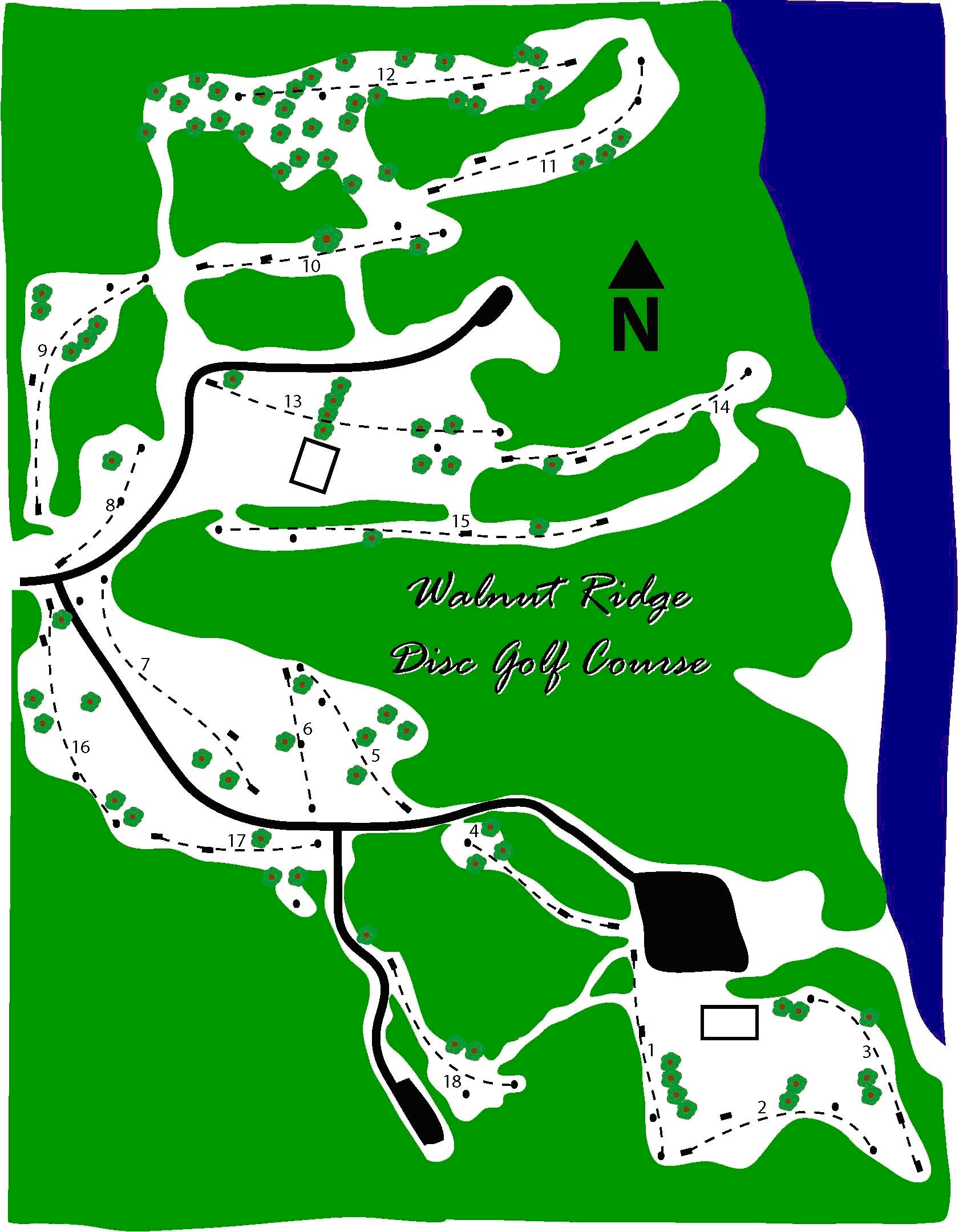
English: Map of Walnut Ridge Disc Golf Course from United States Army Corps of Engineers Rock Island District Website. Date unknown.
https://www.mvr.usace.army.mil/Missions/Recreation/Saylorville-Lake/Recreation/Disc-Golf/ https://www.mvr.usace.army.mil/Portals/48/docs/Recreation/ODS/Maps/DiscGolfMap.jpg |
|||||||||
| Date | ||||||||||
| Source | https://www.mvr.usace.army.mil/Missions/Recreation/Saylorville-Lake/Recreation/Disc-Golf/ | |||||||||
| Creator |
United States Army Corps of Engineers |
|||||||||
| Geotemporal data | ||||||||||
| Bounding box |
|
|||||||||
| Georeferencing | ||||||||||
Licensing
[edit]
This image or file is a work of a U.S. Army Corps of Engineers soldier or employee, taken or made as part of that person's official duties. As a work of the U.S. federal government, the image is in the public domain.
|
File history
Click on a date/time to view the file as it appeared at that time.
| Date/Time | Thumbnail | Dimensions | User | Comment | |
|---|---|---|---|---|---|
| current | 06:21, 11 January 2021 | | 1,681 × 2,159 (535 KB) | Iketsi (talk | contribs) | Uploaded a work by United States Army Corps of Engineers from https://www.mvr.usace.army.mil/Missions/Recreation/Saylorville-Lake/Recreation/Disc-Golf/ with UploadWizard |
You cannot overwrite this file.
File usage on Commons
The following 3 pages use this file:
File usage on other wikis
The following other wikis use this file:
- Usage on www.wikidata.org