File:Walbury Iron-age Hillfort - A defender's view - geograph.org.uk - 1194146.jpg
Jump to navigation
Jump to search
No higher resolution available.
Walbury_Iron-age_Hillfort_-_A_defender's_view_-_geograph.org.uk_-_1194146.jpg (640 × 422 pixels, file size: 72 KB, MIME type: image/jpeg)
Captions
Captions
Add a one-line explanation of what this file represents
Summary
[edit]| Description |
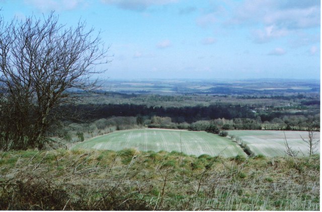
English: Walbury Iron-age Hillfort A defenders view This is the view of a defender looking over the northern rampart of the Walbury hillfort, across to the village of Inkpen http://www.inkpen-village.co.uk/history.html and further towards Kintbury and the valley of the river Kennet 3 miles away. Walbury Hill is the highest part of a great chalk escarpment which stretches away to the east as far as Kingsclere and the rabbits on Watership Down. At 974 feet ASL (279 metres) Walbury is said to be the highest chalk hill in England. Given the fort area covers all of 82 acres and the subsoil is chalk, it must have been a major feat to construct http://www.megalithic.co.uk/article.php?sid=4529 . See Gallery https://www.geograph.org.uk/gallery/iron_age_hillforts_9959 |
| Date | |
| Source | From geograph.org.uk |
| Author | D Gore |
| Attribution (required by the license) | D Gore / Walbury Iron-age Hillfort – A defender’s view / |
| Camera location | | View this and other nearby images on: OpenStreetMap |
|---|
| Object location | | View this and other nearby images on: OpenStreetMap |
|---|
Licensing
[edit]
|
This image was taken from the Geograph project collection. See this photograph's page on the Geograph website for the photographer's contact details. The copyright on this image is owned by D Gore and is licensed for reuse under the Creative Commons Attribution-ShareAlike 2.0 license.
|
This file is licensed under the Creative Commons Attribution-Share Alike 2.0 Generic license.
Attribution: D Gore
- You are free:
- to share – to copy, distribute and transmit the work
- to remix – to adapt the work
- Under the following conditions:
- attribution – You must give appropriate credit, provide a link to the license, and indicate if changes were made. You may do so in any reasonable manner, but not in any way that suggests the licensor endorses you or your use.
- share alike – If you remix, transform, or build upon the material, you must distribute your contributions under the same or compatible license as the original.

_heading:0.00&language=en)
_heading:0.00&language=en)
File history
Click on a date/time to view the file as it appeared at that time.
| Date/Time | Thumbnail | Dimensions | User | Comment | |
|---|---|---|---|---|---|
| current | 01:46, 26 February 2011 | | 640 × 422 (72 KB) | GeographBot (talk | contribs) | == {{int:filedesc}} == {{Information |description={{en|1=Walbury Iron-age Hillfort A defenders view This is the view of a defender looking over the northern rampart of the Walbury hillfort, across to the village of Inkpen http://www.inkpen-village.c |
You cannot overwrite this file.
File usage on Commons
The following page uses this file: