File:WR140 Cistern (33472293740).jpg
Jump to navigation
Jump to search

Size of this preview: 800 × 533 pixels. Other resolutions: 320 × 213 pixels | 640 × 427 pixels | 1,024 × 683 pixels | 1,280 × 853 pixels | 2,560 × 1,707 pixels | 5,472 × 3,648 pixels.
Original file (5,472 × 3,648 pixels, file size: 14.71 MB, MIME type: image/jpeg)
Captions
Captions
Add a one-line explanation of what this file represents
Summary
[edit].jpg&action=edit§ion=1)
| Description |
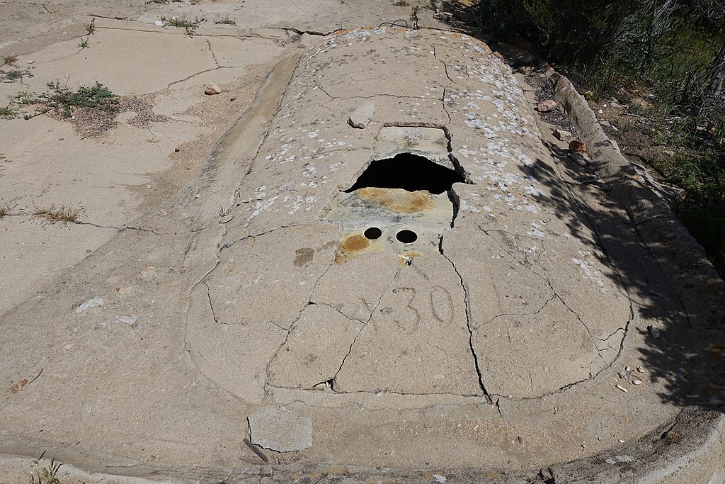
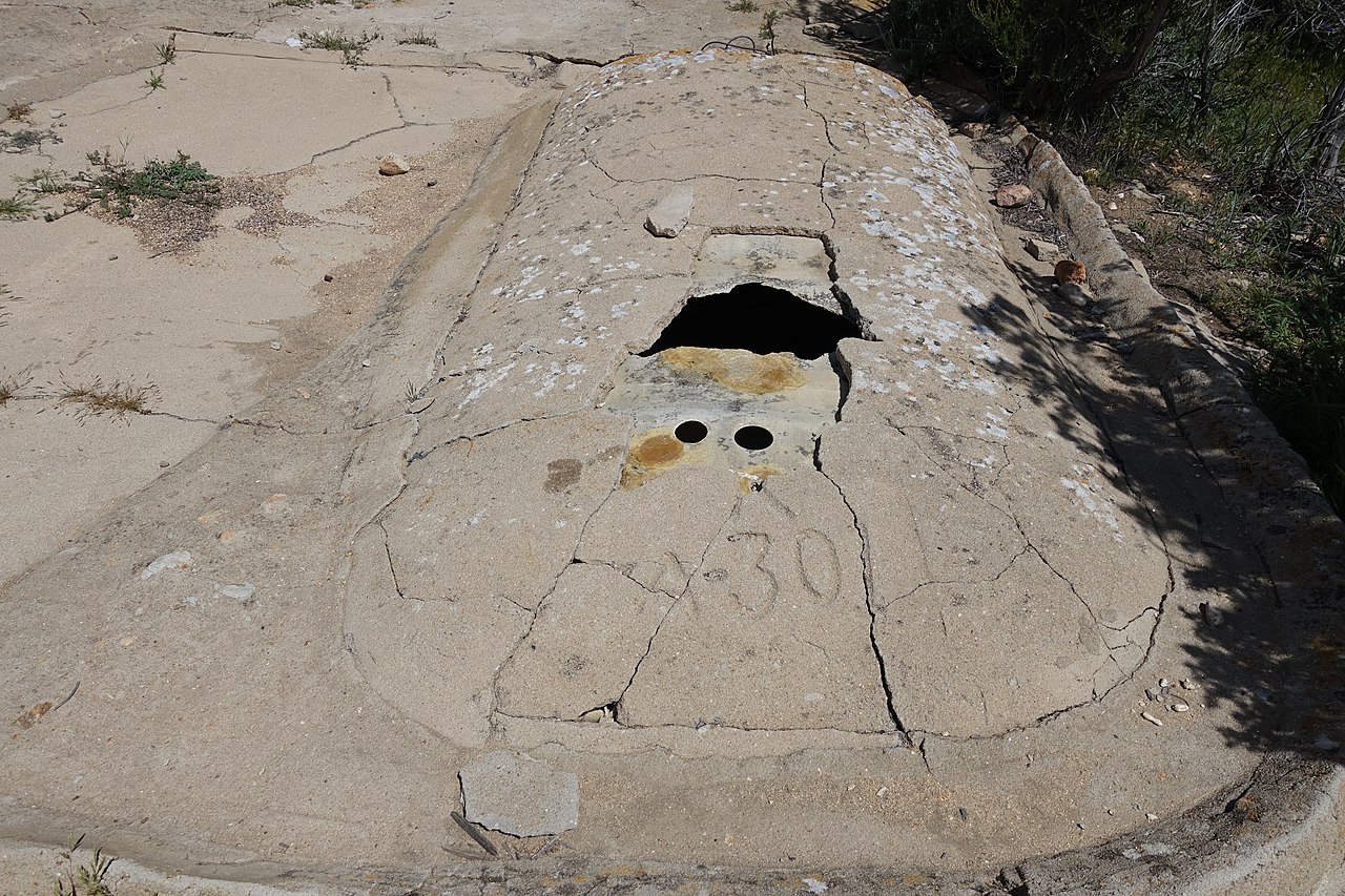
This guzzler is used to collect rain water as a resource to PCT hikers. The cistern can hold up to 800 gallons of water. When we visited in the spring of a year with heavy winter rains, the cistern contained 600 gallons and was 3/4 full but the water was greenish with algae. CAUTION - the top of the guzzler is fragile and unsafe to stand on. The guzzler is constructed of thin fiberglass and the concrete overlay is not strong enough to support a person. Photo by Rodger Bauer DSC01393 |
| Date | Taken on 25 March 2017, 13:11 |
| Source | WR140 Cistern |
| Author | Chris Hunkeler from Carlsbad, California, USA |
| Camera location | | View this and other nearby images on: OpenStreetMap |
|---|
.jpg¶ms=033.475469_N_-116.578317_E_globe:Earth_type:camera_source:Flickr_&language=en)
Licensing
[edit].jpg&action=edit§ion=2)
This file is licensed under the Creative Commons Attribution-Share Alike 2.0 Generic license.
- You are free:
- to share – to copy, distribute and transmit the work
- to remix – to adapt the work
- Under the following conditions:
- attribution – You must give appropriate credit, provide a link to the license, and indicate if changes were made. You may do so in any reasonable manner, but not in any way that suggests the licensor endorses you or your use.
- share alike – If you remix, transform, or build upon the material, you must distribute your contributions under the same or compatible license as the original.
| This image was originally posted to Flickr by Chris Hunkeler at https://flickr.com/photos/14913305@N00/33472293740. It was reviewed on 31 January 2021 by FlickreviewR 2 and was confirmed to be licensed under the terms of the cc-by-sa-2.0. |
File history
Click on a date/time to view the file as it appeared at that time.
| Date/Time | Thumbnail | Dimensions | User | Comment | |
|---|---|---|---|---|---|
| current | 09:15, 31 January 2021 | | 5,472 × 3,648 (14.71 MB) | Matlin (talk | contribs) | Transferred from Flickr via #flickr2commons |
You cannot overwrite this file.
File usage on Commons
There are no pages that use this file.
.jpg&oldid=889686571)